MAP DETAILS | |
|---|---|
| TITLE | Marietta |
| STATE | Ohio, West Virginia |
| LOCATION | 10 miles northeast of Parkersburg, WV |
| SERIES | 15-minute |
| SURVEYED | 1902 Field Survey |
| GEOGRAPHER | H.M. Wilson |
| ENGRAVED | 1904 |
| EDITION | 1904 |
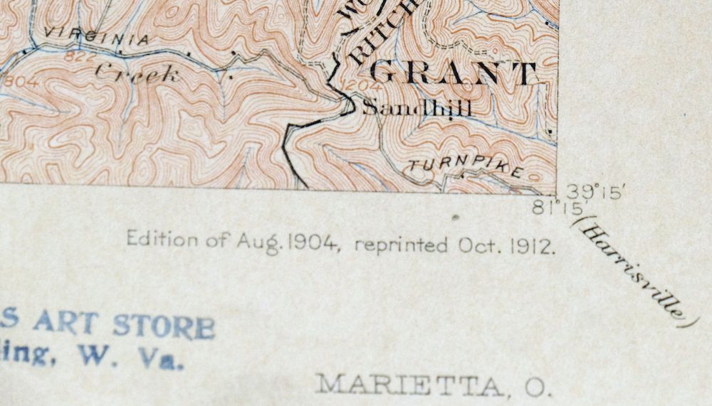
| PRINTED | 1912 |
| PRINT NOTES | Thick paper stock |
| SCALE | 1:62500 |
| CONTOUR INTERVAL | 20 feet |
| SHEET DIMENSIONS | 16 1/2 x 20 inches |
| MAP DIMENSIONS | 13 1/2 x 17 1/2 inches |
| COVERAGE AREA | 13 x 17 miles |
| MAP NOTES | A fascinating historical snapshot surveyed before the modern highway system, with historic travel routes, ferries, and rail lines. |
| SHEET CONDITION For maps of this vintage, effort is made to note all visible flaws, no matter how minor. | |
| OVERALL CONDITION | Very Good |
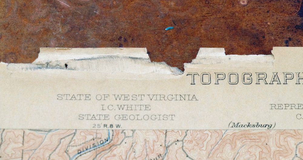
| SHEET NOTES | lightly handled, never folded, evenly age-toned paper |
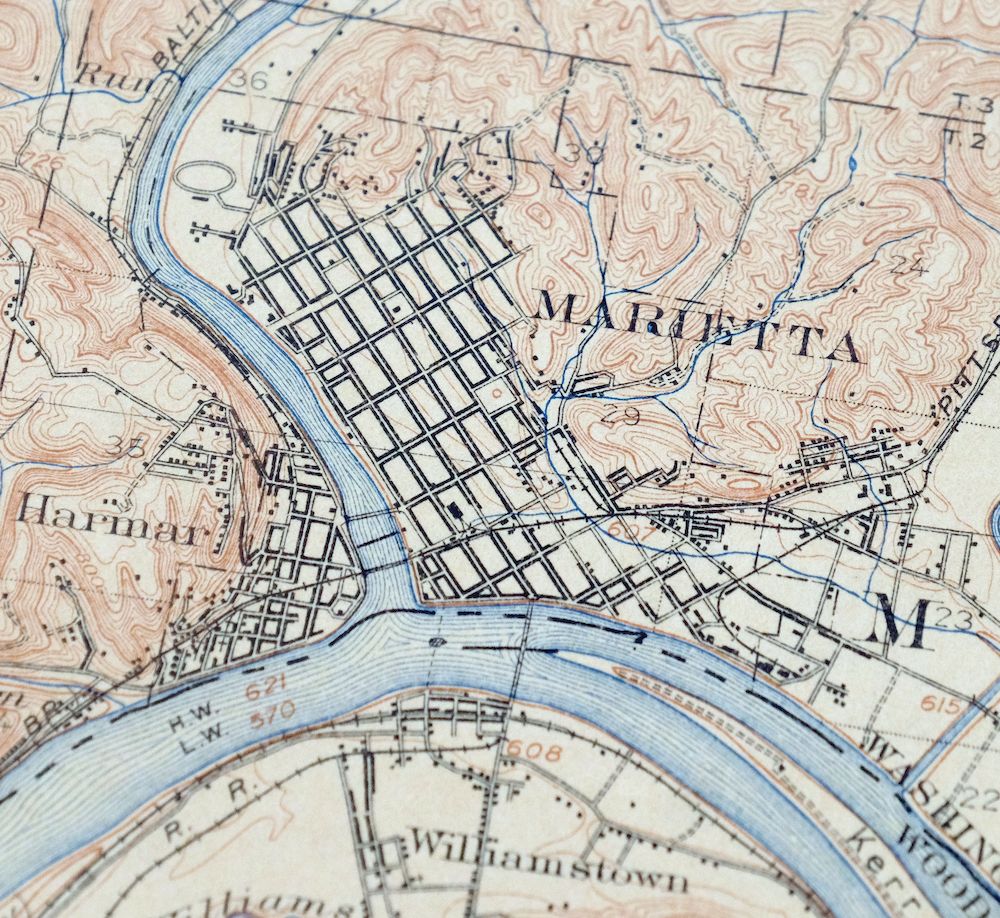
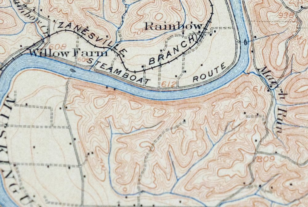
| MAP AREA | flawless map area |
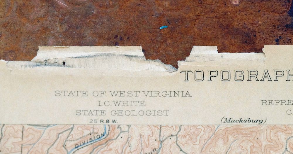
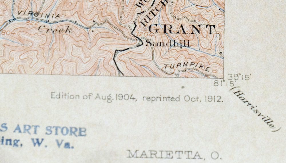
| COLLARS | minor blemishes, minor edge damage in upper left collar, small inventory stamp on bottom right collar, pencilled inventory notation in top collar |
  | |
| MAP COVERAGE Quadrangle extent overlaid on current basemap. | |
| BACKSIDE LEGEND | |
 A map summary is printed on the back side of the Marietta sheet similar to the one shown in the picture. It outlines the history, purpose, and status of the USGS mapping program at the time of the printing in 1912. It also provides instructions on how to read contour lines and a description of how they are used to depict the terrain. At the bottom of the page is a legend showing all of the symbols used to represent the cultural, relief, and water features found on the map. | |
| PLACENAMES Depending on map series and survey date, all of the features listed below may not be shown on this map. This list contains features that currently exist or historically existed within the area covered by the map. The list can be used as a reference to determine if this map covers your area of interest. Placenames are listed alphabetically next to each feature type. | |
| CITIES AND TOWNS (CURRENT) | Belmont, Boaz, Devola, Marietta, and Williamstown |
| COUNTIES COVERED | Pleasants, Ritchie, Washington, and Wood |
| FEDERAL LAND UNITS | Wayne National Forest and Wayne National Forest Purchase Unit |
| RIVERS AND STREAMS | Allen Run, Archers Fork, Atward Run, Big Run, Bolivian Run, Brush Run, Bull Creek, Bull Run, Burchs Run, Burns Run, Calf Creek, Campbell Run, Carpenter Run, Clay Lick Run, Cow Creek, Cow Run, Devol Run, Dodge Run, Duck Creek, Eightmile Creek, Fifteenmile Creek, Fivemile Run, Gillespie Run, Goss Fork, Gough Run, Hog Run, Hogland Run, Horseneck Run, Indian Run, Isaacs Fork, Island Run, Jackson Fork, Johnson Run, Kesselring Run, Laurel Fork, Left Fork Stillwell Creek, Lick Run, Limestone Run, Little Eightmile Creek, Little Muskingum River, Long Run, Mile Run, Mill Fork, Mill Run, Moss Run, Mudlick Run, Muskingum River, Myers Fork, New Years Creek, Newell Run, North Fork Stillwell Creek, Northup Run, Ohio River, Old Road Run, Peggs Fork, Plum Run, Porter Run, Potpie Run, Rainbow Creek, Reeds Run, Right Fork Bull Creek, Second Creek, Sheets Run, Sled Run, Stillwell Creek, Sugar Creek, Sugarcamp Run, Sulphur Spring Run, Tadpole Run, Tupper Creek, Walker Creek, Williams Creek, and Worthington Creek |
| Ohio Locations: Argan Landing, Barkers Landing, Clarks Landing, Eisners Landing, Frontier Shopping Center, Lafayette Shopping Center, Leonards Landing, Marietta Industrial Park, Old Posey Landing, Reno Landing, Repparts Landing, Schnaufers Landing, Smiths Landing, Valley Church, Ward Landing, Washington County Childrens Home, Washington County Fairgrounds, Washington Shopping Center, and Willow Farm. Administrative Boundaries: Township of Fearing, Township of Lawrence, Township of Marietta New, City of Marietta, Township of Muskingum, and Township of Newport. Mountains, Peaks, and Summits: Conus Mound and Fox Point. Valleys and Canyons: Coon Hollow, Dark Hollow, Painter Hollow, Patterson Hollow, and Pheasant Hollow. Parks: Buckeye Park, Don Drumm Stadium, East Muskingum Park, Fort Harmar Monument, Harmar Historic District, Indian Acres Park, Lookout Park, Marietta Historic District, Muskingum Park, Ohio Riverfront Park, Pioneer Park, Quadranaou Park, and Sacra Via Park. Drainages: Allen Run, Archers Fork, Baker Run, Bear Run, Bells Run, Bolivian Run, Brush Run, Bucks Run, Burchs Run, Burns Run, Coal Run, Cow Run, Devol Run, Dodge Run, Duck Creek, Eightmile Creek, Fifteenmile Creek, Goose Creek, Goss Fork, Hoff Run, Hog Run, Indian Run, Kerr Run, Killwell Run, Lick Prong Run, Lick Run, Little Eightmile Creek, Little Muskingum River, Long Run, March Run, Mile Run, Mill Fork, Mill Run, Moss Run, Muskingum River, Newell Run, Northup Run, Peggs Fork, Plum Run, Plummers Creek, Porter Run, Potpie Run, Rainbow Creek, Reeds Run, Second Creek, Sheets Run, Steel Run, Sugar Creek, Tadpole Run, and Tupper Creek. Churches: Bear Run Church, Beech Grove Presbyterian Church, Beech Grove United Brethren Church, Cedar Ridge Church, Central Christian Church, Christ United Methodist Church, Church of Christ, Church of God, Crown of Life Evangelical Lutheran Church, Faith United Methodist Church, First Baptist Church, First Church of the Nazarene, First Congregational Church, First Presbyterian Church, Fort Harmar Assembly of God Church, Gilman United Methodist Church, Grace Gospel Church, Harmar Congregational Church, Harmar Hill Chapel, Harmar Hill Church of Christ, Lawrence Baptist Church, Lynch Church, Marietta Bible Center, Marietta Church of Christ, Marietta Seventh Day Adventist Church, Moss Run Church, New Life United Pentecostal Church, Norwood United Methodist Church, Number Nine Church, Open Door Baptist Church, Pine Ridge Church, Putnam Church, Reno Christian Church, Saint Jacobs Church, Saint Lukes Episcopal Church, Saint Lukes Lutheran Church, Saint Marys Catholic Church, Saint Pauls United Church of Christ, Sand Hill United Methodist Church, Unitarian Universalist Church, Wagner Union Church, Wayne Street Congregational Church, and Willow Springs Chapel. Forests: Marietta State Forest Nursery and Marietyta Unit Office - Athens Ranger District. Hospitals: Marietta Memorial Hospital, Selby General Hospital, and Selby Hospital. Buildings: Childrens Toy and Doll Museum, Alumni Hall, Andrews Hall, Ban Johnson Field House, Butchs Cola Museum, Campus Martius Museum, Elsie Newton Hall, Erwin Hall, Dawes Memorial Library, Dorothy Webster Hall, Douglas Putnam Hall, Edward Rolfe Brown Hall, Fayer Weather Hall, Fire Station Number 1, Fire Station Number 2, Gilman Student Center, Grange Hall, Marietta City Hall, Mary O Beach Hall, Mills Hall, Parsons Hall, Washington County Courthouse, Washington County Home, Washington County Public Library, and William Bay Irvine Administration Building. Dams: Cyanamid Corporation Pond Dam, Dam Number 2, Lock Number 2, and Muskingum River Lock and Dam Number Two. Crossings: Interchange 1 and Interchange 6. Bridges: Hills Hildreth Bridge and Schwendenman Bridge. Airports: Selby General Hospital Heliport. Schools: Ewing School, Fairview Heights Elementary School, Harmar Elementary School, Lawrence Elementary School, Marietta College, Marietta High School, Marietta Middle School, Marion Elementary School, North Hills Elementary School, Norwood School, Phillips Elementary School, Putnam Elementary School, Reno Elementary School, Saint Marys School, and Washington Elementary School. Ridges: Bean Ridge. Reservoirs and Tanks: Cyanamid Corporation Pond and Muskingum River Lock and Dam Number. Towers: WBRJ-AM (Marietta), WCMO-FM (Marietta), WMBP-FM (Belpre), WMOA-AM (Marietta), and WMRT-FM (Marietta). | |
| West Virginia Locations: James Lane and Parish. Administrative Boundaries: District A Magisterial District, Union Magisterial District, and Williams Magisterial District. Mountains, Peaks, and Summits: Buzzard Rocks and Hunter Hill. Valleys and Canyons: Campbell Hollow, Graveyard Hollow, Happy Hollow, Pohick Hollow, and Polecat Hollow. Parks: Veterans Memorial Park. Drainages: Atward Run, Laurel Fork, Limestone Run, Big Run, Bull Creek, Bull Run, Calf Creek, Campbell Run, Carpenter Run, Chancellors Run, Clay Lick Run, Cow Creek, Davis Run, Feeny Run, Fivemile Run, French Creek, Gillespie Run, Gough Run, Henry Run, Hogland Run, Horseneck Run, Isaacs Fork, Island Run, Jackson Fork, Johnson Run, Long Run, McElroys Run, Old Road Run, Peters Fork, Pickens Run, Pigeonroost Run, Plum Run, Reed Run, Right Fork Bull Creek, Robins Run, Rush Run, Sixmile Run, Slate Run, Sled Run, Stretchet Run, Sugarcamp Run, Sulphur Spring Run, and Williams Creek. Islands: Broadback Island, Buckley Island, Eureka Island, and First Brother Island. Churches: Belmont Baptist Church, Belmont United Methodist Church, Bethel Church, Christ Memorial Church, Faith Bible Church, First Baptist Church of Williamstown, First Presbyterian Church, Horseneck Church, Middle Ridge Church, Mount Moriah Church, Mount Pleasant Church, Nash Springs Church, Pine Grove Church, Pleasant Grove Church, Ruckman Church, Shiloh Church, Union Valley Church, Williamstown Church of Christ, Williamstown Church of God, Williamstown Church of the Nazarene, Williamstown United Methodist Church, and Willow Island Baptist Church. Dams: Lock Number 17, Mcelroys Run Embankment Dam, Tennants Farm Pond Dam, Willow Island Locks And Dam, and Willow Island Locks and Dam. Crossings: Interchange 176, Interchange 179, and Interchange 185. Bars: Carpenter Road. Airports: Wood County Airport. Schools: Belmont Elementary School, Boreman School, Core Road School, Oak Grove School, Old Boreman School, Pleasants County Middle School, Pumpkin Knob School, Waverly Elementary School, Williamstown Elementary School, Williamstown Junior-Senior High School, and Winding School. Ridges: Ashby Ridge, Hannan Ridge, Middle Ridge, and Spider Ridge. Springs: Wolf Spring. | |
| SHIPPING AND RETURNS | |
 This map sheet will be carefully rolled in a sturdy tube and shipped via the US Postal Service. If you find that the sheet you receive is not as described in the listing, you may ship it back to us for a refund of the purchase price. | |
Marietta Ohio Wayne NF Devola USGS Topo Map 1912 Antique
$62
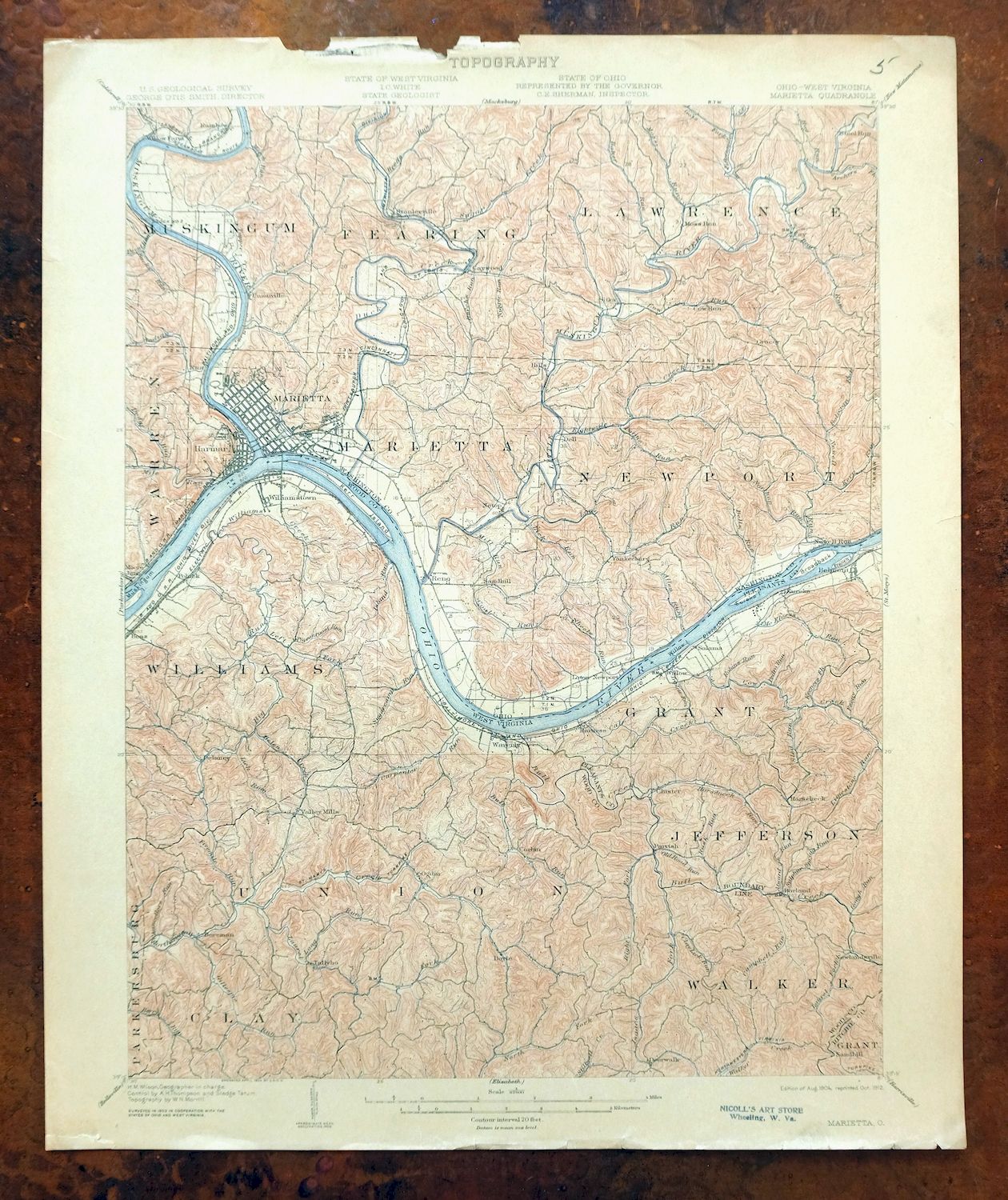
This 15-minute USGS topographic sheet is a 1904 edition printed in 1912, engraved by H.M. Wilson from an earlier field survey, and it survives in very good condition on thick stock: lightly handled, never folded, with a flawless map area and evenly age-toned paper. The quad straddles the Ohio River along the Ohio–West Virginia line, taking in Marietta and Williamstown along with Devola, Boaz, and Belmont, plus portions of the Wayne National Forest and its purchase unit. Surveyed before the modern highway system, it records historic travel routes, ferries, and rail lines as they stood at the turn of the century, and the reverse carries printed reference material on reading the map.
In stock
This antique sheet is a 1904 edition of the Marietta Ohio USGS topographic map. It is an authentic 114-year-old 1912 United States Geological Survey print in very good condition.
HOW THIS MAP CAN BE USED
In addition to making a fascinating conversation piece, this sheet would look great in a frame or on display, make a unique and prized gift for anyone interested in this area, be perfect as a reference for genealogy studies or general historical research, or fill that missing piece in your collection.
FEATURES SHOWN ON THE MAP
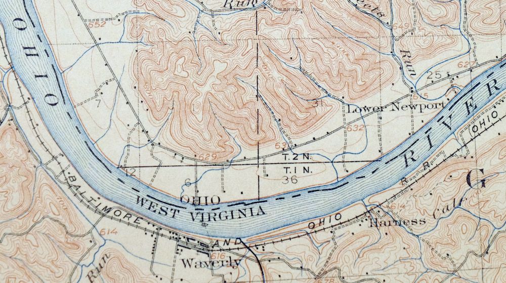
The Marietta 15-minute map shows cities and towns, roads, railroads, rivers, creeks, elevation contour lines, public land survey lines, county, state, and other administrative boundaries as they existed at the time of the survey in 1902. All known structures (houses, businesses, churches, schools, barns, cabins, etc) are also shown, with exceptions in some urban areas, where only landmark buildings may be shown.
A VALUABLE HISTORICAL RECORD
Maps from the 15-minute series for the continental United States are no longer produced or printed by the USGS and original prints are becoming increasingly difficult to find. They are a valuable historical record for an area, as they contain many placenames and features that have been dropped from more recent maps.
Nearby maps
-

Parkersburg Ohio Marietta Vienna USGS Topo Map 1912 Antique
$63 Add to cart -

Saint Marys West Virginia Ellenboro Pike USGS Topo Map 1916
$47 Add to cart -

Pomeroy Ohio Middleport Mason USGS Topo Map 1907 Antique
$37 Add to cart -

Ravenswood West Virginia New Haven Evans USGS Topo Map 1908
$40 Add to cart -

Point Pleasant West Virginia Middleport USGS Topo Map 1908
$25 Add to cart -

Winfield West Virginia Bancroft Southside USGS Topo Map 1908
$37 Add to cart -

Sutton West Virginia Glenville Elk River USGS Topo Map 1907
$110 Add to cart -

Pocatalico West Virginia Dunbar USGS Topographic Map 1977
$30 Add to cart -

Charleston West Virginia Cross Lanes Rand USGS Topo Map 1914
$75 Add to cart -

Saint Albans West Virginia Dunbar USGS Topographic Map 1909
$37 Add to cart -

Charleston West West Virginia Dunbar USGS Topo Map 1978
$22 Add to cart -

Nicholas West Virginia Summersville Cowen USGS Topo Map 1912
$54 Add to cart -
Burgettstown Pennsylvania Midway USGS Topographic Map 1958
$47 Add to cart -

Peytona West Virginia Marmet Belle USGS Topographic Map 1911
$42 Add to cart -

Era Ohio South Bloomfield Williamsport USGS Topo Map 1913
$40 Add to cart -

Brownsville Pennsylvania Monessen Donora USGS Topo Map 1954
$38 Add to cart -

Carnegie Pennsylvania Pittsburgh Dormont USGS Topo Map 1954
$48 Add to cart -
Beaver Pennsylvania Aliquippa Carnot-Moon USGS Topo Map 1958
$44 Add to cart -

Wayne West Virginia Dunlow Cove Gap USGS Topo Map 1909
$42 Add to cart -

Bald Knob West Virginia Mallory USGS Topo Map 1923 Antique
$50 Add to cart -

Kenova Kentucky Louisa Grayson USGS Topo Map 1912 Antique
$54 Add to cart -

Garrison Kentucky Portsmouth York USGS Topo Map 1918 Antique
$32 Add to cart -
Mount Sterling Ohio Washington Midway USGS Topo Map 1925
$42 Add to cart -

Raleigh West Virginia Beckley Oak Hill USGS Topo Map 1901
$95 Add to cart
