MAP DETAILS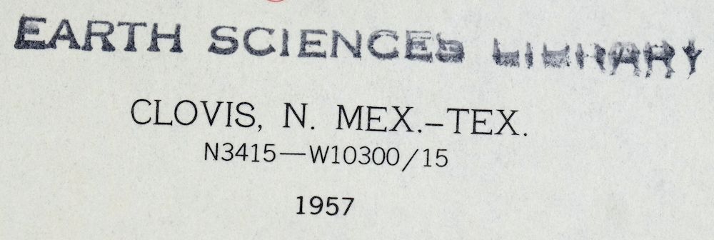 | |
|---|---|
| TITLE | Clovis |
| STATE | New Mexico, Texas |
| LOCATION | 90 miles northwest of Lubbock, TX |
| SERIES | 15-minute |
| SURVEYED | 1954 through 1957 Aerial and Field Survey |
| EDITION | 1957 |
| PRINTED | 1958 |
| SCALE | 1:62500 |
| CONTOUR INTERVAL | 10 feet |
| SHEET DIMENSIONS | 17 x 21 inches (approximate) |
| MAP DIMENSIONS | 14 1/2 x 17 1/2 inches |
| COVERAGE AREA | 14 x 17 miles |
| SHEET CONDITION For maps of this vintage, effort is made to note all visible flaws, no matter how minor. | |
| OVERALL CONDITION | Excellent |
| SHEET NOTES | unhandled, never folded |
| MAP AREA | flawless map area |
| COLLARS | no wear or tears, no markings, no blemishes, has inventory/library stamp |
| MAP COVERAGE Quadrangle extent overlaid on current basemap. | |
| PLACENAMES Depending on map series and survey date, all of the features listed below may not be shown on this map. This list contains features that currently exist or historically existed within the area covered by the map. The list can be used as a reference to determine if this map covers your area of interest. Placenames are listed alphabetically next to each feature type. | |
| CITIES AND TOWNS (CURRENT) | Cameo, Clovis, Farwell, and Texico |
| COUNTIES COVERED | Bailey, Curry, Parmer, and Roosevelt |
| WATER BODIES | Greene Lake, Pleasure Lake, and Santa Fe Lake |
| New Mexico Locations: Clovis Weather Station, Hardwick Ranch, North Plains Mall, and Stewart Ranch. Parks: Clovis Historical Marker, Hillcrest Park, and Potter Park. Churches: Bethal Assembly of God Church, Bible Missionary Church, Causey Baptist Church, Church of Christ, Church of God, Church of God Prophecy, Fairview Church, Fairview Church of the Nazarene, Faith Christian Fellowship Church, First Assembly of God Church, First Baptist Church, First Church of Christ Scientist, Forest Heights Church, Goodwill Spanish Church, Kingdom Hall, Northside Church of Christ, Parkview Baptist Church, Place of Prayer, Pleasant Hill Baptist Church, Sandia Baptist Church, Templo Bautista, and Yeso Baptist Church. Hospitals: Clovis High Plains Hospital. Lakes and Ponds: Pleasure Lake and Santa Fe Lake. Buildings: Clovis Base Library, Clovis Community College Library, Clovis High Plains Hospital Library, Clovis-Carver Public Library, Hotel Clovis Historic Site, and United States Air Force Hospital Library. Airports: Aero Tech Inc Airport and Clovis Municipal Airport. Schools: Barry Elementary School, Bella Vista Elementary School, Bickley School, Cameo Elementary School, Center School, Clovis Community College, Clovis Evening School, Clovis High School, Highland Elementary School, Highland School, James Bickley Elementary School, La Casita Elementary School, Lincoln Jackson Elementary School, Lockwood Elementary School, Marshall Junior High School, Mesa Elementary School, Parkview Elementary School, Ranchvale Elementary School, Sandia Elementary School, Texico Elementary School, Texico High School, Texico Junior High School, W D Gattis Junior High School, Yucca Junior High School, and Zia Elementary School. Reservoirs and Tanks: Greene Lake. Towers: KCLV-AM (Clovis), KCLV-FM (Clovis), KTQM-FM (Clovis), and KWKA-AM (Clovis). Wells: 10022 Water Well, 10068 Water Well, 10069 Water Well, 10086 Water Well, 10088 Water Well, 10109 Water Well, 10154 Water Well, 10158 Water Well, 10165 Water Well, 10033 Water Well, 10034 Water Well, 10035 Water Well, 10036 Water Well, 10037 Water Well, 10038 Water Well, 10060 Water Well, 10061 Water Well, 10062 Water Well, 10063 Water Well, 10064 Water Well, 10065 Water Well, 10066 Water Well, 10067 Water Well, 10437 Water Well, 10442 Water Well, 10443 Water Well, 10444 Water Well, 10445 Water Well, 10447 Water Well, 10448 Water Well, 10561 Water Well, 10564 Water Well, 10707 Water Well, 10748 Water Well, 10749 Water Well, 10772 Water Well, 10807 Water Well, 10830 Water Well, 10831 Water Well, 10833 Water Well, 10937 Water Well, 10938 Water Well, 10939 Water Well, 10940 Water Well, 11329 Water Well, 11634 Water Well, 11635 Water Well, 11696 Water Well, 11710 Water Well, 11711 Water Well, 11712 Water Well, 11726 Water Well, 11727 Water Well, 11728 Water Well, 11729 Water Well, 11730 Water Well, 11734 Water Well, 12002 Water Well, 12167 Water Well, 12188 Water Well, 12240 Water Well, 12241 Water Well, 12260 Water Well, 12261 Water Well, 12262 Water Well, 12385 Water Well, 12691 Water Well, 12710 Water Well, CC-575 Water Well, CC-659 Water Well, and CC-92 Water Well. | |
| Texas Airports: Incorporated Airport Farwell Spraying Service. Towers: KIJN-AM (Farwell). | |
| SHIPPING AND RETURNS | |
 This map sheet will be carefully rolled in a sturdy tube and shipped via the US Postal Service. If you find that the sheet you receive is not as described in the listing, you may ship it back to us for a refund of the purchase price. | |
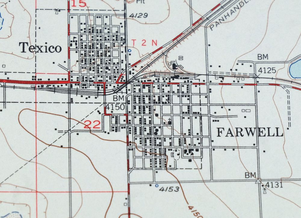
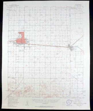
Clovis New Mexico Texico Farwell USGS Topo Map 1958 Vintage
$18
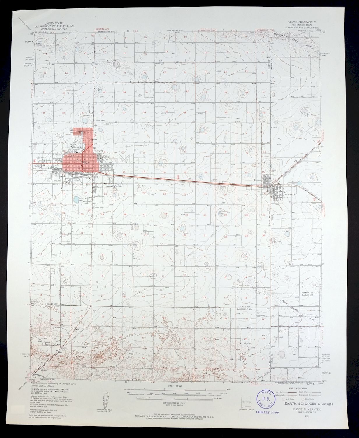
A 1957 edition printed in 1958, this USGS 15-minute topographic sheet is in excellent condition, unhandled and never folded, with a flawless map area. It takes in country along the New Mexico–Texas line about 90 miles northwest of Lubbock, and the quad area includes Clovis, New Mexico, together with the border towns of Farwell and Texico across the state line in Bailey, Curry, Parmer, and Roosevelt counties. Drawn from a 1954 through 1957 aerial and field survey, it records the flat High Plains farm country of the eastern New Mexico–West Texas border at ten-foot contour intervals, where the twin towns of Texico and Farwell sit right on the boundary. The collar carries an inventory stamp but is otherwise clean, with no wear, tears, or markings.
In stock
This vintage sheet is a 1957 edition of the Clovis New Mexico USGS topographic map. It is an original 68-year-old 1958 United States Geological Survey print in excellent condition.
HOW THIS MAP CAN BE USED
In addition to making a fascinating conversation piece, this sheet would look great in a frame or on display, make a unique and prized gift for anyone interested in this area, be perfect as a reference for genealogy studies or general historical research, or fill that missing piece in your collection. Maps of this vintage are printed on durable stock and are well-suited for outdoor activities and recreation of all kinds, including hiking, backpacking, hunting, rafting and kayaking, backcountry skiing, geocaching, general exploration, treasure hunting, etc.
FEATURES SHOWN ON THE MAP
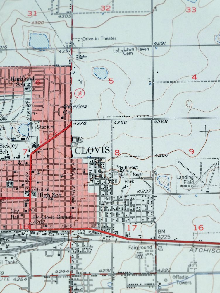
The Clovis 15-minute map shows cities and towns, roads, railroads, utilities and energy infrastructure, rivers, creeks, elevation contour lines, public land survey lines, county, state, and other administrative boundaries as they existed at the time of the survey in 1954 through 1957. A reddish tint may be used on this sheet to indicate urban areas where only landmark buildings will be shown. Outside of those areas, all known structures (houses, businesses churches, schools, barns, cabins, etc) are shown.
A VALUABLE HISTORICAL RECORD
Maps from the 15-minute series for the continental United States are no longer produced or printed by the USGS and original prints are becoming increasingly difficult to find. They are a valuable historical record for an area, as they contain many placenames and features that have been dropped from more recent maps.
Nearby maps
-
Arch New Mexico Grulla NWR USGS 15-Min Topo Map 1958 Vintage
$20 Add to cart -

Horseshoe Bend New Mexico USGS 15-Min Topo Map 1964 Vintage
$22 Add to cart -

Lobo Hill New Mexico Estancia USGS Topo Map 1963 Vintage
$14 Add to cart -

Stanley New Mexico USGS 15-Min Topographic Map 1963 Vintage
$14 Add to cart -
Carrizozo New Mexico Lincoln NF USGS Topo Map 1954 Vintage
$48 Add to cart -
Mountainair New Mexico Estancia Willard USGS Topo Map 1958
$32 Add to cart -
Koehler New Mexico Maxwell NWR Maxwell USGS Topo Map 1937
$51 Add to cart -
Brilliant New Mexico USGS 15-Min Topo Map 1915 Antique
$47 Add to cart -
Sweetwater Oklahoma Mayfield Grimes USGS Topo Map 1961
$22 Add to cart -

Mount Carrizo Colorado Kim Andrix USGS Topographic Map 1901
$40 Add to cart -

Mesa De Maya Colorado Branson Villegreen USGS Topo Map 1901
$44 Add to cart -
Apishapa Colorado Thatcher Delhi USGS Topo Map 1897 Antique
$52 Add to cart -
Brazos Peak New Mexico USGS 15-Min Topo Map 1971 Vintage
$39 Add to cart -
North Franklin Mountain Texas Fort Bliss USGS Topo Map 1959
$27 Add to cart -
Chama New Mexico Brazos Tierra Amarilla USGS Topo Map 1973
$39 Add to cart -

Nepesta Colorado Pueblo Fowler USGS Topo Map 1904 Antique
$45 Add to cart -
Aden New Mexico USGS 15-Min Topographic Map 1943 Vintage
$30 Add to cart -
Pueblo Colorado San Isabel NF Penrose USGS Topo Map 1923
$52 Add to cart -
Electric Peak Colorado Sangre de Cristo USGS Topo Map 1974
$33 Add to cart -
Camel Mountain New Mexico USGS 15-Min Topo Map 1917 Antique
$38 Add to cart -
Arroyo Colorado Wild Horse Boyero USGS Topo Map 1901 Antique
$41 Add to cart -

Cheyenne Wells Colorado Arapahoe USGS Topo Map 1894 Antique
$68 Add to cart -
Big Springs Colorado Ellicont Rush USGS Topographic Map 1900
$40 Add to cart -
Hermanas New Mexico USGS 15-Min Topographic Map 1943 Vintage
$38 Add to cart