MAP DETAILS | |
|---|---|
| TITLE | Koehler |
| STATE | New Mexico |
| LOCATION | 20 miles southwest of Raton |
| SERIES | 15-minute |
| SURVEYED | 1915 Field Survey |
| GEOGRAPHER | R.B. Marshall |
| ENGRAVED | 1917 |
| EDITION | 1917 |
| PRINTED | 1937 |
| PRINT NOTES | Thick paper stock |
| SCALE | 1:62500 |
| CONTOUR INTERVAL | 50 feet |
| SHEET DIMENSIONS | 16 1/2 x 20 inches |
| MAP DIMENSIONS | 14 x 17 1/2 inches |
| COVERAGE AREA | 14 x 17 miles |
| SHEET CONDITION For maps of this vintage, effort is made to note all visible flaws, no matter how minor. | |
| OVERALL CONDITION | Excellent |
| SHEET NOTES | very lightly handled, never folded |
| MAP AREA | flawless map area |
| COLLARS | no markings, no blemishes, minor handling wear along right collar, no edge tears |
| MAP COVERAGE Quadrangle extent overlaid on current basemap. | |
| BACKSIDE LEGEND | |
 A map summary is printed on the back side of the Koehler sheet similar to the one shown in the picture. It outlines the history, purpose, and status of the USGS mapping program at the time of the printing in 1937. It also provides instructions on how to read contour lines and a description of how they are used to depict the terrain. At the bottom of the page is a legend showing all of the symbols used to represent the cultural, relief, and water features found on the map. | |
| PLACENAMES Depending on map series and survey date, all of the features listed below may not be shown on this map. This list contains features that currently exist or historically existed within the area covered by the map. The list can be used as a reference to determine if this map covers your area of interest. Placenames are listed alphabetically next to each feature type. | |
| CITIES AND TOWNS (CURRENT) | Colfax, Koehler, and Maxwell |
| COUNTIES COVERED | Colfax |
| FEDERAL LAND UNITS | Maxwell National Wildlife Refuge |
| RIVERS AND STREAMS | Canadian River, Crow Creek, Curtis Creek, Dry Arroyo, Falls Creek, Kappis Arroyo, Loco Arroyo, Saltpeter Creek, Spring Arroyo, Springer Arroyo, Stubblefield Arroyo, Van Bremmer Creek, Vermejo River, and Willow Creek |
| WATER BODIES | Dorsey Lake, Koehler Lake, Laguna Madre, Number Thirteen Lake, Number Twelve Lake, Number Twenty Lake, Stubblefield Reservoir, and Twin Lakes |
| Locations: Crow Creek C S Farms, Martinez, Maxwell Weather Station, Messick, Pompoe, and Raton Trap Club. Mountains, Peaks, and Summits: Cedar Hills and Saltpeter Mountain. Valleys and Canyons: Ashenfelder Canyon, Beardon Canyon, Crow Canyon, Curtis Canyon, Falls Canyon, North Curtis Canyon, Ox Canyon, Prairie Crow Canyon, Saltpeter Canyon, Turkey Canyon, and Waldron Canyon. Parks: Maxwell National Wildlife Refuge. Drainages: Crow Creek, Curtis Creek, Falls Creek, Kappis Arroyo, Loco Arroyo, Saltpeter Creek, Spring Arroyo, Springer Arroyo, Stubblefield Arroyo, and Van Bremmer Creek. Mines: Koehler Mine, Koehler Number One, Koehler Number Three Mine, Koehler Number Two Mine, and Ox Canyon Mine. Churches: Maxwell First Baptist. Lakes and Ponds: Lake Eight, Number Eleven Lake, and Lake Seven. Dams: Dam Number 13, Dam Number Two, Koehler Dam, Maxwell Number 11 Dam, Maxwell Number 12 Dam, Maxwell Number 14 Dam, Saltpeter Creek Site 1a Dam, Saltpeter Dam, Stubblefield Dam, and Stublefield Dam. Canals: Dyke Ditch, Eagle Tail Canal, East Thirteen Ditch, East Twelve Ditch, High Line Ditch, Highline Ditch, Laguna Eagle Tail Lateral, Middle Drain Ditch, North Drain Ditch, North Fourteen Ditch, Number 11 And Stubblefield Lateral, Number 11 Inflow Canal, Number 11 Lateral, Number 12 Inflow Canal, Number 14 Inflow Canal, Number 14 Lateral, Red River Ditch, Ridge Ditch, Siphon Ditch, Siphon Lateral, South Drain Ditch, South Fourteen Ditch, South Laguna Lateral, Stubblefield Eagle Tail Lateral, Stubblefield Lateral, Vermejo Ditch, and West Thirteen Ditch. Airports: Raton Municipal Airport. Schools: Maxwell Elementary School, Maxwell High School, and Red River School. Reservoirs and Tanks: Dorsey Lake, Koehler Lake, Laguna Madre, Maxwell Number 14 Reservoir, Number Fourteen lake, Number Thirteen Lake, Number Twelve Lake, Number Twenty Lake, Reservoir Number 13, Reservoir Number Two, Stubblefield Reservoir, and Twin Lakes. | |
| SHIPPING AND RETURNS | |
 This map sheet will be carefully rolled in a sturdy tube and shipped via the US Postal Service. If you find that the sheet you receive is not as described in the listing, you may ship it back to us for a refund of the purchase price. | |
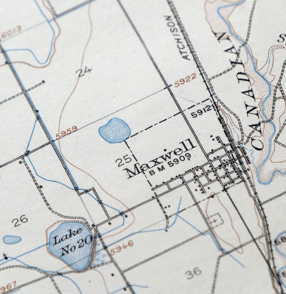
Koehler New Mexico Maxwell NWR Maxwell USGS Topo Map 1937
$51
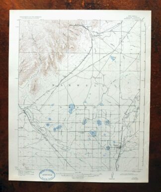
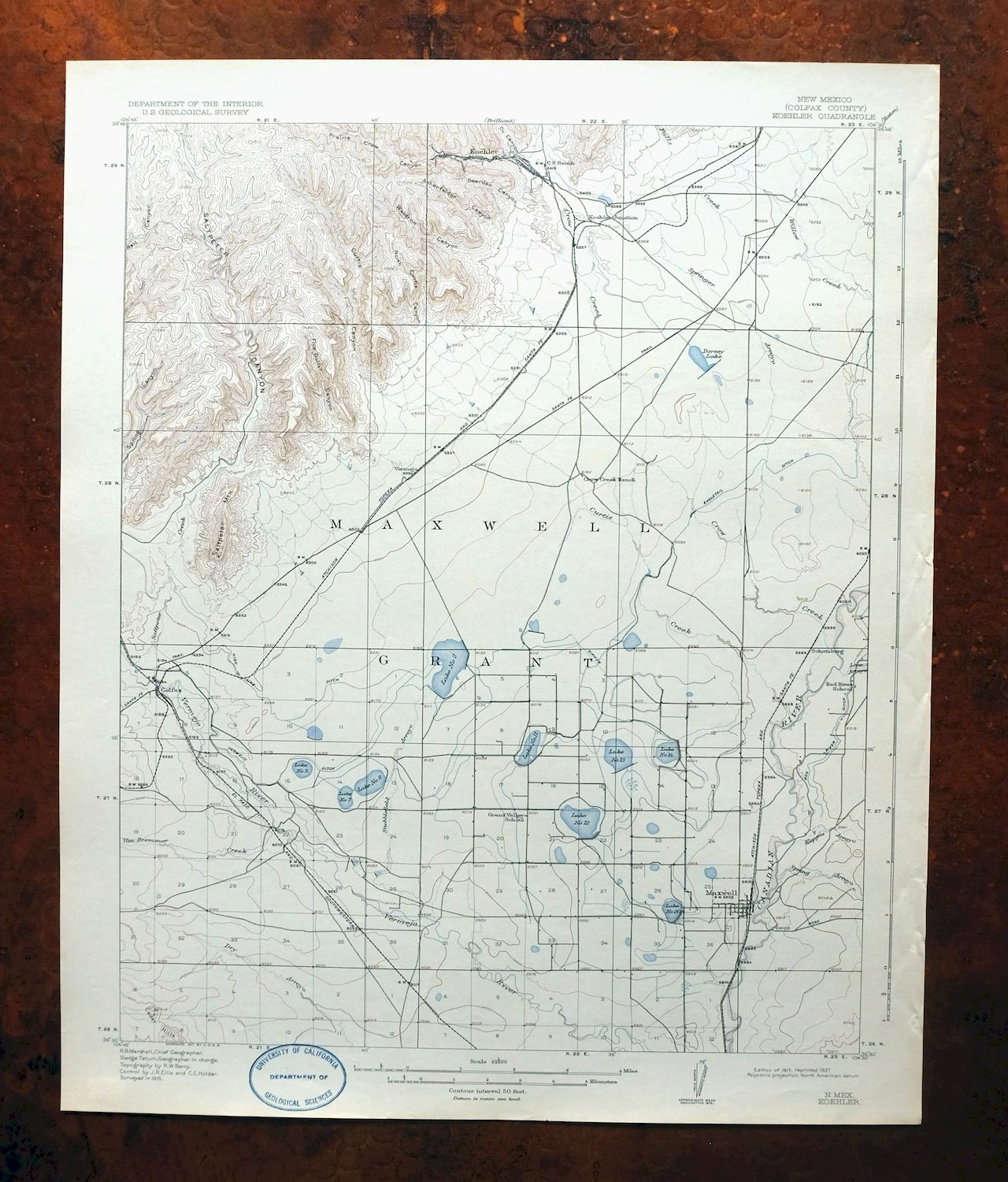
This 15-minute USGS topographic sheet is a 1917 edition, printed in 1937, and survives in excellent condition on thick stock – very lightly handled and never folded, with a flawless map area and only minor handling wear along the right collar. Covering a stretch of Colfax County about 20 miles southwest of Raton, the quad area takes in the communities of Maxwell, Koehler, and Colfax along with part of the Maxwell National Wildlife Refuge. Koehler was a coal-mining town in northeastern New Mexico, and a map of this era captures the country during the years that industry shaped the region. Never having been folded, the sheet lies flat and would frame well.
In stock
This antique sheet is a 1917 edition of the Koehler New Mexico USGS topographic map. It is an authentic 89-year-old 1937 United States Geological Survey print in excellent condition.
HOW THIS MAP CAN BE USED
In addition to making a fascinating conversation piece, this sheet would look great in a frame or on display, make a unique and prized gift for anyone interested in this area, be perfect as a reference for genealogy studies or general historical research, or fill that missing piece in your collection.
FEATURES SHOWN ON THE MAP
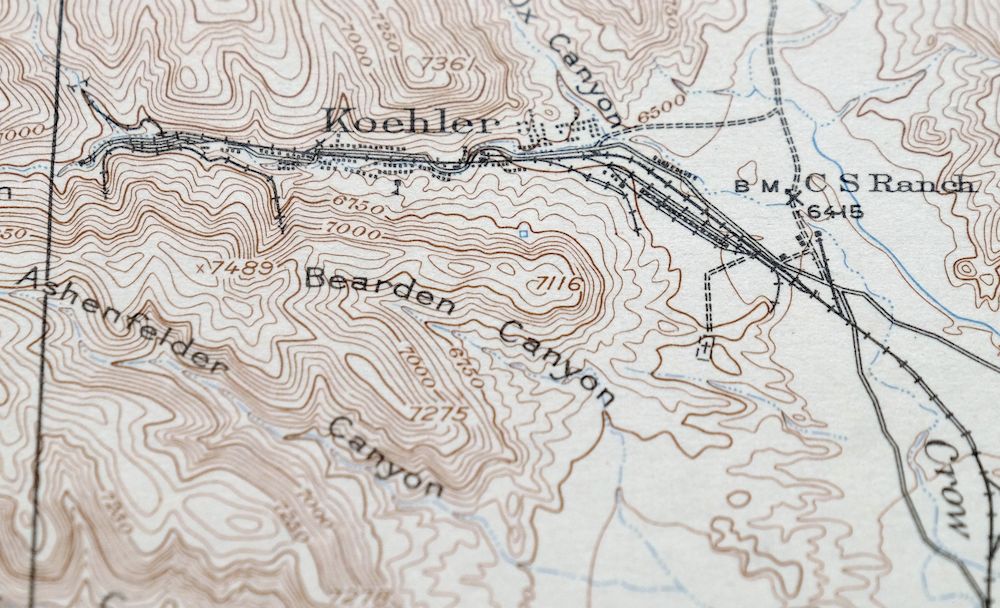
The Koehler 15-minute map shows cities and towns, roads, railroads, rivers, creeks, elevation contour lines, public land survey lines, county, state, and other administrative boundaries as they existed at the time of the survey in 1915. All known structures (houses, businesses, churches, schools, barns, cabins, etc) are also shown, with exceptions in some urban areas, where only landmark buildings may be shown.
A VALUABLE HISTORICAL RECORD
Maps from the 15-minute series for the continental United States are no longer produced or printed by the USGS and original prints are becoming increasingly difficult to find. They are a valuable historical record for an area, as they contain many placenames and features that have been dropped from more recent maps.
Nearby maps
-
Brilliant New Mexico USGS 15-Min Topo Map 1915 Antique
$47 Add to cart -

Mesa De Maya Colorado Branson Villegreen USGS Topo Map 1901
$44 Add to cart -
Apishapa Colorado Thatcher Delhi USGS Topo Map 1897 Antique
$52 Add to cart -

Mount Carrizo Colorado Kim Andrix USGS Topographic Map 1901
$40 Add to cart -
Brazos Peak New Mexico USGS 15-Min Topo Map 1971 Vintage
$39 Add to cart -
Chama New Mexico Brazos Tierra Amarilla USGS Topo Map 1973
$39 Add to cart -
Pueblo Colorado San Isabel NF Penrose USGS Topo Map 1923
$52 Add to cart -

Nepesta Colorado Pueblo Fowler USGS Topo Map 1904 Antique
$45 Add to cart -
Electric Peak Colorado Sangre de Cristo USGS Topo Map 1974
$33 Add to cart -

Stanley New Mexico USGS 15-Min Topographic Map 1963 Vintage
$14 Add to cart -

Lobo Hill New Mexico Estancia USGS Topo Map 1963 Vintage
$14 Add to cart -
Big Springs Colorado Ellicont Rush USGS Topographic Map 1900
$40 Add to cart -
Poncha Springs Colorado Salida Nathrop USGS Topo Map 1970
$41 Add to cart -
Mountainair New Mexico Estancia Willard USGS Topo Map 1958
$32 Add to cart -
Arroyo Colorado Wild Horse Boyero USGS Topo Map 1901 Antique
$41 Add to cart -
Clovis New Mexico Texico Farwell USGS Topo Map 1958 Vintage
$18 Add to cart -
Durango East Colorado USGS 7.5-Min Topo Map 1965 Vintage
$30 Add to cart -
Iola Colorado USGS 7.5-Min Topographic Map 1963 Vintage
$31 Add to cart -
Silverton Colorado Camp Bird USGS Topo Map 1962 Vintage
$34 Add to cart -
Arch New Mexico Grulla NWR USGS 15-Min Topo Map 1958 Vintage
$20 Add to cart -

Cheyenne Wells Colorado Arapahoe USGS Topo Map 1894 Antique
$75 Add to cart -
Kassler Colorado Roxborough Park Louviers USGS Topo Map 1956
$48 Add to cart -
Platte Canyon Colorado South Platte USGS Topo Map 1955
$44 Add to cart -
Bailey Colorado Will-O-The-Wisp Wandcrest USGS Topo Map 1973
$40 Add to cart