MAP DETAILS | |
|---|---|
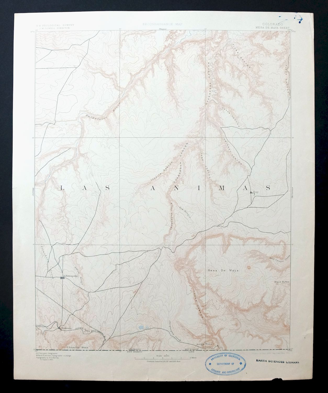
| TITLE | Mesa De Maya |
| STATE | Colorado |
| LOCATION | 40 miles east of Trinidad |
| SERIES | 30-minute |
| SURVEYED | 1890 Field Survey |
| GEOGRAPHER | A.H. Thompson |
| EDITION | 1893 |
| PRINTED | 1901 |
| PRINT NOTES | Thick paper stock |
| SCALE | 1:125000 |
| SHEET DIMENSIONS | 16 x 20 inches (approximate) |
| MAP DIMENSIONS | 13 7/8 x 17 1/2 inches |
| COVERAGE AREA | 27 x 35 miles |
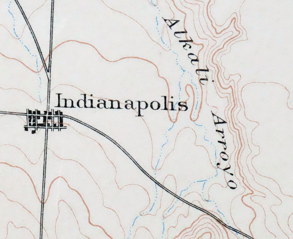
| MAP NOTES | Includes the vanished towns of Indianapolis, Watervale, and Troy. |
| SHEET CONDITION For maps of this vintage, effort is made to note all visible flaws, no matter how minor. | |
| OVERALL CONDITION | Good |
| SHEET NOTES | lightly handled, never folded, lightly age-toned sheet |
| MAP AREA | flawless map area |
| COLLARS | no markings, ink blemishes in upper right collar corner, multiple edge tears carefully stabilized with clear archival tape on backside of sheet, inventory stamp on lower collar |
| MAP COVERAGE Quadrangle extent overlaid on current basemap. | |
| BACKSIDE LEGEND | |
 A map summary is printed on the back side of the Mesa De Maya sheet similar to the one shown in the picture. It outlines the history, purpose, and status of the USGS mapping program at the time of the printing in 1901. It also provides instructions on how to read contour lines and a description of how they are used to depict the terrain. At the bottom of the page is a legend showing all of the symbols used to represent the cultural, relief, and water features found on the map. | |
| PLACENAMES Depending on map series and survey date, all of the features listed below may not be shown on this map. This list contains features that currently exist or historically existed within the area covered by the map. The list can be used as a reference to determine if this map covers your area of interest. Placenames are listed alphabetically next to each feature type. | |
| CITIES AND TOWNS (CURRENT) | Branson and Villegreen |
| COUNTIES COVERED | Las Animas |
| FEDERAL LAND UNITS | Comanche National Grassland and Fort Carson Military Reservation |
| RIVERS AND STREAMS | Alkali Arroyo, Bachicha Creek, Big Water Arroyo, Burke Arroyo, Chacuaco Creek, Chaney Arroyo, Doss Arroyo, Lockwood Arroyo, Luning Arroyo, Plum Creek, Poitrey Creek, Purgatoire River, Taylor Arroyo, Tobe Creek, Trementina Creek, Van Bremer Arroyo, and West Carrizo Creek |
| Locations: Box Ranch, Double Tank Windmill, Garfield Windmill, George Canyon Windmill, Linder Camp, Lone Oak, Lower Windmill, Mesa De Maya Ranch, Plum Windmill, Reed Canyon Windmill, Rincon Windmill, Rock Crossing, Round Corral Windmill, Upper Windmill, and Williams Windmill. Areas: Mesa de Maya. Mountains, Peaks, and Summits: Bar Four Pocket, Brushy Mountain, Cobert Mesa, The Corona, Cotton Mesa, Hardesty Mesa, Jesus Mesa, Lone Butte, Mesa de Maya, Mesa de Maya, Miners Peak, Saddle Rock, Seven D Pocket, Seven L Buttes, and Watervale Butte. Valleys and Canyons: Aguaje Canyon, Alejandro Canyon, Bachicha Canyon, Barriet Canyon, Blue Water Canyon, Briggs Canyon, Flathead Canyon, Calf Canyon, Chacuaco Canyon, Cheney Canyon, Cherry Canyon, Cotton Canyon, Dead Horse Canyon, Deadman Canyon, Deep Draw, Doss Canyon, Fox Canyon, George Canyon, Goat Ranch Canyon, Gotera Canyon, Gotera Rincon, Grandma Canyon, Gutierrez Canyon, Hart Canyon, Henry George Canyon, Honeymoon Canyon, Indian Trial Canyon, Humbar Canyon, Hunt Canyon, Jack Canyon, Johnson Canyon, Jones Canyon, Kiowa Canyon, Lions Canyon, Little Pine Canyon, Lockwood Canyon, Lost Canyon, Officer Canyon, Pacheco Canyon, Painted Canyon, Perly Canyon, Phillips Canyon, Pine Canyon, Plum Canyon, Poitrey Canyon, Rodriques Canyon, Rough Canyon, Salazar Rincon, Sandoval Canyon, School Section Canyon, Schoolhouse Canyon, Scorpio Canyon, Sherman Canyon, Spring Canyon, Steel Trap Canyon, Tobe Canyon, Trementina Canyon, Trough Canyon, Trujillo Canyon, Umbrella Canyon, Water Canyon, West Canyon, and Whitewater Canyon. Drainages: Alkali Arroyo, Bachicha Creek, Big Water Arroyo, Burke Arroyo, Lockwood Arroyo, Plum Creek, Poitrey Creek, Taylor Arroyo, Tobe Creek, Trementina Creek, and Van Bremer Arroyo. Gaps: Cotton Gap and The Narrows. Airports: Big Canyon Tyron Airport and Branson Heliport. Ridges: The Hogback and Pinon Ridge. Reservoirs and Tanks: Seven D Tank. Wells: Seven D Well. Pillars: Courthouse Rock and Heart Rock. Springs: Barriet Spring, Fallas Spring, Chapman Spring, Glover Spring, Hart Spring, Humbar Spring, J J Water Spring, Jack Canyon Spring, John Hart Spring, Little Colorado Spring, Romero Spring, and Wilcox Spring. | |
| SHIPPING AND RETURNS | |
 This map sheet will be carefully rolled in a sturdy tube and shipped via the US Postal Service. If you find that the sheet you receive is not as described in the listing, you may ship it back to us for a refund of the purchase price. | |
Mesa De Maya Colorado Branson Villegreen USGS Topo Map 1901
$44
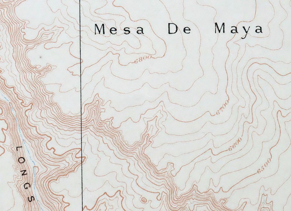
This USGS reconnaissance topographic sheet is an 1893 edition printed in 1901, a thick-stock sheet in good condition that was never folded and is only lightly age-toned. Covering a stretch of Las Animas County about 40 miles east of Trinidad, the quad takes in the high tableland of Mesa de Maya along with the communities of Branson and Villegreen and part of what is now the Comanche National Grassland. Based on an 1890 field survey under geographer A.H. Thompson, it also records the vanished towns of Indianapolis, Watervale, and Troy, and its reverse carries printed reference material. The map area itself is flawless, with the only condition notes falling in the collar: ink blemishes in the upper right corner, an inventory stamp on the lower collar, and several edge tears carefully stabilized with archival tape on the back.
In stock
This antique sheet is an 1893 edition of the Mesa De Maya Colorado USGS topographic map. It is an authentic 125-year-old 1901 United States Geological Survey print in good condition.
HOW THIS MAP CAN BE USED
In addition to making a fascinating conversation piece, this sheet would look great in a frame or on display, make a unique and prized gift for anyone interested in this area, be perfect as a reference for genealogy studies or general historical research, or fill that missing piece in your collection.
FEATURES SHOWN ON THE MAP
The Mesa De Maya 30-minute map shows cities and towns, roads, railroads, rivers, creeks, elevation contour lines, public land survey lines, county, state, and other administrative boundaries as they existed at the time of the survey in 1890.
A VALUABLE HISTORICAL RECORD
Maps from the USGS 30-minute series have been out of print for many years. They have never been common and original prints are increasingly difficult to find. For areas where the 30-minute map was produced, it is usually the first large-scale survey done by the USGS for that area. These are a valuable historical record, as they contain many placenames and features that have been dropped from more recent series’ and editions.
Nearby maps
-

Mount Carrizo Colorado Kim Andrix USGS Topographic Map 1901
$40 Add to cart -
Apishapa Colorado Thatcher Delhi USGS Topo Map 1897 Antique
$52 Add to cart -

Nepesta Colorado Pueblo Fowler USGS Topo Map 1904 Antique
$45 Add to cart -
Pueblo Colorado San Isabel NF Penrose USGS Topo Map 1923
$52 Add to cart -
Arroyo Colorado Wild Horse Boyero USGS Topo Map 1901 Antique
$41 Add to cart -
Big Springs Colorado Ellicont Rush USGS Topographic Map 1900
$40 Add to cart -

Cheyenne Wells Colorado Arapahoe USGS Topo Map 1894 Antique
$75 Add to cart -
Brilliant New Mexico USGS 15-Min Topo Map 1915 Antique
$47 Add to cart -
Koehler New Mexico Maxwell NWR Maxwell USGS Topo Map 1937
$51 Add to cart -
Electric Peak Colorado Sangre de Cristo USGS Topo Map 1974
$33 Add to cart -
Brazos Peak New Mexico USGS 15-Min Topo Map 1971 Vintage
$39 Add to cart -
Poncha Springs Colorado Salida Nathrop USGS Topo Map 1970
$41 Add to cart -
Chama New Mexico Brazos Tierra Amarilla USGS Topo Map 1973
$39 Add to cart -
Kassler Colorado Roxborough Park Louviers USGS Topo Map 1956
$48 Add to cart -
Platte Canyon Colorado South Platte USGS Topo Map 1955
$44 Add to cart -
Highland Ranch Colorado Denver Southglenn USGS Topo Map 1949
$42 Add to cart -
Coal Creek Colorado Aurora USGS Topographic Map 1942 Antique
$45 Add to cart -
Bailey Colorado Will-O-The-Wisp Wandcrest USGS Topo Map 1973
$40 Add to cart -
Fitzsimons Colorado Denver Aurora USGS Topo Map 1948 Vintage
$36 Add to cart -
Shawnee Colorado Singleton USGS Topographic Map 1972 Vintage
$39 Add to cart -

Fort Logan Colorado Denver Bow Mar USGS Topographic Map 1941
$38 Add to cart -

Box Elder School Colorado Denver Aurora USGS Topo Map 1942
$38 Add to cart -

Bonny Reservoir Colorado Hale USGS Topo Map 1969 Vintage
$20 Add to cart -

Stanley New Mexico USGS 15-Min Topographic Map 1963 Vintage
$14 Add to cart
