MAP DETAILS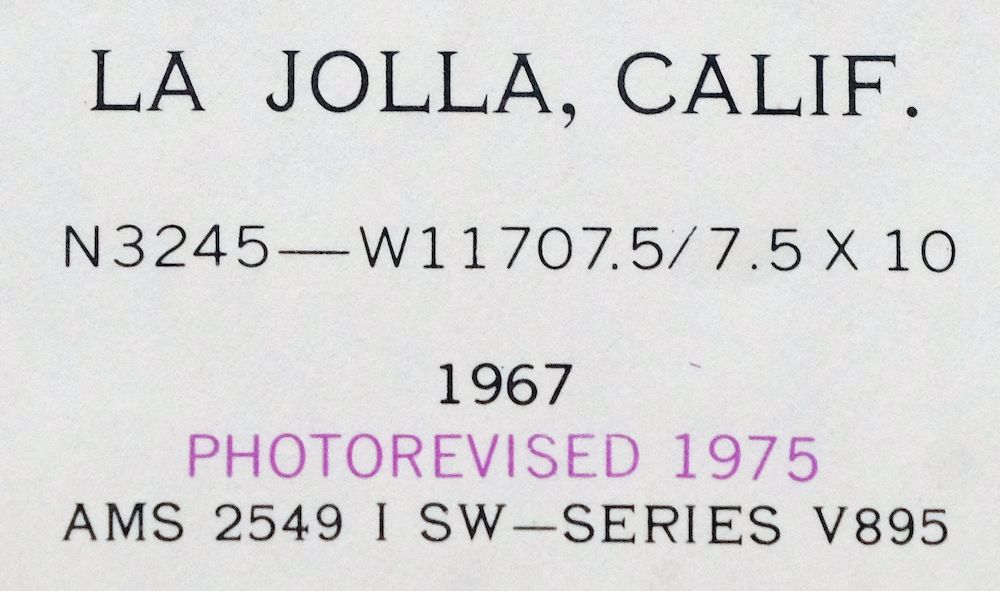 | |
|---|---|
| TITLE | La Jolla |
| STATE | California |
| LOCATION | Vicinity of San Diego |
| SERIES | 7.5-minute |
| EDITION | 1967 |
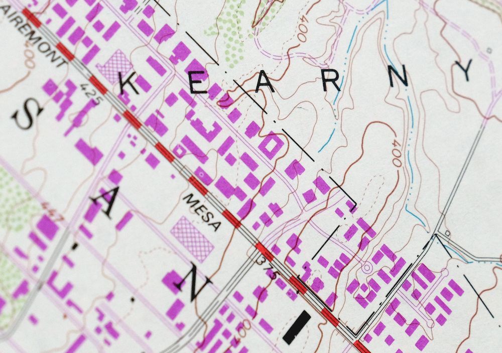
| REVISIONS | Photo revision in 1975 is shown in purple. |
| PRINTED | 1978 |
| PRINT NOTES | Thick paper stock, includes woodland tint (green to indicate vegetated areas) |
| SCALE | 1:24000 |
| SHEET DIMENSIONS | 28 x 27 inches |
| MAP DIMENSIONS | 19 1/8 x 22 3/4 inches |
| COVERAGE AREA | 7 x 9 miles |
| SHEET CONDITION For maps of this vintage, effort is made to note all visible flaws, no matter how minor. | |
| OVERALL CONDITION | Good |
| SHEET NOTES | midsheet horizontal and vertical foldlines (1/4) |
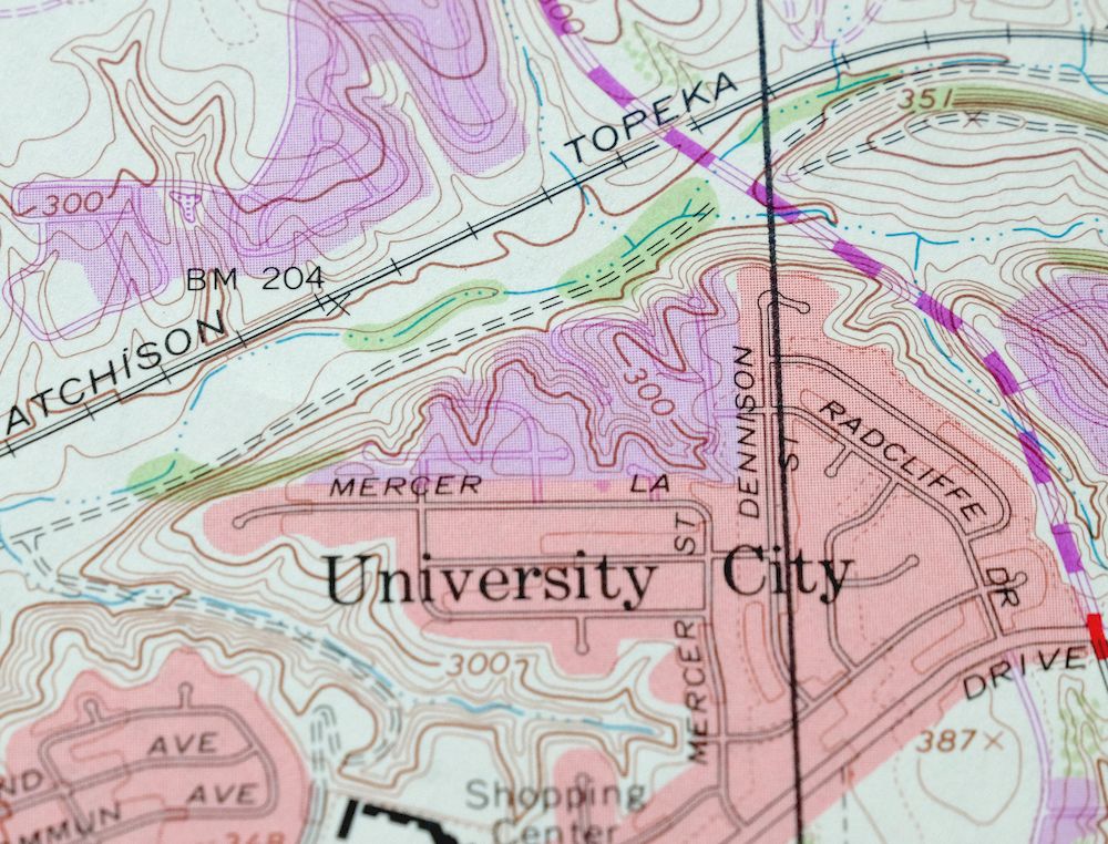
| MAP AREA | no wear, no blemishes, drafting lines neatly applied in the University City area |
| COLLARS | no markings, no blemishes, some wear in corners |
| MAP COVERAGE Quadrangle extent overlaid on current basemap. | |
| PLACENAMES Depending on map series and survey date, all of the features listed below may not be shown on this map. This list contains features that currently exist or historically existed within the area covered by the map. The list can be used as a reference to determine if this map covers your area of interest. Placenames are listed alphabetically next to each feature type. | |
| CITIES AND TOWNS (CURRENT) | San Diego |
| COUNTIES COVERED | San Diego |
| FEDERAL LAND UNITS | Miramar Naval Air Station |
| RIVERS AND STREAMS | San Diego River and Tecolote Creek |
| Locations: Balboa Mesa Shopping Center, Clairemont Square Shopping Center, Clairemont Village Shopping Center, Colony Plaza Shopping Center, Convoy Pointe Plaza Shopping Center, Convoy Village Shopping Center, Costa Verde Shopping Center, Dana Landing, Diane Village Shopping Center, Empire Square Shopping Center, Fashion Valley Shopping Center, Genesee Plaza Shopping Center, Glasshouse Square Shopping Center, Hazard Center Shopping Center, Hillside Village Shopping Center, Independence Square Shopping Center, Kearney Village Shopping Center, Kearny Mesa Shopping Center, Kearny Villa Square Shopping Center, La Jolla Village Square Shopping Center, Linda Vista Plaza Shopping Center, Madison Square Shopping Center, Magnolia Square Shopping Center, Mercury Village Shopping Center, Midway Towne Center Shopping Center, Mission Bay Boat and Ski Club, Mission Bay Public Golf Course, Mission Bay Visitor Center, Mission Bay Yacht Club, Mission Valley Shopping Center, Mission Village Shopping Center, Morena Plaza Shopping Center, Old Town Esplanade Shopping Center, Pacific Beach, Pacific Plaza II Shopping Center, Pacific Plaza Shopping Center, Point Loma Junction, Point Loma Plaza Shopping Center, Presidio Hills Golf Course, Presidio Ruins, River Valley Golf Course, Sam Snead All American Golf Course, Seaforth Landing, Serra Cross, Serra Mesa Shopping Center, Sports Arena Square Shopping Center, Star Center Shopping Center, Stardust Country Club, University City Shopping Center, University City Village Golf Course, University Square Shopping Center, University Towne Centre Shopping Center, Windward Boat Club, and Zlac Rowing Club. Administrative Boundaries: Pueblo Lands of San Diego. Valleys and Canyons: Mission Valley, Murray Canyon, Rose Canyon, and San Clemente Canyon. Parks: Cabrillo Heights Park, Cadman Park and Recreation Center, Celestine Park, Clairmont Park, Clairmont Park Recreation Center, Cliffridge Park, Doyle Community Park, East Clairmont Athletic Area, El Campo Santo, Fanuel Street Park, Gershwin Park, Heritage County Park, Kate O Sessions Memorial Park, Kearny Mesa Park, Kearny Mesa Recreation Center, Linda Vista Park, Lindberg Park, Marcy Park, Missile Park, Mission Bay Athletic Area, Mission Bay Park, Mission Heights Park, Mount Acadia Park, Mount Brundage Park, Mount Etna Park, Nobel Athletic Area, North Park, North Park Recreation Center, Northern Wildlife Preserve, Old Town Plaza, Old Town San Diego Historic District, Old Town San Diego State Historical Park, Old Trolley Barn Park, Olive Grove Park, Pacific Beach Community Park, Presidio Park, Robb Memorial Field, Rose Canyon Open Space, San Clemente Park, Santa Clara Point Community Park, Santa Clara Point Recreation Center, Sea World Aquatic Park, Serra Mesa Park, Serra Mesa Recreation Center, Soledad Park, Squibob Square, Standley Park, Standley Recreation Center, Tecolate Canyon Natural Park, Tecolote Park, University Gardens Park, University Heights Park, University Village Park, Villa La Jolla Park, and Western Hills Park. Drainages: San Diego River and Tecolote Creek. Islands: East Ski Island, Enchanted Isle, Fiesta Island, Ski Islands, Vacation Isle, and West Ski Island. Capes: Bahia Point, El Carmel Point, Crown Point, Hospitality Point, Inner Crown Point, Point Lowell, Mariners Point, Mission Point, Point De Anza, Quivira Point, Santa Clara Point, Stony Point, Sunset Point, Ventura Cove, and Ventura Point. Churches: American Holistic Church, Atonement Lutheran Church, Balboa Avenue Alliance Church, Apostolic Church, Baha'i Faith Church, Calvary Southern Baptist Church, Church of Christ, Church of the Nazarene, Clairemont Bible Baptist Church, Clairemont Church of God, Clairemont Covenant Church, Clairemont Emmanuel Baptist Church, Clairemont Faith Center, Community Pentecostal Church, Covenant Presbyterian Church, East Clairemont Southern Baptist Church, Eastgate Chapel, Eight Church of Christ Scientist, First Alliance Church, First Baptist Church of Bay Park, First Chinese Southern Baptist Church, First Christian Fellowship Church, First Ecumenical United Church, First Oriental Mission Church, First Southern Baptist Church, First Unitarian Church, Full Gospel Temple, Grace Brethren Church, Holy Angels Byzantine Catholic Church, Holy Family Catholic Church, Horizon Christian Fellowship Church, Immaculate Conception Church, Kingdom Hall of Jehovahs Witnesses, Korean Ban Suk Presbyterian Church, Korean Calvary Church, Korean Congregational Church, Korean Full Gospel Church, Korean Joy Baptist Church, Korean Seventh Day Adventist Church, Korean United Methodist Church, Linda Vista Church of Christ, Linda Vista Presbyterian Church, Linda Vista Second Baptist Church, Linda Vista United Methodist Church, Maranatha Ethiopia Church, Metro United Pentecostal Church, Metropolitan Community Church, Mission Hills First Congregational Church, Mission Hills United Church, Mission San Pablo - Clairemont, Mission Village Southern Church, North Clairemont United Methodist Church, Northminster Presbyterian Church, Oasis Christian Fellowship Church, Our Lady of Refuge Church, Our Mother of Confidence Church, Our Saviors Evangelical Church, Pacific Beach Bible Church, Pacific Beach Praise Center, Pacific Beach Presbyterian Church, Pacific Beach United Methodist Church, Pathway Christian Fellowship Church, Paul E Kidd African Methodist Episcopal Church, Peace Lutheran Church, Reformation Lutheran Church, Reorganized Church of Jesus Christ of Latter Day Saints, Saint Andrews by the Sea Church, Saint Catherine Labourne Catholic Church, Saint Columba Catholic Church, Saint Davids Episcopal Church, Saint Elizabeths Episcopal Church, Saint George Serbian Orthodox Church, Saint Johns Catholic Church, Saint Maximillian Kolbe Polish Church, Saint Pauls Lutheran Church, Saint Vincent de Paul Church, San Diego Grace and Truth Chapel, San Diego Korean Evangelical Church, Science of Mind Church, Scott Memorial Baptist Church, Seventh Church, Sojourners Christian Church, Swedenborgian Church of San Diego, The Church of Jesus Christ of Latter Day Saints, United Church of Christ, and University City United Church. Hospitals: Clairmont Community Hospital, Donald N Sharp Memorial Hospital, Hillside Hospital, Mercy Hospital, Mesa Vista Hospital, and Mission Bay Memorial Hospital. Lakes and Ponds: Smiley Lagoon. Buildings: American Presidents Museum, Balboa Branch San Diego Public Library, Childrens Museum of San Diego, Clairmont Branch San Diego Public Library, Derby Pendleton House, Hillcrest Receiving Home, International Arena, Jean Farb Memorial Medical Library, Juniper Serra Museum, Linda Vista Branch San Diego Public Library, Mission Bay Park Headquarters, North Clairemont Branch San Diego Public Library, Old Town San Diego Visitor Center, Pacific Beach Branch San Diego Public Library, Pacific Beach Chamber of Commerce, San Diego Office of Education, Serra Mesa Branch San Diego Public Library, University Community Branch San Diego Public Library, University Heights Branch San Diego Public Library, and Whaley House. Channels: Entrance Channel, Fishermans Channel, Mission Bay Channel, and Pacific Passage. Bayous and Sloughs: Famosa Slough. Beaches: Crown Point Shores and Ski Beach. Bays: Bonita Cove, De Anza Cove, Enchanted Cove, Fiesta Bay, Hidden Anchorage, Leisure Lagoon, Mariners Basin, Mission Bay, North Cove, Perez Cove, Quivira Basin, Rose Inlet, Sail Bay, San Juan Cove, Santa Barbara Cove, Santa Clara Cove, and South Cove. Airports: Hazard Center Office Tower One Heliport, Mercy Hospital and Medical Center Heliport, Montgomery Field, and The Plaza La Jolla Village Heliport. Schools: Academy of our Lady of Peace, Alcott Elementary School, Anderson School, Angier Elementary School, Barnard Elementary School, Bay Park Elementary School, Bayview Terrace Elementary School, Beale School, Birney Elementary School, Cadman Elementary School, Carson Elementary School, Chesterton Elementary School, Clairemont Senior High School, Clara Barton School, Crown Point Elementary School, Doyle Elementary School, Edward A MacDowell Elementary School, Farnum School, Field Elementary School, Fletcher Elementary School, Garfield High School, Hale Junior High School, Hawthorne Elementary School, Holmes Elementary School, Holy Family School, Islamic School of San Diego, Jones Elementary School, Kearny Senior High School, Kroc Middle School, Lafayette Elementary School, Linda Vista Elementary School, Lindberg-Schweitzer School, Longfellow Elementary School, Lutheran School, Madison Senior High School, Marcy School, Marie Curie Elementary School, Marston Middle School, Midway High School, Mission Bay Senior High School, Montgomery Junior High School, Pacific Beach Elementary School, Pacific Beach Middle School, Parker School, Revere School, Riley Elementary School, Ross Elementary School, Saint Columbia School, Saint Johns School, Saint Mary Magdeline School, Saint Vincents School, San Diego Mesa College, San Diego University High School, San Miguel School, Sequoia Elementary School, Sessions Elementary School, Spreckels Elementary School, Standley Junior High School, Stephen Decatur School, Stevenson School, Sunshine School, Taft Junior High School, Toler Elementary School, Torrey Pines Elementary School, Twain Junior-Senior High School, University City High School, University Of San Diego, Wegeforth Elementary School, Whitman Elementary School, Whittier School, and Wiggin School. Towers: KCBQ-FM (San Diego), KFMB-FM (San Diego), KFMB-TV (San Diego), KFSD-FM (San Diego), KGTV-TV (San Diego), KIFM-FM (San Diego), KJQY-FM (San Diego), KKYY-FM (San Diego), KSDO-FM (San Diego), KSDS-FM (San Diego), and KYXY-FM (San Diego). | |
| SHIPPING AND RETURNS | |
 This map sheet will be carefully rolled in a sturdy tube and shipped via the US Postal Service. If you find that the sheet you receive is not as described in the listing, you may ship it back to us for a refund of the purchase price. | |


1978 USGS Topo Map: La Jolla, San Diego, California
$27
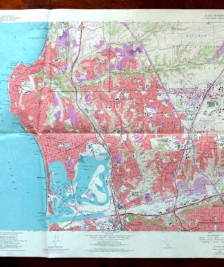
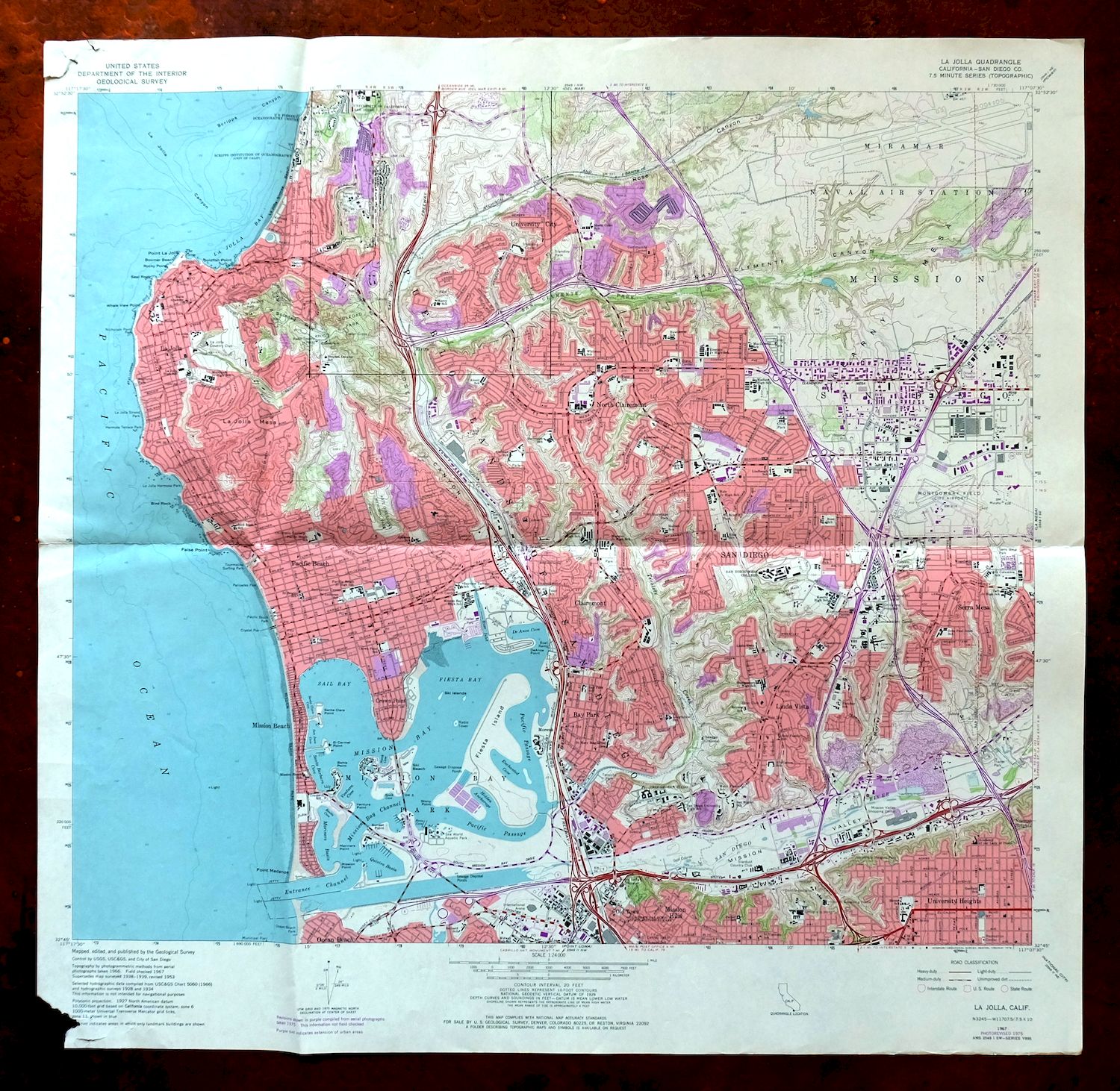
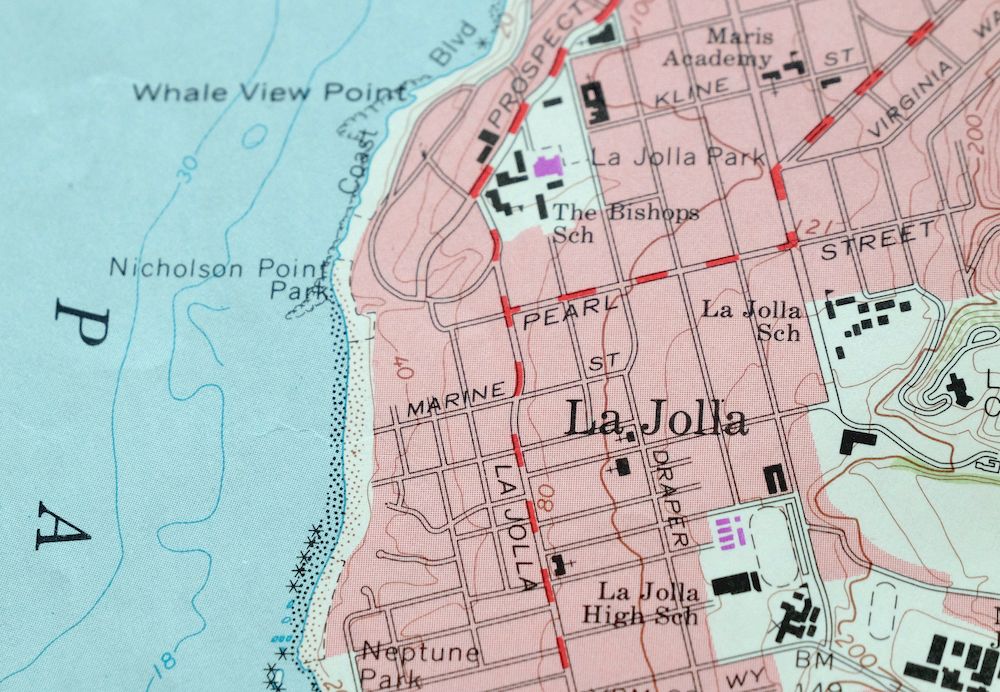
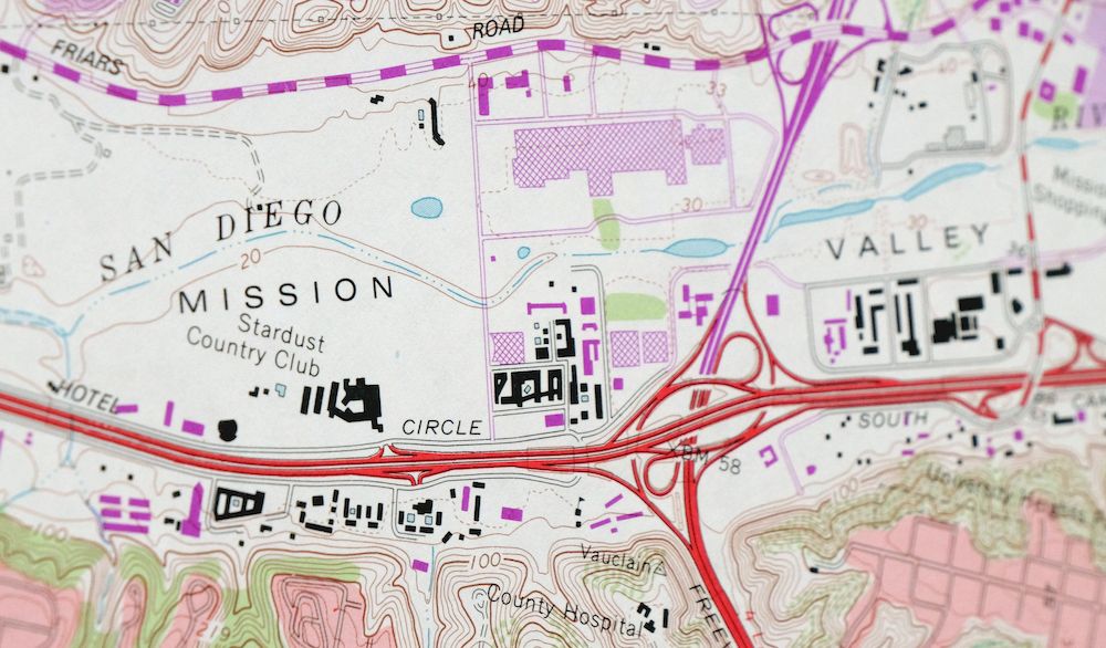
This is a 1:24,000-scale USGS topographic map of the La Jolla quadrangle, a 1967 edition revised in 1975 and printed in 1978 on thick paper with a green woodland tint marking vegetated areas. It covers part of San Diego’s northwestern coast, taking in La Jolla, the University City area, and the shoreline bluffs south toward Pacific Beach. The 1975 revision caught University City in mid-build, when UC San Diego and the surrounding neighborhoods were reshaping the mesa above La Jolla from open land into a planned community.
In stock
This vintage sheet is a 1967 edition of the La Jolla California USGS topographic map revised in 1975 using aerial photography. It is an original 48-year-old 1978 United States Geological Survey print in good condition.
HOW THIS MAP CAN BE USED
In addition to making a fascinating conversation piece, this sheet would look great in a frame or on display, make a unique and prized gift for anyone interested in this area, be perfect as a reference for genealogy studies or general historical research, or fill that missing piece in your collection. Maps of this vintage are printed on durable stock and are well-suited for outdoor activities and recreation of all kinds, including hiking, backpacking, hunting, rafting and kayaking, backcountry skiing, geocaching, general exploration, treasure hunting, etc.
FEATURES SHOWN ON THE MAP
The La Jolla 7.5-minute map shows cities and towns, roads, paths, railroads, utilities and energy infrastructure, rivers, creeks, elevation contour lines, public land survey lines, county, state, and other administrative boundaries as they existed at the time of the survey. A reddish tint may be used on this sheet to indicate urban areas where only landmark buildings will be shown. Outside of those areas, all known structures (houses, businesses churches, schools, barns, cabins, etc) are shown.
A VALUABLE HISTORICAL RECORD
This map is from the 7.5-minute series, the most detailed series that is widely available from the USGS. The 1967 La Jolla map is a valuable historical record for the area. It contains some placenames and features that have been dropped from more recent maps.
The map was photorevised in 1975. Any features that changed or were added between the original edition year of 1967 and the photorevision year of 1975 are overlayed in purple. The purple overlay provides an excellent view of the fast-growing and changing areas within the quad boundary.
Nearby maps
-

Potrero California Morena Village Tecate USGS Topo Map 1954
$27 Add to cart -

Temecula California Fallbrook Rainbow USGS Topo Map 1978
$38 Add to cart -
Hemet California Valle Vista Valle Vista USGS Topo Map 1943
$39 Add to cart -

1950 Santa Catalina East California USGS Topo Map: Avalon
$35 Add to cart -
Orange Anaheim California Vintage USGS Topographic Map 1970
$36 Add to cart -
Riverside East California Edgemont USGS Topographic Map 1955
$40 Add to cart -

1969 USGS Topo Map: Riverside East, California
$46 Add to cart -

Santa Catalina South California USGS Topo Map 1950 Vintage
$30 Add to cart -

Anaheim California Santa Ana Garden Grove USGS Topo Map 1956
$44 Add to cart -

1965 USGS Topo Map: Coachella, Indio, California
$47 Add to cart -
1969 USGS Topo Map: Ontario, Rancho Cucamonga, California
$35 Add to cart -

1966 San Gorgonio Mountain California USGS Topo Map
$47 Add to cart -
Cucamonga California Ontario Chino USGS Topographic Map 1917
$30 Add to cart -
1959 Ontario California USGS Topo Map: Chino
$54 Add to cart -
Cottonwood Spring California USGS Topo Map 1973 Vintage
$39 Add to cart -
Inglewood California Los Angeles Torrance USGS Topo Map 1965
$45 Add to cart -
San Antonio California Wrightwood USGS Topo Map 1903 Antique
$42 Add to cart -
Rock Creek California Angeles NF USGS Topo Map 1903 Antique
$52 Add to cart -
Apple Valley California Bell Mountain USGS Topo Map 1968
$29 Add to cart -

San Fernando California Angeles NF USGS Topographic Map 1955
$26 Add to cart -
Shadow Mountains California El Mirage USGS Topo Map 1948
$28 Add to cart -
1980 Oat Mountain California USGS Topo Map: Los Angeles
$34 Add to cart -
Santa Susana California Brandeis USGS Topographic Map 1970
$42 Add to cart -
Newbury Park California Camarillo USGS Topographic Map 1972
$46 Add to cart