MAP DETAILS | |
|---|---|
| TITLE | White Plains |
| STATE | Virginia, North Carolina |
| LOCATION | 75 miles northeast of Raleigh |
| SERIES | 15-minute |
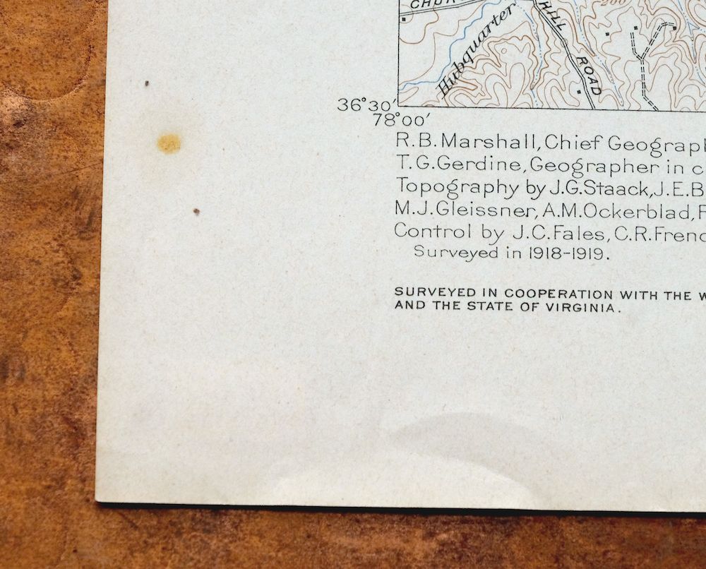
| SURVEYED | 1918 and 1919 Field Survey |
| GEOGRAPHER | R.B. Marshall |
| EDITION | 1920 |
| PRINTED | 1944 |
| PRINT NOTES | Thick paper stock |
| SCALE | 1:62500 |
| CONTOUR INTERVAL | 20 feet |
| SHEET DIMENSIONS | 16 1/2 x 20 inches (approximate) |
| MAP DIMENSIONS | 14 x 17 1/2 inches |
| COVERAGE AREA | 14 x 17 miles |
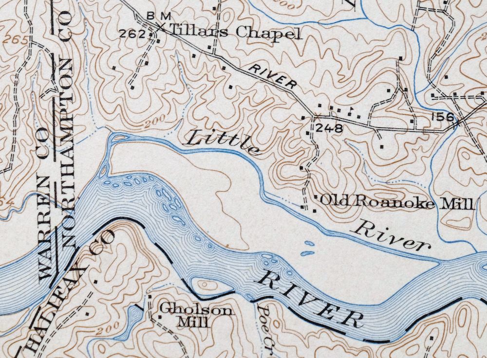
| MAP NOTES | Surveyed before construction of Gaston Dam on the Roanoke River. |
| SHEET CONDITION For maps of this vintage, effort is made to note all visible flaws, no matter how minor. | |
| OVERALL CONDITION | Very Good |
| SHEET NOTES | lightly handled, never folded |
| MAP AREA | flawless map area |
| COLLARS | handwritten two-letter notation in lower right collar corner, single small blemish in lower left collar, no edge tears |
 | |
| MAP COVERAGE Quadrangle extent overlaid on current basemap. | |
| BACKSIDE LEGEND | |
 A map summary is printed on the back side of the White Plains sheet similar to the one shown in the picture. It outlines the history, purpose, and status of the USGS mapping program at the time of the printing in 1944. It also provides instructions on how to read contour lines and a description of how they are used to depict the terrain. At the bottom of the page is a legend showing all of the symbols used to represent the cultural, relief, and water features found on the map. | |
| PLACENAMES Depending on map series and survey date, all of the features listed below may not be shown on this map. This list contains features that currently exist or historically existed within the area covered by the map. The list can be used as a reference to determine if this map covers your area of interest. Placenames are listed alphabetically next to each feature type. | |
| CITIES AND TOWNS (CURRENT) | Ebony and Triplet |
| COUNTIES COVERED | Brunswick, Greensville, Halifax, Northampton, and Warren |
| RIVERS AND STREAMS | Allen Creek, Beddingfield Creek, Big Branch, Brandy Creek, Briery Branch, Buford Branch, Cabin Branch, Coldwater Creek, Devils Branch, Evans Creek, Flat Branch, Genito Creek, Goodrich Branch, Great Creek, Hardy Spring Branch, Hays Creek, Hicks Creek, Houses Creek, Little Coldwater Creek, Little Genito Creek, Little Poplar Creek, Lizard Creek, Long Branch, Main Creek, Martins Branch, Meadow Branch, Meherrin River, Middle Creek, Mill Creek, Pea Hill Creek, Peters Branch, Pigeonroost Creek, Poe Creek, Pole Creek, Quarrel Creek, Rattlesnake Creek, Revistown Branch, Roanoke River, Robinson Creek, Rocky Run, Roses Creek, Saddletree Creek, Sandy Branch, Songbird Creek, Spring Branch, Starks Mill Branch, Stevens Branch, Tanyard Branch, Totaro Creek, and Whit Branch |
| WATER BODIES | Lake Gaston and Roanoke Rapids Lake |
| Virginia Locations: Oak Corner and Phipps Store. Administrative Boundaries: Meherrin Magisterial District and Powellton Magisterial District. Mountains, Peaks, and Summits: Fort Hill. Drainages: Allen Creek, Barnes Creek, Big Branch, Briery Branch, Edwards Creek, Buford Branch, Cabin Branch, Cold Spring Branch, Coldwater Creek, Evans Creek, Ezell Branch, Flat Branch, Genito Creek, Goodrich Branch, Great Creek, Greentown Branch, Hardy Spring Branch, Hays Creek, Hicks Creek, Houses Creek, Johnsons Branch, Little Coldwater Creek, Little Genito Creek, Lizard Creek, Long Branch, Martins Branch, Mason Branch, Meadow Branch, Mill Creek, Pea Hill Creek, Peters Branch, Pigeonroost Creek, Revistown Branch, Rock Branch, Roses Creek, Saddletree Creek, Sandy Branch, Scout Branch, Sims Branch, Songbird Creek, Spring Branch, Starks Mill Branch, Stevens Branch, Tanyard Branch, Totaro Creek, and Whit Branch. Churches: Bethany Church, James Square Church, Jerusalem Church, Light of Liberty Church, Little Bethel Church, Little Chapel Holiness Church, Little Union Church, Mason Grove Church, Matthews Chapel, Mount Olive Church, Oak Grove Church, Paradise Church, Philadelphia Church, Pleasant Hill Church, Popular Mount Church, Prospect Church, Rock Church, Saint Pauls Chapel, Tabernacle Church, and Zion Union Church. Bridges: Gholson Bridge, Pennington Bridge, and Wrights Bridge. Schools: Meherrin-Powellton School. Reservoirs and Tanks: Clary Millpond. | |
| North Carolina Administrative Boundaries: Township of Roanoke. Mountains, Peaks, and Summits: Wilkins Hill. Drainages: Black Gut Creek, Devils Branch, Hubquarter Creek, Jimmies Creek, Little River, Lizard Creek, Mill Creek, Pea Hill Creek, Pigeonroost Creek, and Songbird Creek. Churches: Antioch Church, First Cedar Grove Church, Gaston Church, Roanoke Chapel, Saint Lukes Church, and Tillans Chapel. Dams: Gaston Dam. Schools: Gaston School. Reservoirs and Tanks: Lake Gaston. | |
| SHIPPING AND RETURNS | |
 This map sheet will be carefully rolled in a sturdy tube and shipped via the US Postal Service. If you find that the sheet you receive is not as described in the listing, you may ship it back to us for a refund of the purchase price. | |
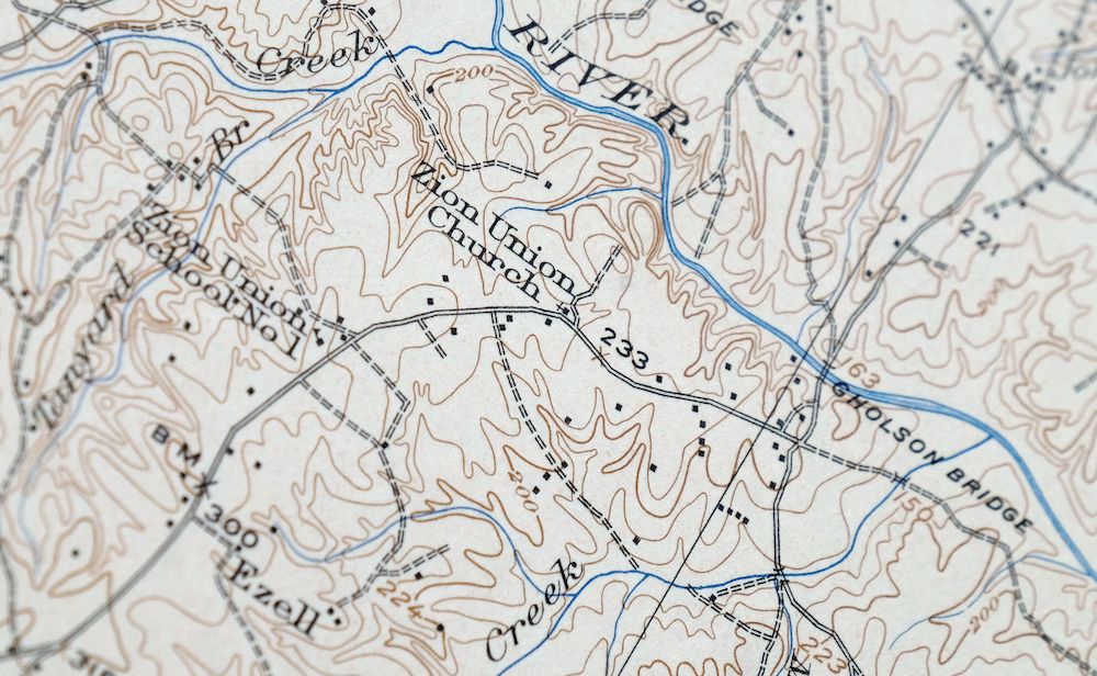
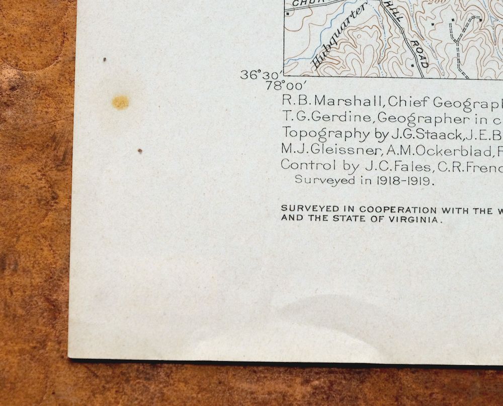
White Plains Virginia Triplet Ebony USGS Topo Map 1944
$39
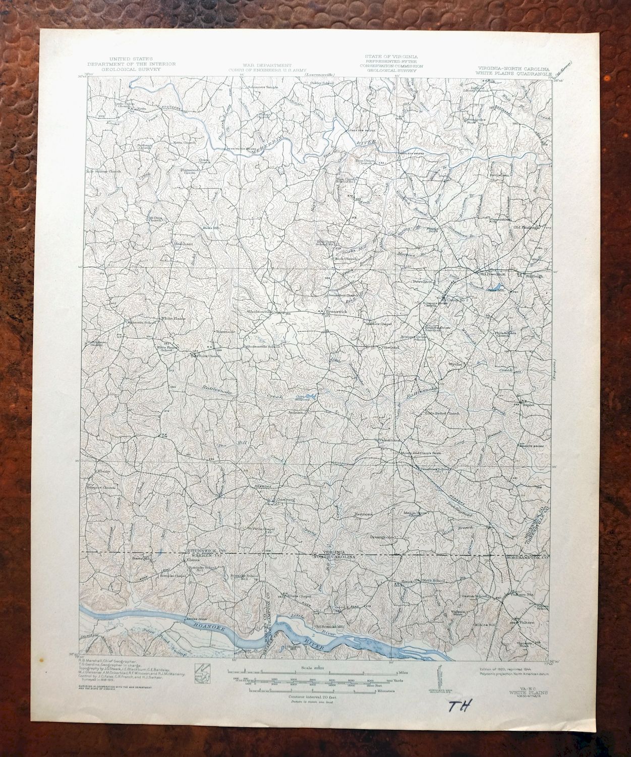
A 1920 edition printed in 1944, this War Department topographic sheet is in very good condition and survives on thick stock. Straddling the Virginia–North Carolina line about 75 miles northeast of Raleigh, the quad takes in parts of Brunswick, Greensville, and Halifax counties in Virginia along with Warren and Northampton in North Carolina, including the communities of Triplet and Ebony. Based on field survey work from 1918 and 1919, it shows the Roanoke River country before the Gaston Dam was built, so the river runs free across the sheet. The map area is flawless, the sheet was never folded, and it carries only a small blemish and a handwritten two-letter notation in the collar.
In stock
This vintage sheet is a 1920 edition of the White Plains Virginia USGS topographic map. It is an original 82-year-old 1944 United States Geological Survey print in very good condition.
HOW THIS MAP CAN BE USED
In addition to making a fascinating conversation piece, this sheet would look great in a frame or on display, make a unique and prized gift for anyone interested in this area, be perfect as a reference for genealogy studies or general historical research, or fill that missing piece in your collection.
FEATURES SHOWN ON THE MAP
The White Plains 15-minute map shows cities and towns, roads, railroads, rivers, creeks, elevation contour lines, public land survey lines, county, state, and other administrative boundaries as they existed at the time of the survey in 1918 and 1919. All known structures (houses, businesses, churches, schools, barns, cabins, etc) are also shown, with exceptions in some urban areas, where only landmark buildings may be shown.
A VALUABLE HISTORICAL RECORD
Maps from the 15-minute series for the continental United States are no longer produced or printed by the USGS and original prints are becoming increasingly difficult to find. They are a valuable historical record for an area, as they contain many placenames and features that have been dropped from more recent maps.
Nearby maps
-

Jarratt Virginia Stony Creek Yale USGS Topographic Map 1951
$38 Add to cart -
Rocky Mount North Carolina Wilson Red Oak USGS Topo Map 1965
$48 Add to cart -
Amelia Virginia Richmond Bon Air USGS Topo Map 1904 Antique
$120 Add to cart -
Farmville Virginia Blackstone Rice USGS Topographic Map 1914
$55 Add to cart -
Appomattox Virginia Brookneal Toga USGS Topographic Map 1912
$55 Add to cart -

Palmyra Virginia Lake Monticello Dillwyn USGS Topo Map 1907
$75 Add to cart -
Vanceboro North Carolina Ernul USGS Topo Map 1968 Vintage
$45 Add to cart -

Natural Bridge Virginia Covington Selma USGS Topo Map 1911
$62 Add to cart -
Staunton Virginia Stuarts Draft USGS Topographic Map 1913
$120 Add to cart -

Luray Virginia Front Royal Stanley USGS Topographic Map 1910
$115 Add to cart -

Mount Vernon Virginia Washington Accokeek USGS Topo Map 1912
$250 Add to cart -
Patuxent Maryland Washington Bowie USGS 30-Min Topo Map 1907
$65 Add to cart -

Franklin West Virginia Petersburg Onego USGS Topo Map 1914
$49 Add to cart -

Winchester Virginia Middletown Inwood USGS Topo Map 1916
$100 Add to cart -

Wytheville Virginia Marion Sparta USGS Topo Map 1907 Antique
$105 Add to cart -

Romney West Virginia Keyser Delray USGS Topographic Map 1909
$115 Add to cart -

Patapsco Maryland Baltimore Jessup USGS Topographic Map 1908
$195 Add to cart -

Nicholas West Virginia Summersville Cowen USGS Topo Map 1912
$54 Add to cart -

Raleigh West Virginia Beckley Oak Hill USGS Topo Map 1901
$95 Add to cart -

Tolchester Maryland Dundalk Essex USGS Topo Map 1908 Antique
$145 Add to cart -

Sutton West Virginia Glenville Elk River USGS Topo Map 1907
$110 Add to cart -
Dover Delaware Bombay Hook NWR Middletown USGS Topo Map 1906
$47 Add to cart -

Bald Knob West Virginia Mallory USGS Topo Map 1923 Antique
$50 Add to cart -

Chambersburg Pennsylvania Guilford USGS Topographic Map 1964
$40 Add to cart