MAP DETAILS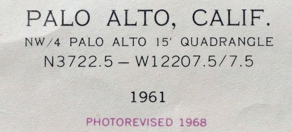 | |
|---|---|
| TITLE | Palo Alto |
| STATE | California |
| LOCATION | 18 miles northwest of San Jose |
| SERIES | 7.5-minute |
| SURVEYED | 1948 through 1961 Aerial and Field Survey |
| EDITION | 1961 |
| REVISIONS | Photo revision in 1968 is shown in purple. |
| PRINTED | 1969 |
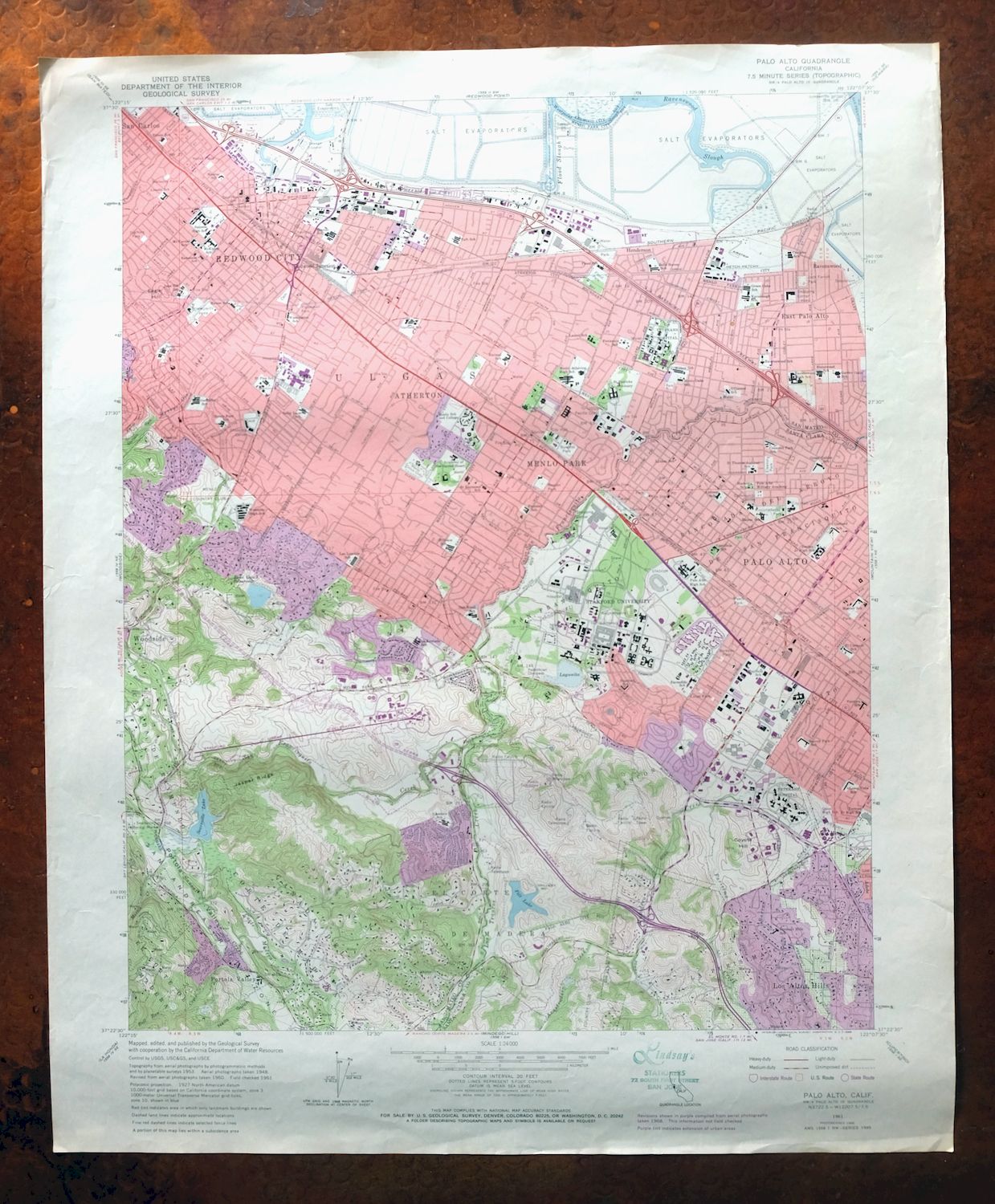
| PRINT NOTES | Thick paper stock, includes woodland tint (green to indicate vegetated areas). A reddish tint is used to indicate urban areas where only landmark buildings are shown. |
| SCALE | 1:24000 |
| CONTOUR INTERVAL | 20 feet |
| SHEET DIMENSIONS | 22 x 27 inches |
| MAP DIMENSIONS | 18 1/8 x 22 3/4 inches |
| COVERAGE AREA | 7 x 9 miles |
| SHEET CONDITION For maps of this vintage, effort is made to note all visible flaws, no matter how minor. | |
| OVERALL CONDITION | Very Good |
| SHEET NOTES | lightly handled, never folded |
| MAP AREA | very minor wear, no markings, no blemishes |
| COLLARS | minor wear or tears, no markings, no blemishes |
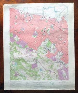
| MAP COVERAGE Quadrangle extent overlaid on current basemap. | |
| PLACENAMES Depending on map series and survey date, all of the features listed below may not be shown on this map. This list contains features that currently exist or historically existed within the area covered by the map. The list can be used as a reference to determine if this map covers your area of interest. Placenames are listed alphabetically next to each feature type. | |
| CITIES AND TOWNS (CURRENT) | Atherton, East Palo Alto, Ladera, Los Altos, Los Altos Hills, Menlo Park, North Fair Oaks, Palo Alto, Portola Valley, Redwood City, San Carlos, Stanford, West Menlo Park, and Woodside |
| COUNTIES COVERED | San Mateo and Santa Clara |
| FEDERAL LAND UNITS | Don Edwards San Francisco Bay National Wildlife Refuge |
| RIVERS AND STREAMS | Adobe Creek, Arastradero Creek, Arroyo Ojo De Agua, Barron Creek, Bear Creek, Corte Madera Creek, Deer Creek, Los Trancos Creek, Martin Creek, Matadero Creek, and San Francisquito Creek |
| WATER BODIES | Bear Gulch Reservoir, Felt Lake, Lagunita, and Searsville Lake |
| Locations: Allied Arts Guild, Bohannon Industrial Park, Britton Station Shopping Center, Circle Star Shopping Center, Creekside Plaza Shopping Center, Docktown Marina, Jefferson Plaza Shopping Center, Menlo Circus Club, Menlo Country Club, Menlo McCandless Office Park, Menlo Park Civic Center, Menlo Park Office Center, Mervyns Plaza Shopping Center, Palo Alto Hills Golf and Country Club, Palo Alto Office Center, Palo Alto Square Shopping Center, Redwood City Municipal Services Center, Redwood Marina, Redwood Plaza Shopping Center, Sharon Heights Golf and Country Club, Sharon Heights Shopping Center, Sharon Shopping Center, Stanford Golf Course, Stanford Industrial Park, Stanford Linear Accelerator, Stanford Shopping Center, The Quadrangle, Town and Country Shopping Center, University Village Shopping Center, Vallombrosa Catholic Retreat Center, Veterans Golf Course, Welch Road Professional Center, Woodside Manor Shopping Center, and Woodside Plaza Shopping Center. Areas: The Oval. Administrative Boundaries: Canada Del Corte De Madera, Pulgas, and San Francisquito. Mountains, Peaks, and Summits: Coyote Hill and Eagle Hill. Valleys and Canyons: Neils Gulch and Portola Valley. Woods: El Palo Alto. Parks: Andrew Spinas Park, Angell Field, Arastradero Preserve, Bayfront Park, Berkeley Park, Bol Park, Boulware Park, Bowden Park, Bowling Green Park, Briones Park, Burgess Park, Camp Fremont Park, Casa De Tableta State Historic Landmark, Cogswell Plaza, Doctor E E Johnson Park, Eaton Park, El Camino Field, El Camino Park, Eleanor Park, Elizabeth Gamble Garden Center, Escondido Mall, Ester Clark Park, Fleishman Park, Flood Park, Galvez Mall, Guinean Sculpture Garden, Hawes Park, Holbrook Palmer Park, Hoover Park, Hopkins Creekside Park, Hopkins Park, Jack Farrell Park, Jardin de Ninos Park, Jasper Ridge Biological Preserve, Joseph Kelly Park, Lasuan Mall, Linden Park, Little House Recreation Center, Lomita Mall, Lytton Plaza, Maddux Park, Mayfield Park, Mezes Plaza, Nealon Park, Palm Park, Pardee Park, Peers Park, Professorville Historic District, Ray Field, Red Morton Community Park, Redding Park, Rinconada Park, Rodin Sculpture Garden, Scott Park, Searsville Historical Marker, Sharon Park, Stafford Park, Stanford Hills Park, Stanford Stadium, Stulsaft Park, Terman Park, Weisshaar Park, Wellesley Park, White Memorial Plaza, and Willow Oaks Park. Drainages: Alambique Creek, Arastradero Creek, Bear Creek, Bull Run Creek, Cordilleras Creek, Corte Madera Creek, Deer Creek, Martin Creek, Matadero Creek, Arroyo Ojo De Agua, Sausal Creek, and Los Trancos Creek. Churches: All Saints Episcopal Church, Ananda Church of Self-Realization, Bethany Lutheran Church, Christ Episcopal Church, Christ Temple Apostolic Church, Church of the Nativity, Corpus Christi Monastery, First Baptist Church, First Church of Christ Scientist, First Congregational Church, First Lutheran Church, First Presbyterian Church, First United Methodist Church, First United Pentecostal Church, Free Will Baptist Church, Greater Friendship Baptist Church, Holy Trinity Episcopal Church, Jerusalem Baptist Church, Ladera Community United Church of Christ, Macedonia Baptist Church, Memorial Church, Menalto Baptist Church, Menlo Park Christian Methodist Episcopal Church, Menlo Park Community Church of God in Christ, Menlo Park Presbyterian Church, Our Lady of the Wayside Roman Catholic Church, Peninsula Covenant Church, Redeemer Lutheran Church, Russian Orthodox Church of Nativity, Saint Albert the Great Roman Catholic Church, Saint Anns Chapel, Saint Anthonys Catholic Church, Saint Denis Catholic Church, Saint Raymonds Roman Catholic Church, Saint Thomas Aquinas Catholic Church, Seventh Day Adventist Church, Starlight Missionary Baptist Church, Temple Beth Am, The Church of Jesus Christ of Latter Day Saints, Trinity Lutheran Church, University Lutheran Church, Valley United Presbyterian Church, Wesley United Methodist Church, and Woodside Priory. Hospitals: Brouer Medical Center, California Ear Institute, Cowell Health Center, Kaiser Permanente Hospital, Le Home Convalescent Hospital, Lucille Packard Childrens Hospital, Lytton Gardens Health Care Center, Menlo Medical Clinic, Palo Alto Medical Foundation Clinic, Stanford Childrens Hospital, and Stanford University Hospital. Buildings: Arrillaga Sports Center, Atherton Branch San Mateo County Library, Atherton City Hall, Barbie Hall of Fame, Barnes Laboratory, Belle Haven Office of Public Services, Bleeker Laboratory, Bowman Library, Branner Hall, Braun Hall, Burgess Theater, Burnham Pavilion, Cardinal Cogen Center, Cecil H Green Library, Cedar Hall, Center for Advanced Study in the Behavioral Sciences, Center for Continuing Study of California Economy Library, Center for Integrated Systems, Center for the Study of Language and Information, Chinese Community Center, College Terrace Library, Crothers Hall, Crothers Memorial Hall, Cummings Hall, Cypress Hall, De Guerre Pool, Dinkelspiel Memorial Music Auditorium, Durand Hall, East Palo Alto Branch San Mateo County Library, East Palo Alto City Hall, Encina Commons, Encina Gymnasium, Encina Hall, Fair Oaks Branch Redwood City Public Library, Fire Station Number 6, First Congregational Church Library, Florence Moore Hall, Ford Center, Forsythe Data Center, Frost Amphitheatre, Galvez Help Center, Gates Center, Gilbert Hall, Ginzton Laboratory, Green Hall, Hansen Laboratory, Harris Community Center, Herbert Hoover Memorial Building, Herrin Hall, Herrin Labs, Revolution and Peace Hoover Institution on War, Hoover Pavilion, Institute of Molecular Medical Sciences, J Henry Meyer Memorial Library, Jordan Hall, Keck Hall, Kimball Hall, Kresge Auditorium, Lagunita Court, Littlefield Center, Lou Henry Hoover Building, Lucie Stern Community Center, Manzanita Center, Maples Pavilion, Margaret Jacks Hall, McClatchy Hall, McCullough Hall, McKeon Memorial Library, Memorial Hall, Menlo Park Central Library, Menlo Park City Hall, Mitchell Hall, Mudd Hall, Museum of American Heritage, National Bureau of Economic Research, Palo Alto Childrens Library, Palo Alto City Hall, Palo Alto Club, Palo Alto Downtown Library, Palo Alto Main Library, Palo Alto Railroad Station, Palo Alto Unified School District Instructional Material Center, Palo Alto Unified School District Instructional Materials Center, Pine Hall, Polya Data Center, Portola Valley Branch San Mateo County Library, Portola Valley Town Hall, Price Laboratory, Redwood City City Hall, Redwood City Public Library, Redwood Hall, Rinconada Fire Station, Roble Gymnasium, Roble Hall, Sam McDonald Track House, San Mateo County Courthouse, San Mateo County Government Center, Schaberg Branch Redwood City Public Library, Sequoia Hall, Serra Complex, Skilling Hall, Sloan Hall, Spruce Hall, Stanford Auxiliary Library, Stanford Center for Research and Development in Education, Stanford Museum, Sterling Quadrangle, Stern Hall, Storke Hall, Sweet Hall, Terman Center, Terman Park Branch Palo Alto City Library, Toyon Hall, Tresidder Memorial Union, Turing Hall, University Park Fire Station, Varian Hall, Wilbur Hall, and Womens Club of Palo Alto. Dams: Bear Gulch 581-006 Dam, Felt Lake 614-002 Dam, Lagunita 614-003 Dam, and Searsville 614 Dam. Bayous and Sloughs: Flood Slough and Ravenswood Slough. Airports: Stanford University Hospital Center Heliport. Schools: Addison Elementary School, Barron Park School, Belle Haven Elementary School, Bing Nursery School, Brentwood Oaks School, Bullis-Purisima Elementary School, Castilleja High School, College of the Sacred Heart, Costano Elementary School, Crescent Park School, David Starr Jordan Middle School, Duveneck Elementary School, El Carmelo Elementary School, Encinal Elementary School, Escondido Elementary School, Fair Oaks Elementary School, Flood School, Fremont School, Garfield Elementary School, Green Oaks School, Harker School, Hawes Elementary School, Henry Ford Elementary School, Henry M Gunn High School, Herbert Hoover Elementary School, Hillview Middle School, Hoover School, John F Kennedy Middle School, John Gill Elementary School, Kavanaugh School, La Entrada Intermediate School, Las Lomitas School, Laurel School, Lincoln School, Loma Vista School, Lucille M Nixon Elementary School, Lytton School, Mayfield School, McKinley Intermediate School, Menlo Oaks Elementary School, Menlo School and College, Menlo-Atherton High School, Mid Peninsula Education Center, Monroe Elementary School, Mount Carmel School, Narobi College, Nativity School, O'Connor School, Oak Knoll Elementary School, Orion Elementary School, Ormandale Elementary School, Palo Alto High School, Peninsula School, Phillips Brooks School, Pinewood High School, Portola School, Ravenswood Elementary School, Ravenswood High School, Redeemer School, Ronald McNair Intermediate School, Roosevelt Elementary School, Sacred Heart High School, Saint Joseph Elementary School, Saint Patricks Seminary, Saint Pius Elementary School, Saint Raymond Elementary School, Saint Thomas Aquinas School, Selby Lane Elementary School, Sequoia High School, Stanford Research Institute, Stanford School, Stanford University, Taft Elementary School, Terman Junior High School, Trinity Episcopal Elementary School, Ventura School, Walter Hayes Elementary School, Washington Elementary School, Willow Elementary School, Woodland Elementary School, and Woodside High School. Ridges: Jasper Ridge. Reservoirs and Tanks: Bear Gulch Reservoir, Felt Lake, Lagunita, and Searsville Lake. Towers: KCEA-FM (Atherton), KDFC-AM (Palo Alto), and KZSU-FM (Stanford). | |
| SHIPPING AND RETURNS | |
 This map sheet will be carefully rolled in a sturdy tube and shipped via the US Postal Service. If you find that the sheet you receive is not as described in the listing, you may ship it back to us for a refund of the purchase price. | |
Palo Alto California Redwood City Ladera USGS Topo Map 1969
$45
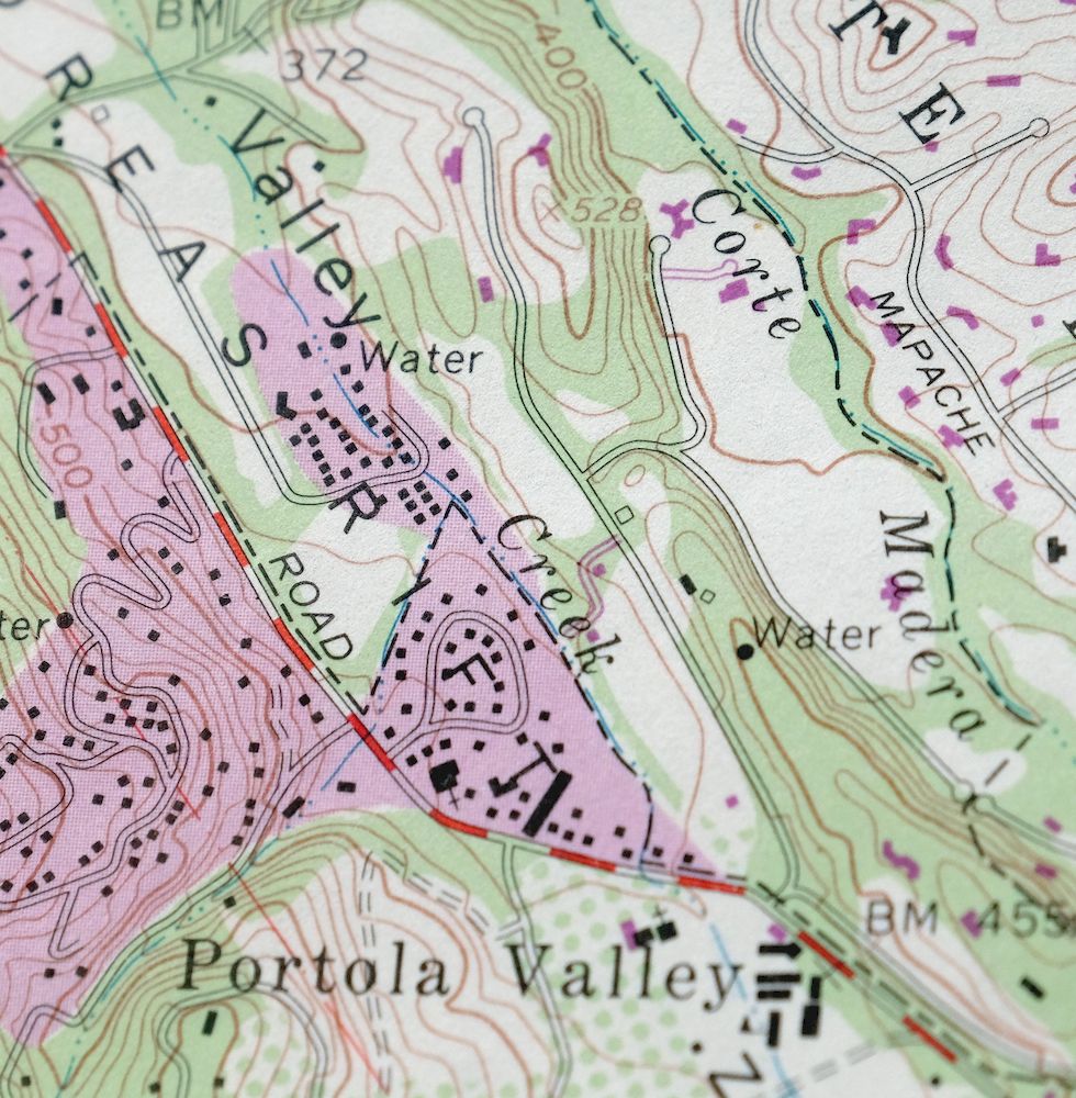
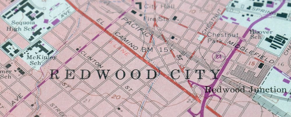
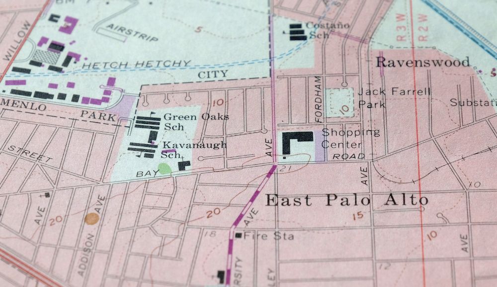
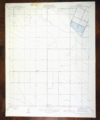
This USGS 7.5-minute topographic map is a 1961 edition printed in 1969, carrying photorevisions through 1968, and the sheet is in very good condition, lightly handled and never folded on thick stock. Set about 18 miles northwest of San Jose, the quad takes in Palo Alto, Redwood City, Menlo Park, and Los Altos, along with Atherton, Woodside, Portola Valley, and part of the Don Edwards San Francisco Bay National Wildlife Refuge. It captures the mid-Peninsula at the start of the 1960s, when the towns between the bay marshes and the wooded hills to the west were filling in with the suburban growth that reshaped this stretch of the San Francisco Bay Area. Because it was never folded and printed on heavier paper, it lies flat and frames well.
In stock
This vintage sheet is a 1961 edition of the Palo Alto California USGS topographic map revised in 1968 using aerial photography. It is an original 57-year-old 1969 United States Geological Survey print in very good condition.
HOW THIS MAP CAN BE USED
In addition to making a fascinating conversation piece, this sheet would look great in a frame or on display, make a unique and prized gift for anyone interested in this area, be perfect as a reference for genealogy studies or general historical research, or fill that missing piece in your collection. Maps of this vintage are printed on durable stock and are well-suited for outdoor activities and recreation of all kinds, including hiking, backpacking, hunting, rafting and kayaking, backcountry skiing, geocaching, general exploration, treasure hunting, etc.
FEATURES SHOWN ON THE MAP
The Palo Alto 7.5-minute map shows cities and towns, roads, paths, railroads, utilities and energy infrastructure, rivers, creeks, elevation contour lines, public land survey lines, county, state, and other administrative boundaries as they existed at the time of the survey in 1948 through 1961. A reddish tint is used on this sheet to indicate urban areas where only landmark buildings are depicted. Outside of those areas, all known structures (houses, businesses, churches, schools, barns, cabins, etc) are shown.
A VALUABLE HISTORICAL RECORD
This map is from the 7.5-minute series, the most detailed series that is widely available from the USGS. The 1961 Palo Alto map is a valuable historical record for the area. It contains some placenames and features that have been dropped from more recent maps.
The map was photorevised in 1968. Any features that changed or were added between the original edition year of 1961 and the photorevision year of 1968 are overlayed in purple. The purple overlay provides an excellent view of the fast-growing and changing areas within the quad boundary.
Nearby maps
-

Redwood Point California Fremont Hayward USGS Topo Map 1948
$24 Add to cart -
Mindego Hill California Palo Alto USGS Topo Map 1980 Vintage
$32 Add to cart -

Newark California Fremont Hayward USGS Topo Map 1948 Vintage
$47 Add to cart -
Hunters Point California Oakland USGS Topographic Map 1969
$38 Add to cart -
San Francisco South California USGS 7.5-Min Topo Map 1975
$47 Add to cart -
Point Bonita California Sausalito USGS Topographic Map 1955
$44 Add to cart -
San Quentin California Richmond Tiburon USGS Topo Map 1980
$46 Add to cart -

San Rafael California Mill Valley Tiburon USGS Topo Map 1966
$60 Add to cart -
Port Chicago California Concord Martinez USGS Topo Map 1956
$38 Add to cart -
Petaluma Point California Novato USGS Topographic Map 1951
$30 Add to cart -
Pittsburg California Concord Fairfield USGS Topo Map 1965
$38 Add to cart -
Mount Vaca California Fairfield Vacaville USGS Topo Map 1967
$40 Add to cart -

Cressey California Livingston Delhi USGS Topo Map 1948
$23 Add to cart -
Greenfield California Salinas River USGS Topo Map 1973
$30 Add to cart -

Merced California Planada USGS 15-Min Topo Map 1963 Vintage
$18 Add to cart -

Chowchilla California Le Grand El Nido USGS Topo Map 1962
$20 Add to cart -

Firebaugh California Mendota USGS Topo Map 1947 Vintage
$18 Add to cart -
Kentucky Well California USGS 7.5-Min Topo Map 1948 Vintage
$32 Add to cart -

Le Grand California Madera Chowchilla USGS Topo Map 1963
$14 Add to cart -
San Ardo California Salinas River USGS Topographic Map 1943
$58 Add to cart -

Raynor Creek California Chowchilla River USGS Topo Map 1947
$30 Add to cart -

Jawbone Ridge California Buck Meadows USGS Topo Map 1949
$27 Add to cart -
Kismet California Madera USGS 7.5-Min Topo Map 1948 Vintage
$32 Add to cart -
Englebrecht Ranch California Cantua Creek USGS Topo Map 1947
$17 Add to cart