MAP DETAILS | |
|---|---|
| TITLE | San Quentin |
| STATE | California |
| LOCATION | Vicinity of Richmond |
| SERIES | 7.5-minute |
| EDITION | 1959 |
| REVISIONS | Photo revision in 1980 is shown in purple. |
| PRINTED | 1980 |
| PRINT NOTES | Thick paper stock, includes woodland tint (green to indicate vegetated areas) |
| SCALE | 1:24000 |
| SHEET DIMENSIONS | 22 x 27 inches (approximate) |
| MAP DIMENSIONS | 18 x 22 3/4 inches |
| COVERAGE AREA | 7 x 9 miles |
| SHEET CONDITION For maps of this vintage, effort is made to note all visible flaws, no matter how minor. | |
| OVERALL CONDITION | Very Good |
| SHEET NOTES | midsheet horizontal foldline (in half), pencilled map title on back of sheet |
| MAP AREA | no wear, no markings, no blemishes |
| COLLARS | no markings, no blemishes, minor repaired edge tear in lower left collar corner |
| MAP COVERAGE Quadrangle extent overlaid on current basemap. | |
| PLACENAMES Depending on map series and survey date, all of the features listed below may not be shown on this map. This list contains features that currently exist or historically existed within the area covered by the map. The list can be used as a reference to determine if this map covers your area of interest. Placenames are listed alphabetically next to each feature type. | |
| CITIES AND TOWNS (CURRENT) | Belvedere, Corte Madera, Richmond, San Quentin, San Rafael, Santa Venetia, Strawberry, and Tiburon |
| COUNTIES COVERED | Contra Costa and Marin |
| FEDERAL LAND UNITS | Golden Gate National Recreation Area |
| RIVERS AND STREAMS | San Pablo Bay, San Pablo Creek, San Rafael Creek, and Wildcat Creek |
| WATER BODIES | Belvedere Lagoon |
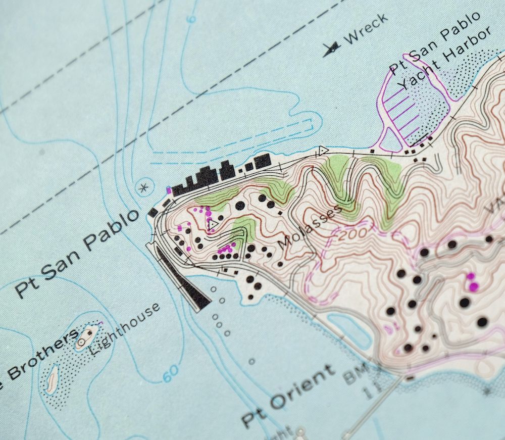
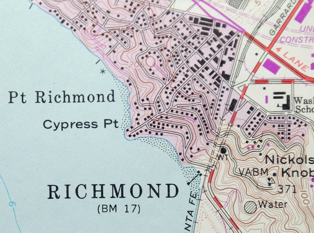
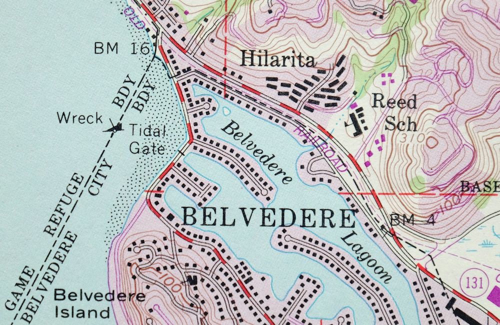
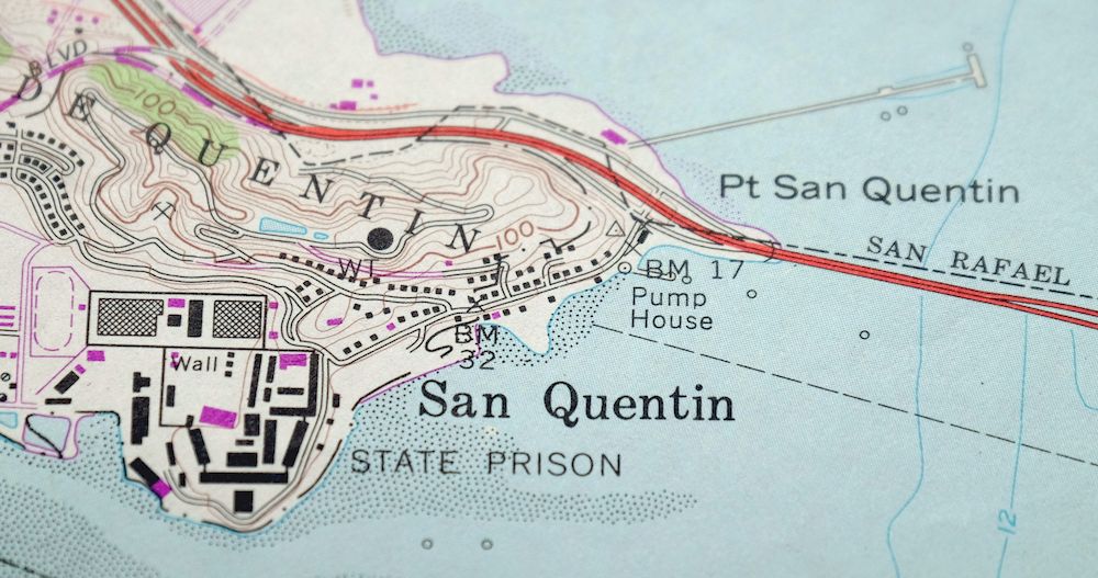
| Locations: Boardwalk Shopping Center, Brickyard Cove Marina, Cove Shopping Center, East Brother Lighthouse, Long Wharf, Marin Rod and Gun Club, Municipal Pier, Peacock Gap Golf Country Club, Richmond Pier, Tiburon Oceanographic Center, and Tiburon Peninsula Club. Mountains, Peaks, and Summits: Nickols Knob, Ring Mountain, and San Pedro Hill. Parks: Belvedere Park, George Miller Junior Memorial Regional Shoreline, Henry A Barbier Memorial Park, John T Knox Shoreline, Kellers Beach Park, McKegney Field, McNears Beach County Park, Old Saint Hilarys Historic Preserve, Paradise Beach County Park, Peacock Gap Neighborhood Park, Pickleweed Park, Richardson Bay Audubon Center and Wildlife Sanctuary, Richardson Bay Park, San Clemente Park, Schoen Park, Shoreline Band Park, Tiburon Uplands Nature Preserve, Victor Jones Park, and Washington Park. Trails: Peacock Gap Trail. Drainages: Castro Creek, San Clemente Creek, San Pablo Creek, San Rafael Creek, and Wildcat Creek. Islands: The Brothers, East Marin Island, Red Rock, The Sisters, and West Marin Island. Capes: Bluff Point, California Point, Castro Point, Cypress Point, Paradise Cay, Point Chauncey, Point Molate, Point Orient, Point Richmond, Point San Pablo, Point San Pedro, Point San Quentin, and Tiburon Peninsula. Churches: Community Congregational Church, First Methodist Church, Old Saint Hilarys Church, Our Lady of Mercy Church, Point Richmond Baptist Church, Saint Stephens Episcopal Church, Shepherd of the Hills Lutheran Church, The Point Gospel Chapel, and Tiburon Baptist Church. Harbors: Loch Lomond Yacht Harbor and Turning Basin. Lakes and Ponds: Belvedere Lagoon. Buildings: California State Prison, Fire Station Number 2, Golden State Model Railroad Museum, Lyford House, Point Richmond Historical Society Museum, Tiburon City Hall, and West Side Branch Richmond Public Library. Channels: Point Potrero Reach, Richmond Harbor Entrance Channel, San Pablo Strait, and Southampton Shoal Channel. Bridges: Richmond -San Rafael Bridge. Beaches: Kellers Beach and Point Molate Beach. Bays: Brickyard Cove, Keil Cove, Paradise Cove, Point San Pablo Yacht Harbor, and San Rafael Bay. Bars: Castro Rocks, Invincible Rock, Sandpiper Spit, Southampton Shoal, and Whiting Rock. Airports: San Rafel Heliport. Schools: Bahia Vista Elementary School, Bel Aire Elementary School, Del Mar Intermediate School, Glenwood Elementary School, Marin County Day School, Reed Elementary School, San Clemente School, San Pedro School, and Washington Elementary School. Flats: Blackies Pasture. Towers: KTID-FM (San Rafael). | |
| SHIPPING AND RETURNS | |
 This map sheet will be carefully rolled in a sturdy tube and shipped via the US Postal Service. If you find that the sheet you receive is not as described in the listing, you may ship it back to us for a refund of the purchase price. | |
San Quentin California Richmond Tiburon USGS Topo Map 1980
$46
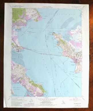
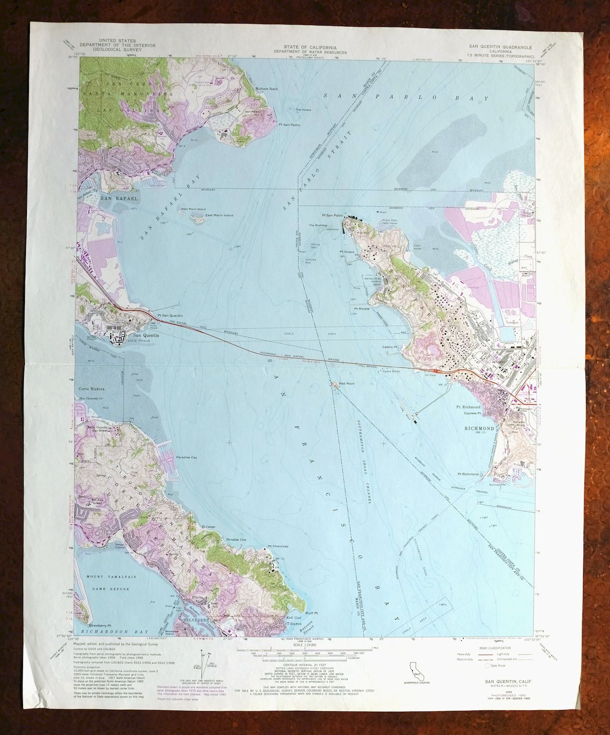
This USGS 7.5-minute topographic map is a 1959 edition with photorevisions through 1980, printed in 1980 on thick stock and in very good condition, with a single midsheet horizontal foldline and a pencilled title on the back. Straddling San Francisco Bay in Contra Costa and Marin counties, the quad area takes in Richmond and San Rafael along with Corte Madera, Tiburon, Belvedere, Strawberry, Santa Venetia, and the community of San Quentin. The bay-shore geography here shows the waterfront points and inlets around the Richmond–San Rafael crossing, with the town of San Quentin lending the sheet its name.
In stock
This vintage sheet is a 1959 edition of the San Quentin California USGS topographic map revised in 1980 using aerial photography. It is an original 46-year-old 1980 United States Geological Survey print in very good condition.
HOW THIS MAP CAN BE USED
In addition to making a fascinating conversation piece, this sheet would look great in a frame or on display, make a unique and prized gift for anyone interested in this area, be perfect as a reference for genealogy studies or general historical research, or fill that missing piece in your collection. Maps of this vintage are printed on durable stock and are well-suited for outdoor activities and recreation of all kinds, including hiking, backpacking, hunting, rafting and kayaking, backcountry skiing, geocaching, general exploration, treasure hunting, etc.
FEATURES SHOWN ON THE MAP
The San Quentin 7.5-minute map shows cities and towns, roads, paths, railroads, utilities and energy infrastructure, rivers, creeks, elevation contour lines, public land survey lines, county, state, and other administrative boundaries as they existed at the time of the survey. A reddish tint may be used on this sheet to indicate urban areas where only landmark buildings will be shown. Outside of those areas, all known structures (houses, businesses churches, schools, barns, cabins, etc) are shown.
A VALUABLE HISTORICAL RECORD
This map is from the 7.5-minute series, the most detailed series that is widely available from the USGS. The 1959 San Quentin map is a valuable historical record for the area. It contains some placenames and features that have been dropped from more recent maps.
The map was photorevised in 1980. Any features that changed or were added between the original edition year of 1959 and the photorevision year of 1980 are overlayed in purple. The purple overlay provides an excellent view of the fast-growing and changing areas within the quad boundary.
Nearby maps
-

San Rafael California Mill Valley Tiburon USGS Topo Map 1966
$60 Add to cart -
Petaluma Point California Novato USGS Topographic Map 1951
$30 Add to cart -
Point Bonita California Sausalito USGS Topographic Map 1955
$44 Add to cart -
San Francisco South California USGS 7.5-Min Topo Map 1975
$47 Add to cart -
Hunters Point California Oakland USGS Topographic Map 1969
$38 Add to cart -
Port Chicago California Concord Martinez USGS Topo Map 1956
$38 Add to cart -

Redwood Point California Fremont Hayward USGS Topo Map 1948
$24 Add to cart -

Newark California Fremont Hayward USGS Topo Map 1948 Vintage
$47 Add to cart -
Pittsburg California Concord Fairfield USGS Topo Map 1965
$38 Add to cart -
Mount Vaca California Fairfield Vacaville USGS Topo Map 1967
$40 Add to cart -
Palo Alto California Redwood City Ladera USGS Topo Map 1969
$45 Add to cart -
Mindego Hill California Palo Alto USGS Topo Map 1980 Vintage
$32 Add to cart -
Lakeport California Lucerne Nice USGS Topo Map 1977 Vintage
$44 Add to cart -
Stonyford California USGS 15-Min Topo Map 1967 Vintage
$39 Add to cart -

Cressey California Livingston Delhi USGS Topo Map 1948
$23 Add to cart -
Gridley California Oroville Live Oak USGS Topo Map 1959
$37 Add to cart -
Fruto California Stony Creek Nye Creek USGS Topo Map 1944
$30 Add to cart -

Merced California Planada USGS 15-Min Topo Map 1963 Vintage
$18 Add to cart -

Chowchilla California Le Grand El Nido USGS Topo Map 1962
$20 Add to cart -
Greenfield California Salinas River USGS Topo Map 1973
$30 Add to cart -

Jawbone Ridge California Buck Meadows USGS Topo Map 1949
$27 Add to cart -

Firebaugh California Mendota USGS Topo Map 1947 Vintage
$18 Add to cart -
Kentucky Well California USGS 7.5-Min Topo Map 1948 Vintage
$32 Add to cart -

Richardson Springs California Chico Nord USGS Topo Map 1966
$35 Add to cart