MAP DETAILS | |
|---|---|
| TITLE | Peytona |
| STATE | West Virginia |
| LOCATION | Vicinity of Marmet, 15 miles south of Charleston |
| SERIES | 15-minute |
| SURVEYED | 1908 and 1909 Field Survey |
| GEOGRAPHER | R.B. Marshall |
| ENGRAVED | 1911 |
| EDITION | 1911 |
| PRINTED | 1911 |
| PRINT NOTES | Thick paper stock |
| SCALE | 1:62500 |
| CONTOUR INTERVAL | 50 feet |
| SHEET DIMENSIONS | 16 1/2 x 20 inches |
| MAP DIMENSIONS | 13 3/4 x 17 1/2 inches |
| COVERAGE AREA | 14 x 17 miles |
| MAP NOTES | Surveyed before the modern highway and interstate system, showing historic travel routes and rail lines. |
| SHEET CONDITION For maps of this vintage, effort is made to note all visible flaws, no matter how minor. | |
| OVERALL CONDITION | Very Good |
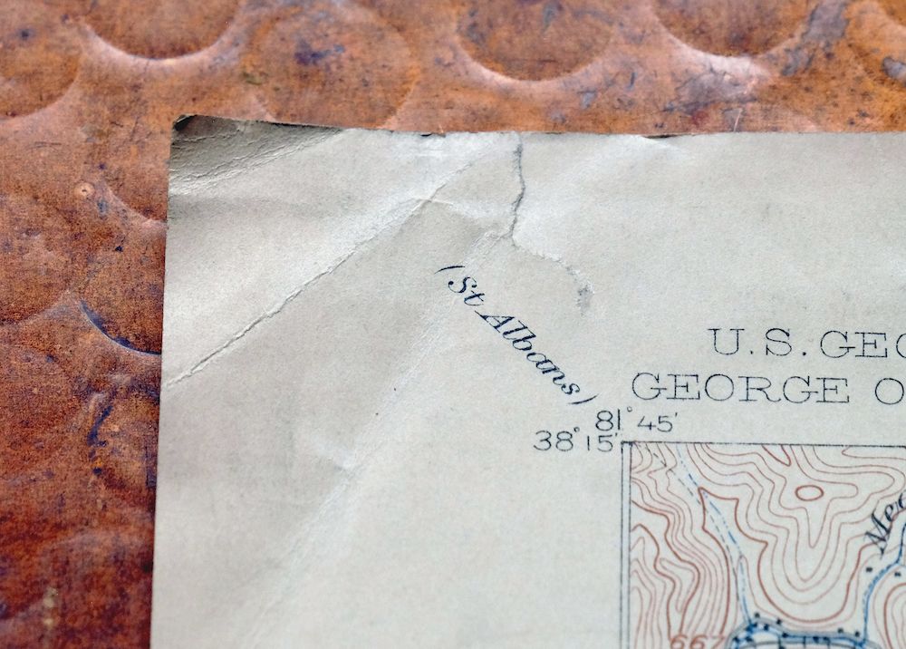
| SHEET NOTES | lightly handled, never folded, attractively age-toned paper |
| MAP AREA | flawless map area |
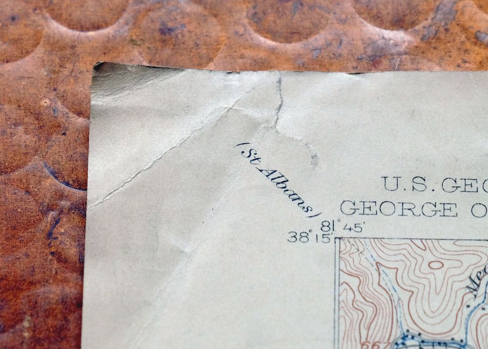
| COLLARS | minor blemishes, small pencilled notation in upper right collar corner, some edgewear in top and lower left collar, small inventory stamp in bottom right collar |
 | |
| MAP COVERAGE Quadrangle extent overlaid on current basemap. | |
| BACKSIDE LEGEND | |
 A map summary is printed on the back side of the Peytona sheet similar to the one shown in the picture. It outlines the history, purpose, and status of the USGS mapping program at the time of the printing in 1911. It also provides instructions on how to read contour lines and a description of how they are used to depict the terrain. At the bottom of the page is a legend showing all of the symbols used to represent the cultural, relief, and water features found on the map. | |
| PLACENAMES Depending on map series and survey date, all of the features listed below may not be shown on this map. This list contains features that currently exist or historically existed within the area covered by the map. The list can be used as a reference to determine if this map covers your area of interest. Placenames are listed alphabetically next to each feature type. | |
| CITIES AND TOWNS (CURRENT) | Belle, Chesapeake, Comfort, Hernshaw, Marmet, Racine, and Sylvester |
| COUNTIES COVERED | Boone and Kanawha |
| RIVERS AND STREAMS | Bennett Fork, Big Coal River, Big Jarrells Creek, Bradley Fork, Brier Branch, Brier Creek, Brush Creek, Brushy Branch, Burnside Branch, Cabin Fork, Cane Branch, Carroll Branch, Chrisley Fork, Coal Fork, Cold Fork, Coon Fork, Curtis Branch, Davis Creek, Drawdy Creek, Dry Branch, Fourmile Branch, Fourmile Fork, Honeycamp Fork, Hopkins Fork, Horse Branch, Indian Creek, Joes Branch, Joes Creek, Kanawha River, Laurel Creek, Laurel Fork, Left Fork Brier Creek, Left Fork Bull Creek, Left Fork Joes Creek, Left Fork Lens Creek, Left Fork Longbottom Creek, Left Fork Rock Creek, Left Fork White Oak Creek, Lens Creek, Lick Creek, Little Creek, Little Jarrells Creek, Little Laurel Creek, Little White Oak Creek, Logan Fork, Long Branch, Longbottom Creek, Meadow Fork Brier Creek, Middlelick Branch, Mikes Run, Mill Branch, Morgan Branch, Mudlick Fork, Orchard Branch, Pond Fork, Potato Branch, Reynolds Branch, Right Fork White Oak Creek, Road Fork, Robinson Creek, Roundbottom Branch, Roundbottom Creek, Rush Creek, Sandlick Creek, Scott Branch, Seng Fork, Sentz Lick Branch, Short Creek, Slaughter Creek, Spicelick Fork, Spruce Fork, Stover Branch, Three Fork Branch, Threemile Branch, Toneys Branch, Trace Fork, Twomile Branch, Wall Fork, Welch Branch, White Oak Branch, White Oak Creek, Whites Branch, and Witcher Creek |
| WATER BODIES | Chesterfield Mine Siltation Pond |
| Locations: Bee Mountain Lookout Tower, Davis Creek Camping Area, Davis Creek Picnic Area, Log Town Hollow Picnic Area, and Williams Hill Lookout Tower. Administrative Boundaries: District 1 Magisterial District. Mountains, Peaks, and Summits: Bee Mountain. Valleys and Canyons: Bradford Hollow, Brawleys Hollow, Burgess Hollow, Coopers Hollow, Foster Hollow, Frey Hollow, Frozen Hollow, Holstein Hollow, Horse Hollow, Loggy Hollow, Low Point Hollow, Longs Hollow, New West Hollow, North Hollow, Old West Hollow, Opera House Hollow, Ring Hollow, Sawmill Hollow, Schoolhouse Hollow, South Hollow, Sweethome Hollow, Town Hollow, Walker Hollow, and Wolfpen Hollow. Parks: Drawdy Falls Roadside Park. Drainages: Little Rich Fork, Bennett Fork, Laurel Branch, Laurel Creek, Lavinia Fork, Left Fork Brier Creek, Left Fork Bull Creek, Left Fork Joes Creek, Left Fork Lens Creek, Left Fork White Oak Creek, Lens Creek, Lick Creek, Little Creek, Little Elk Creek, Little Jarrells Creek, Little Laurel Creek, Little White Oak Creek, Big Jarrells Creek, Bradley Fork, Brier Branch, Brush Creek, Brushy Branch, Bull Creek, Burnside Branch, Cabin Fork, Carroll Branch, Carrow Fork, Chrisley Fork, Cold Fork, Coon Fork, Curtis Branch, Dolans Fork, Dotson Fork, Drawdy Creek, Dry Branch, Falling Rock Fork, Ferneys Branch, Fields Creek, Fourmile Branch, Fourmile Fork, George Branch, Gidd Branch, Haggle Branch, Honeycamp Fork, Hopkins Fork, Horse Branch, Indian Creek, Jakes Branch, Joes Branch, Joes Creek, Logan Fork, Long Branch, Lots Branch, Maple Fork, Mary Fork, Meadow Fork Brier Creek, Mikes Run, Mile Branch, Mill Branch, Morgan Branch, Mudlick Fork, Orchard Branch, Pack Branch, Potato Branch, Reynolds Branch, Rich Fork, Right Fork White Oak Creek, Road Fork, Roundbottom Branch, Roundbottom Creek, Ruffys Fork, Sandlick Creek, Scott Branch, Seng Fork, Sentz Lick Branch, Short Creek, Simmons Creek, Sixmile Branch, Spicelick Fork, Spruce Fork, Stolling Fork, Stover Branch, Sugarcamp Fork, Thomas Branch, Three Fork Branch, Threemile Branch, Toney Fork, Toneys Branch, Trace Fork, Twomile Branch, Walker Creek, Welch Branch, White Oak Branch, White Oak Creek, and Witcher Creek. Islands: Scotts Island. Churches: Ashford Church of God, Atha Chapel, Belle Church of the Nazarene, Belle Presbyterian Church, Lens Creek Church, Leon Memorial Tabernacle, Little Creek Church, Brier Creek Tabernacle, Church of Christ, Church of the Nazarene, Drawdy Church, Drawdy Creek Church, Esta Church, First Baptist Church of Racine, Judson Baptist Church, Mahone Chapel, Marmet Baptist Church, Mount Herman Church, Naomi Church, Peytona Church of Christ, Racine Methodist Church, Reynolds Memorial United Methodist Church, Simmons Creek Church, and Witcher Baptist Church. Hospitals: Marmet Hospital. Buildings: Chesapeake City Hall and Marmet City Hall. Dams: Curtis Branch Dam, Lotts Branch Slurry Impoundment Dam, Road Fork Dam Number 1 Upper, and Road Fork Dam Number 2 - lower. Crossings: Interchange 85 and Interchange 89. Airports: Island Airport and Walker I Heliport. Schools: Ashford-Rumble Elementary School, Belle Elementary School, Chesapeake Elementary School, Comfort Elementary School, Loudon District Junior High School, Marmet Elementary School, Midland Trail Elementary School, Nellis Elementary School, Racine-Peytona Elementary School, Sherman Junior High School, Sherman Senior High School, and Sylvester Elementary School. Reservoirs and Tanks: Big Mountain Slurry Pond and Chesterfield Mine Siltation Pond. Springs: James Kay Spring. | |
| SHIPPING AND RETURNS | |
 This map sheet will be carefully rolled in a sturdy tube and shipped via the US Postal Service. If you find that the sheet you receive is not as described in the listing, you may ship it back to us for a refund of the purchase price. | |
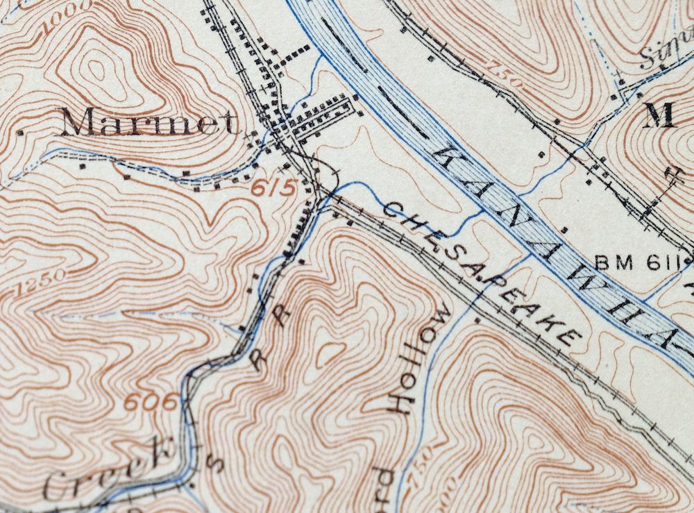
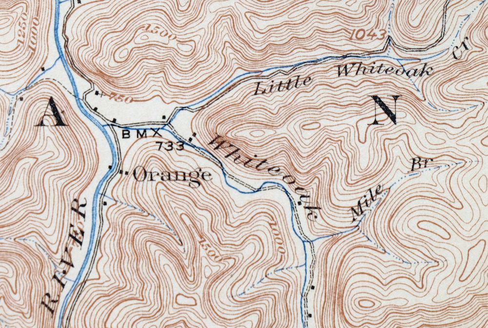
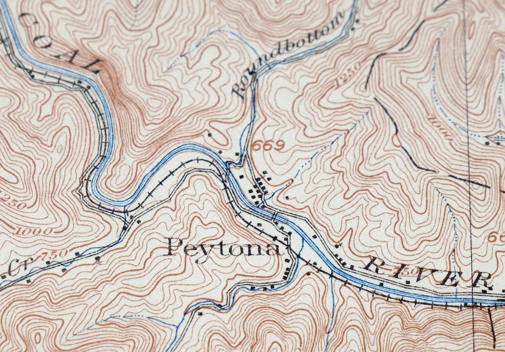
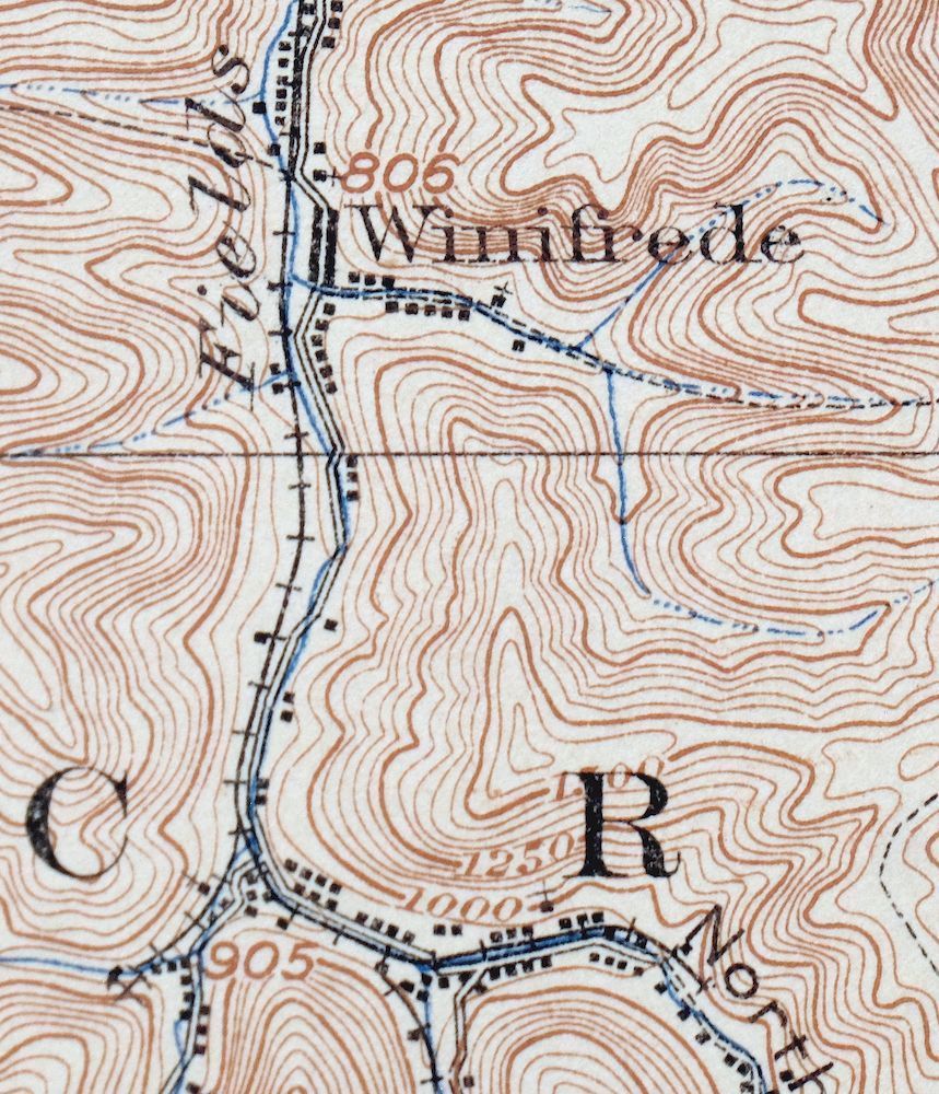
Peytona West Virginia Marmet Belle USGS Topographic Map 1911
$42
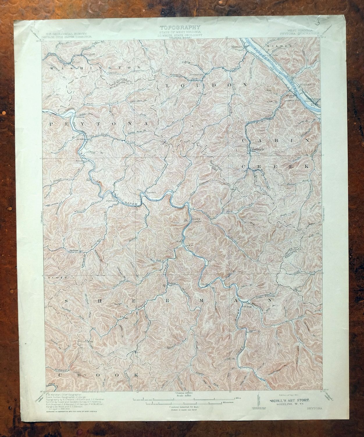
Printed in 1911, its year of first publication, this 15-minute USGS topographic sheet is an antique in very good condition, never folded and on thick stock, with attractively age-toned paper and a flawless map area. Covering ground in the Kanawha and Boone county area about 15 miles south of Charleston, the quad takes in Marmet, Chesapeake, and Belle along with communities such as Racine, Hernshaw, and Sylvester. Surveyed in 1908 and 1909 and engraved in 1911, it predates the modern highway and interstate system, so it records the rail lines and travel routes that carried people and coal through these hollows at the time.
In stock
This antique sheet is a 1911 edition of the Peytona West Virginia USGS topographic map. It is an authentic 115-year-old United States Geological Survey print in very good condition.
HOW THIS MAP CAN BE USED
In addition to making a fascinating conversation piece, this sheet would look great in a frame or on display, make a unique and prized gift for anyone interested in this area, be perfect as a reference for genealogy studies or general historical research, or fill that missing piece in your collection.
FEATURES SHOWN ON THE MAP
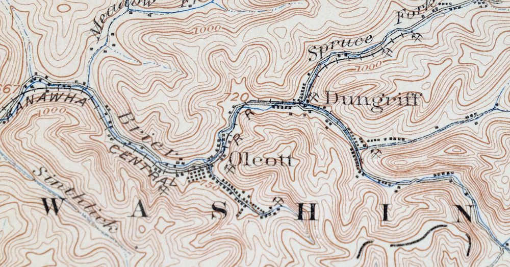
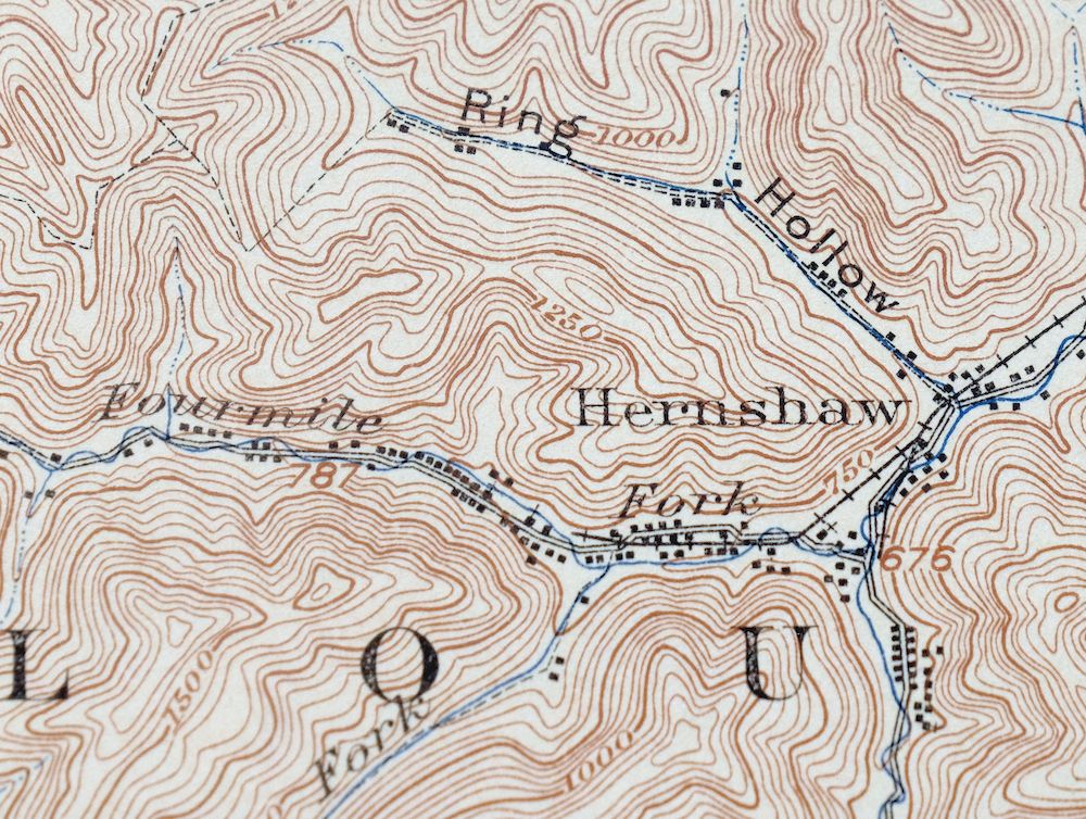
The Peytona 15-minute map shows cities and towns, roads, railroads, rivers, creeks, elevation contour lines, public land survey lines, county, state, and other administrative boundaries as they existed at the time of the survey in 1908 and 1909. All known structures (houses, businesses, churches, schools, barns, cabins, etc) are also shown, with exceptions in some urban areas, where only landmark buildings may be shown.
A VALUABLE HISTORICAL RECORD
Maps from the 15-minute series for the continental United States are no longer produced or printed by the USGS and original prints are becoming increasingly difficult to find. They are a valuable historical record for an area, as they contain many placenames and features that have been dropped from more recent maps.
Nearby maps
-

Bald Knob West Virginia Mallory USGS Topo Map 1923 Antique
$50 Add to cart -

Charleston West Virginia Cross Lanes Rand USGS Topo Map 1914
$68 Add to cart -

Saint Albans West Virginia Dunbar USGS Topographic Map 1909
$37 Add to cart -

Winfield West Virginia Bancroft Southside USGS Topo Map 1908
$37 Add to cart -

Wayne West Virginia Dunlow Cove Gap USGS Topo Map 1909
$42 Add to cart -

Ravenswood West Virginia New Haven Evans USGS Topo Map 1908
$40 Add to cart -

Point Pleasant West Virginia Middleport USGS Topo Map 1908
$25 Add to cart -

Charleston West West Virginia Dunbar USGS Topo Map 1978
$22 Add to cart -

Pocatalico West Virginia Dunbar USGS Topographic Map 1977
$30 Add to cart -

Oceana West Virginia Logan Gilbert USGS Topographic Map 1912
$58 Add to cart -

Raleigh West Virginia Beckley Oak Hill USGS Topo Map 1901
$135 Add to cart -

Warfield West Virginia Pikeville Harts USGS Topo Map 1911
$85 Add to cart -

Nicholas West Virginia Summersville Cowen USGS Topo Map 1912
$54 Add to cart -

Kenova Kentucky Louisa Grayson USGS Topo Map 1912 Antique
$54 Add to cart -

Sutton West Virginia Glenville Elk River USGS Topo Map 1907
$75 Add to cart -

Pomeroy Ohio Middleport Mason USGS Topo Map 1907 Antique
$37 Add to cart -

Whitesburg Kentucky Pikeville Cumberland USGS Topo Map 1910
$80 Add to cart -

Parkersburg Ohio Marietta Vienna USGS Topo Map 1912 Antique
$63 Add to cart -

Marietta Ohio Wayne NF Devola USGS Topo Map 1912 Antique
$62 Add to cart -

Garrison Kentucky Portsmouth York USGS Topo Map 1918 Antique
$32 Add to cart -

Saint Marys West Virginia Ellenboro Pike USGS Topo Map 1916
$47 Add to cart -

Salyersville Kentucky West Liberty Zag USGS Topo Map 1918
$47 Add to cart -

Wytheville Virginia Marion Sparta USGS Topo Map 1907 Antique
$105 Add to cart -

Natural Bridge Virginia Covington Selma USGS Topo Map 1911
$62 Add to cart
