MAP DETAILS | |
|---|---|
| TITLE | Saticoy |
| STATE | California |
| SURVEYED | 1947 through 1951 Aerial and Field Survey |
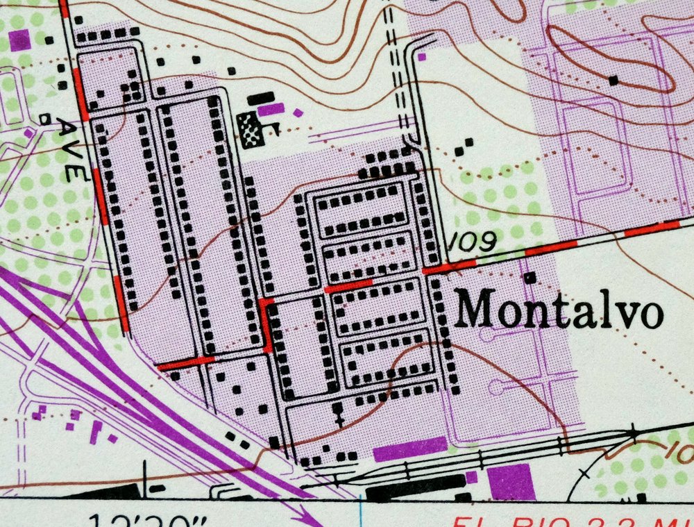
| REVISIONS | Photo revision in 1967 is shown in purple. |
| PRINT NOTES | Thick paper stock, includes woodland tint (green to indicate vegetated areas) |
| SCALE | 1:24000 |
| CONTOUR INTERVAL | 20 feet |
| SHEET DIMENSIONS | 22 x 27 inches |
| MAP DIMENSIONS | 18 7/8 x 22 3/4 inches |
| COVERAGE AREA | 7 x 9 miles |
| SHEET CONDITION For maps of this vintage, effort is made to note all visible flaws, no matter how minor. | |
| SHEET NOTES | lightly handled, midsheet horizontal foldline (in half), title notation pencilled on backside of sheet |
| MAP AREA | no wear, no markings, no blemishes |
| COLLARS | no wear or tears, no markings |
| MAP COVERAGE Quadrangle extent overlaid on current basemap. | |
| PLACENAMES Depending on map series and survey date, all of the features listed below may not be shown on this map. This list contains features that currently exist or historically existed within the area covered by the map. The list can be used as a reference to determine if this map covers your area of interest. Placenames are listed alphabetically next to each feature type. | |
| NOTABLE PLACES | Santa Clara River |
| CITIES AND TOWNS (CURRENT) | El Rio, Montalvo, San Buenaventura (Ventura), and Saticoy |
| COUNTIES COVERED | Ventura |
| Locations: Buenaventura Mall Shopping Center, Central Shopping Center, College Square Shopping Center, Donlon Plaza Shopping Center, Saticoy Regional Golf Course, Telephone Road Plaza Shopping Center, and Victoria Plaza Shopping Center. Administrative Boundaries: Ex Mission San Buenaventura, San Miguel, and Santa Paula Y Saticoy. Valleys and Canyons: Aliso Canyon, Barlow Canyon, Brown Barranca, Coche Canyon, Ellsworth Barranca, Hammond Canyon, Hampton Canyon, Harmon Canyon, Lake Canyon, Long Canyon, Peppertree Canyon, Sexton Canyon, Sulphur Canyon, Wason Barranca, and Wheeler Canyon. Parks: Arroyo Verde Park, Arundell Linear Park, Barranca Vista Park, Bristol Bay Linear Park, Camino Real Park, Chumash Park, County Square Linear Park, Fritz Huntsinger Youth Sports Complex, Harmon Park, Hobert Park, Junipero Serra Park, Kennebec Linear Park, Marion Cannon Park, Northbank Linear Park, Ralston Village Linear Park, Rancho Ventura Linear Park, Riverview Linear Park, and Woodside Linear Park. Churches: Bethel Christian Center, Bible Fellowship Church, Calvary Chapel of Ventura, Church of Scientology Mission, Church of the Foothills, College Heights Baptist Church, College United Methodist Church, East Ventura Foursquare Church, Eastminster Presbyterian Church, Emmanuel Lutheran Church, First Assembly of God Church, First Christian Church, First Church of Christ Scientist, Fundamental Baptist Church, Gold Coast Baptist Church, Grace Lutheran Church, Iglesia Apostolica de Jesu, Kingdom Hall of Jehovahs Witnesses, New Life Fellowship Church, New Vision Community Church, Sacred Heart Church, Seventh Day Adventist Church, The Church of Jesus Christ of Latter Day Saints, Trinity Community Church, Trinity Lutheran Church, Unitarian Universalist Church, Ventura Christian Church, Ventura Church of Christ, Ventura Missionary Church, and Wells Road Baptist Church. Buildings: H P Wright Branch Ventura County Library, Saticoy Community Center, Saticoy Library, and Ventura County Government Center. Schools: Anacapa Middle School, Balboa Middle School, Buena High School, College Heights Christian School, Elmhurst Elementary School, Friends School, Juanamaria Elementary School, Junipero Serra Elementary School, Loma Vista Elementary School, Montalvo Elementary School, Mound Elementary School, Mound School, Olivelands Elementary School, Pacific High School, Poinsettia Elementary School, Portola Elementary School, Rio Mesa High School, Sacred Heart School, Saticoy Elementary School, Temple Christian School, Ventura Adult High School, Ventura Christian School, Ventura College, and Ventura Missionary Christian Day School. Towers: KAGR-FM (Ventura), KOXR-AM (Oxnard), KSTV-TV (Ventura), and KVEN-AM (Ventura). | |
| SHIPPING AND RETURNS | |
 Ships carefully rolled in a sturdy 2" x 24" mailing tube. Shipping and return details are in our terms. | |
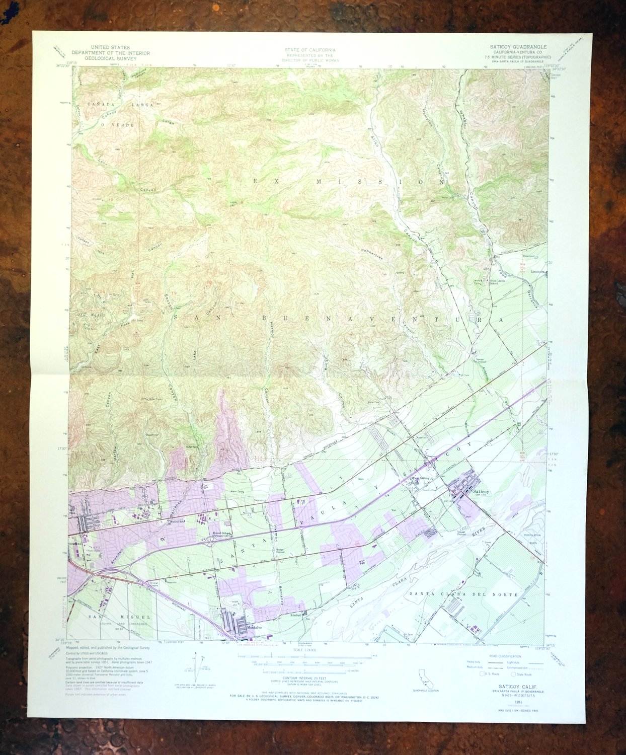

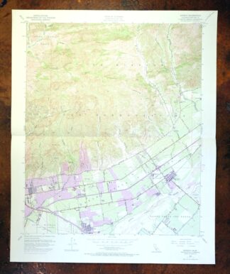
Saticoy, California 1951 USGS Topo Map: Santa Clara River
$40
A 1967 photo revision shows considerable expansion of roads and urban areas.
- Vicinity of San Buenaventura (Ventura), 57 miles west of Los Angeles.
- 7.5-minute series, 1951 edition, printed in 1968.
- Very good condition.
In stock
This vintage sheet is a 1951 edition of the Saticoy California USGS topographic map revised in 1967 using aerial photography. It is an original 58-year-old 1968 United States Geological Survey print in very good condition.
HOW THIS MAP CAN BE USED
In addition to making a fascinating conversation piece, this sheet would look great in a frame or on display, make a unique and prized gift for anyone interested in this area, be perfect as a reference for genealogy studies or general historical research, or fill that missing piece in your collection. Maps of this vintage are printed on durable stock and are well-suited for outdoor activities and recreation of all kinds, including hiking, backpacking, hunting, rafting and kayaking, backcountry skiing, geocaching, general exploration, treasure hunting, etc.
FEATURES SHOWN ON THE MAP
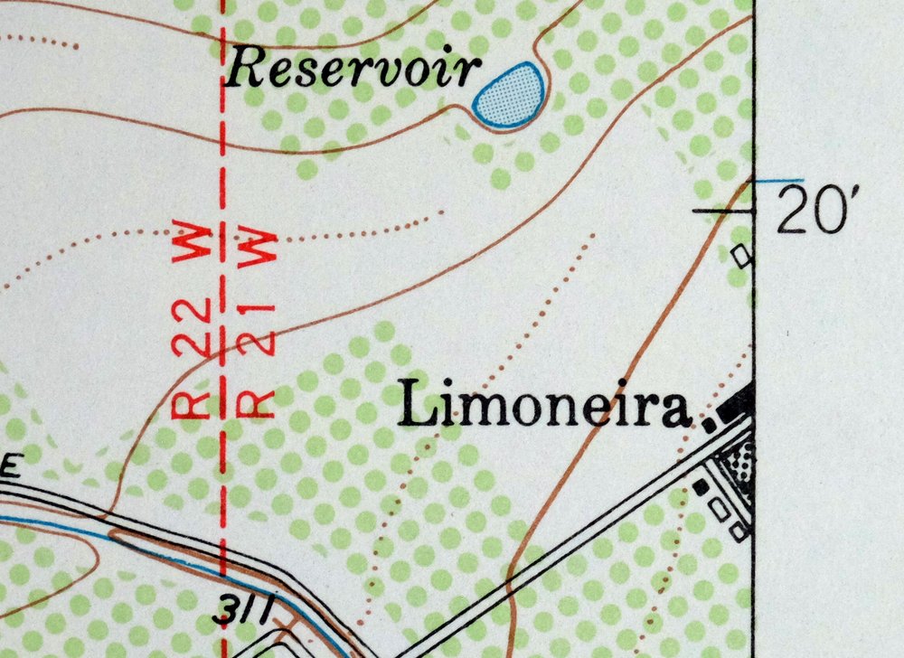
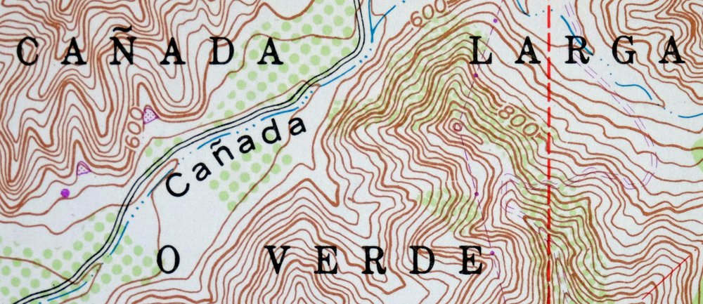
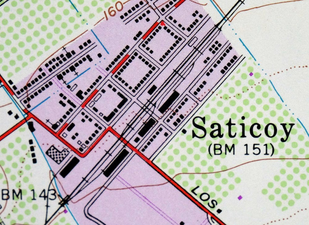
The Saticoy 7.5-minute map shows cities and towns, roads, paths, railroads, utilities and energy infrastructure, rivers, creeks, elevation contour lines, public land survey lines, county, state, and other administrative boundaries as they existed at the time of the survey in 1947 through 1951. All known structures (houses, businesses, churches, schools, barns, cabins, etc) are also shown.
A VALUABLE HISTORICAL RECORD
This map is from the 7.5-minute series, the most detailed series that is widely available from the USGS. The 1951 Saticoy map is a valuable historical record for the area. It contains some placenames and features that have been dropped from more recent maps.
The map was photorevised in 1967. Any features that changed or were added between the original edition year of 1951 and the photorevision year of 1967 are overlayed in purple. The purple overlay provides an excellent view of the fast-growing and changing areas within the quad boundary.
Nearby maps
-
Santa Paula, California 1951 USGS Topo Map (1980 Print)
$45 Add to cart -
1951 USGS Topo Map: Moorpark, California (1978 Print)
$41 Add to cart -
1950 USGS Topo Map: Newbury Park, California (1972 Print)
$45 Add to cart -
Santa Susana, California 1951 USGS Topo Map (1970 Print)
$45 Add to cart -
1952 USGS Topo Map: Oat Mountain, California (1980 Print)
$33 Add to cart -

San Fernando, California 1955 Military AMS Topo Map
$25 Add to cart -

Santiago Creek, CA 1945 Military Army Corp of Engineers To..
$19 Add to cart -

Salisbury Potrero, CA 1944 Military Army Corp of Engineers..
$21 Add to cart -
Neenach, California 1943 USGS Army COE Topo Map (1962 Print)
$32 Add to cart -
Inglewood, California 1964 USGS Topo Map: Gardena
$44 Add to cart -
Stevens, California 1932 USGS Topo Map: Rosedale
$33 Add to cart -
Gosford, California 1932 USGS Topo Map: Bakersfield
$35 Add to cart -
Gosford, California 1954 USGS Topo Map: Bakersfield
$26 Add to cart -
Fairfax School, California 1932 USGS Topo Map: Bakersfield
$36 Add to cart -
1956 USGS Army COE Topo Map: Rosamond, Lancaster, California
$22 Add to cart -
Rock Creek, California 1903 USGS Topo Map
$49 Add to cart -

Rosedale, Prospero, California 1933 USGS Topo Map
$39 Add to cart -
1954 USGS Topo Map: Oil Center, Bakersfield, California
$32 Add to cart -

1949 USGS Topo Map: Anaheim, Santa Ana, California
$51 Add to cart -

1950 USGS Topo Map: Santa Catalina South, California
$29 Add to cart -

1950 USGS Topo Map: Santa Catalina East, Avalon, California
$35 Add to cart -
1943 Military Army Corp of Engineers Topo Map: Simmler, CA
$27 Add to cart -
1964 USGS Topo Map: Orange, Anaheim, California
$35 Add to cart -

Emerald Mountain, CA 1943 Military Army Corp of Engineers ..
$32 Add to cart