MAP DETAILS | |
|---|---|
| TITLE | Tuolumne Meadows |
| STATE | California |
| LOCATION | Yosemite National Park, 80 miles north of Fresno |
| SERIES | 15-minute |
| SURVEYED | 1955 and 1956 Aerial and Field Survey |
| EDITION | 1956 |
| PRINTED | 1973 |
| PRINT NOTES | Thick paper stock, includes woodland tint (green to indicate vegetated areas) |
| SCALE | 1:62500 |
| CONTOUR INTERVAL | 80 feet |
| SHEET DIMENSIONS | 18 x 22 inches |
| MAP DIMENSIONS | 13 7/8 x 17 1/2 inches |
| COVERAGE AREA | 14 x 17 miles |
| SHEET CONDITION For maps of this vintage, effort is made to note all visible flaws, no matter how minor. | |
| OVERALL CONDITION | Excellent |
| SHEET NOTES | very lightly handled, never folded, smooth and flat |
| MAP AREA | flawless map area |
| COLLARS | no wear or tears, no markings, no blemishes |
| MAP COVERAGE Quadrangle extent overlaid on current basemap. | |
| PLACENAMES Depending on map series and survey date, all of the features listed below may not be shown on this map. This list contains features that currently exist or historically existed within the area covered by the map. The list can be used as a reference to determine if this map covers your area of interest. Placenames are listed alphabetically next to each feature type. | |
| NOTABLE PLACES | Yosemite National Park, Cathedral Range, Cold Mountain, and Inyo Forest |
| COUNTIES COVERED | Madera, Mariposa, Mono, and Tuolumne |
| FEDERAL LAND UNITS | Ansel Adams Wilderness, Hoover Wilderness, Inyo National Forest, and Yosemite Wilderness |
| RIVERS AND STREAMS | Alkali Creek, Budd Creek, Cathedral Creek, Cathedral Fork, Conness Creek, Dana Fork, Delaney Creek, Dingley Creek, Echo Creek, Fletcher Creek, Florence Creek, Ireland Creek, Kuna Creek, Lee Vining Creek, Lewis Creek, Lyell Fork, Maclure Creek, McCabe Creek, Mill Creek, Murphy Creek, Parker Pass Creek, Rafferty Creek, Register Creek, Regulation Creek, Return Creek, Snow Creek, South Fork Cathedral Creek, South Fork Mill Creek, Sunrise Creek, Tenaya Creek, and Tuolumne River |
| WATER BODIES | Alpine Lake, Babcock Lake, Bernice Lake, Big Horn Lake, Boothe Lake, Budd Lake, Cascade Lake, Cathedral Lakes, Conness Glacier, Conness Lakes, Dog Lake, Echo Lake, Elizabeth Lake, Emeric Lake, Evelyn Lake, Fantail Lake, Gallison Lake, Gardisky Lake, Gaylor Lakes, Granite Lakes, Greenstone Lake, Hanging Basket Lake, Hidden Lake, Hummingbird Lake, Ireland Lake, Kuna Lake, Maclure Lake, Matthes Lake, Mattie Lake, May Lake, McCabe Lakes, McGee Lake, Mildred Lake, Miller Lake, Nelson Lake, Odell Lake, Oneida Lake, Reymann Lake, Rodgers Lake, Roosevelt Lake, Saddlebag Lake, Shamrock Lake, Skelton Lakes, Spuller Lake, Steelhead Lake, Sunrise Lakes, Tenaya Lake, Tioga Lake, Upper McCabe Lake, Virginia Lake, Vogelsang Lake, Wasco Lake, Young Lakes, and Z Lake |
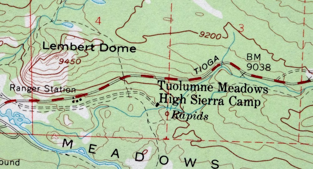
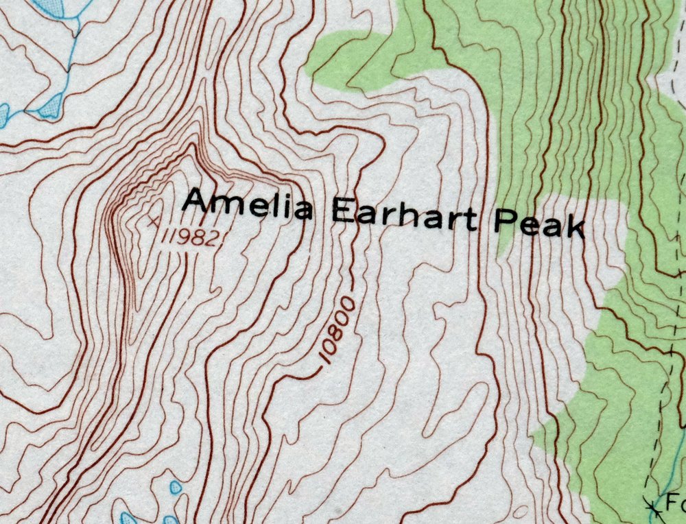
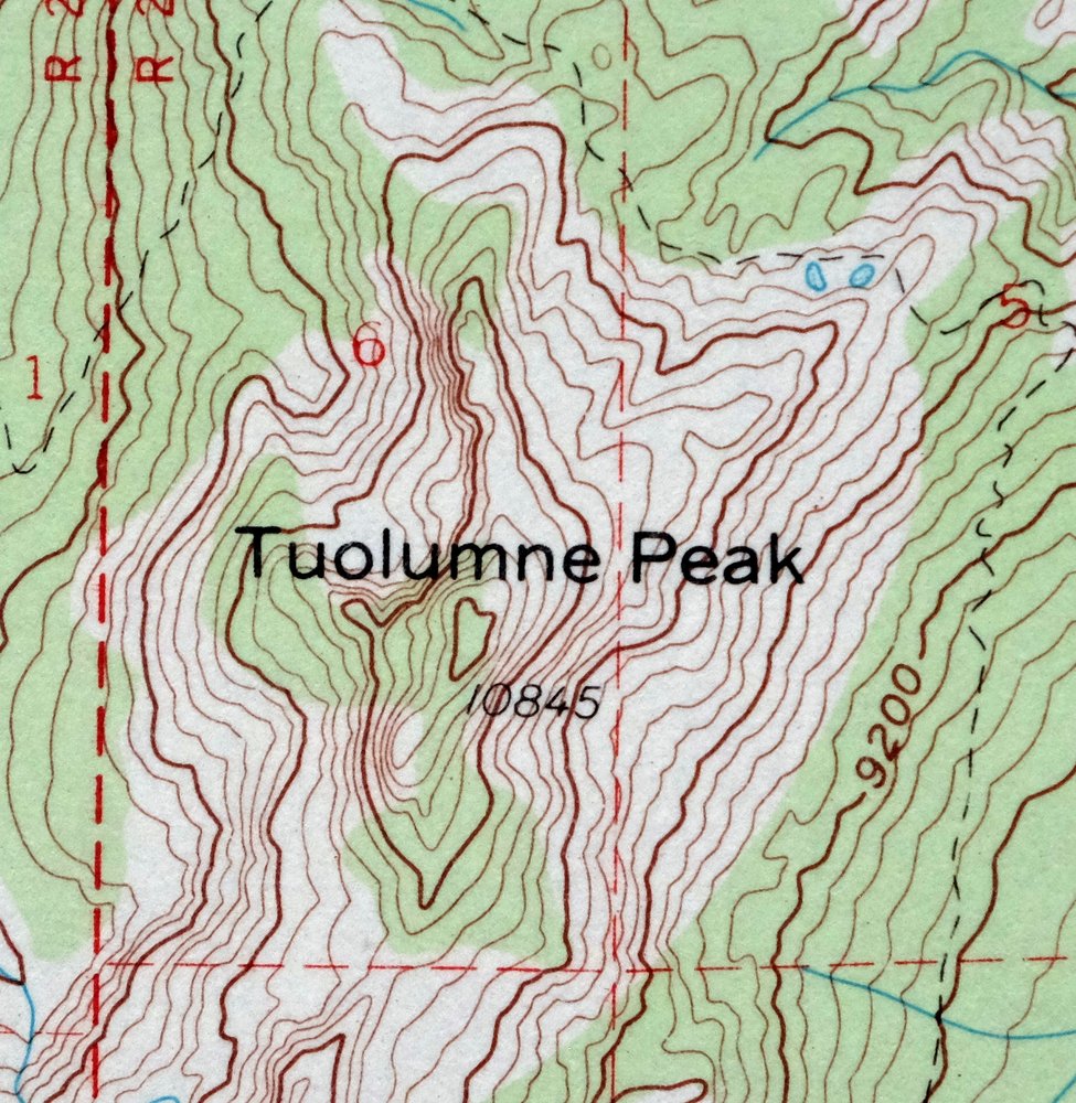
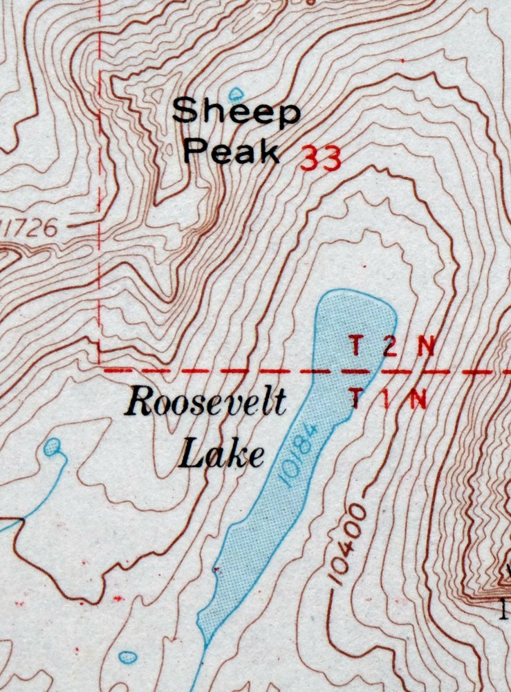
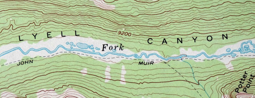
| Locations: Glen Aulin High Sierra Camp, May Lake High Sierra Camp, Parsons Memorial Lodge, Saddlebag Campground, Saddlebag Lake Resort, Sawmill Campground, Sunrise High Sierra Camp, Tenaya Lake Campground, Tioga Campground, Tuolumne Meadows Campground, Tuolumne Meadows Lodge, Tuolumne Meadows Ranger Station, and Vogelsang High Sierra Camp. Areas: Harvey Monroe Hall Research Natural Area. Mountains, Peaks, and Summits: Amelia Earhart Peak, Cathedral Peak, Clouds Rest, Cold Mountain, Columbia Finger, Mount Conness, Echo Peaks, Elbow Hill, Fairview Dome, Fletcher Peak, Gaylor Peak, Hooper Peak, Johnson Peak, Lembert Dome, Mammoth Peak, Medlicott Dome, North Peak, Olmstead Point, Parsons Peak, Pettit Peak, Polly Dome, Pothole Dome, Potter Point, Puppy Dome, Pywiack Dome, Rafferty Peak, Ragged Peak, Regulation Peak, Sheep Peak, Simmons Peak, Sunrise Mountain, Tenaya Peak, Tresidder Peak, Tuolumne Peak, Unicorn Peak, Vogelsang Peak, West Peak, White Mountain, and Wildcat Point. Valleys and Canyons: Cold Canyon, Glacier Canyon, Lyell Canyon, Matterhorn Canyon, and Virginia Canyon. Trails: Gaylor Lakes Trail. Drainages: Alkali Creek, Budd Creek, Cathedral Creek, Cathedral Fork, Conness Creek, Dana Fork, Delaney Creek, Dingley Creek, Emeric Creek, Florence Creek, Ireland Creek, Kuna Creek, Lyell Fork, Maclure Creek, Matterhorn Creek, Murphy Creek, Parker Pass Creek, Rafferty Creek, Regulation Creek, Return Creek, South Fork Cathedral Creek, Spiller Creek, and Unicorn Creek. Mines: Great Sierra Mine and Hess Mine. Lakes and Ponds: Alpine Lake, Babcock Lake, Bernice Lake, Big Horn Lake, Boothe Lake, Budd Lake, Cascade Lake, Cathedral Lakes, Conness Lakes, Dog Lake, Echo Lake, Elizabeth Lake, Emeric Lake, Evelyn Lake, Fantail Lake, Finger Lake, Fletcher Lake, Florence Lake, Gallison Lake, Gardisky Lake, Gaylor Lakes, Granite Lakes, Green Treble Lake, Greenstone Lake, Hanging Basket Lake, Hidden Lake, Hummingbird Lake, Ireland Lake, Kuna Lake, Maclure Lake, Matthes Lake, Mattie Lake, Maul Lake, May Lake, McCabe Lakes, McGee Lake, Mildred Lake, Miller Lake, Nelson Lake, Odell Lake, Oneida Lake, Polly Dome Lakes, Reymann Lake, Rodgers Lake, Roosevelt Lake, Shamrock Lake, Shell Lake, Skelton Lakes, Spuller Lake, Steelhead Lake, Sunrise Lakes, Tenaya Lake, Townsley Lake, Twin Lakes, Upper Fletcher Lake, Upper Gaylor Lake, Upper McCabe Lake, Virginia Lake, Vogelsang Lake, Wasco Lake, Young Lakes, and Z Lake. Waterfalls: California Falls, Le Conte Falls, Pywiack Cascade, Tuolumne Falls, Waterwheel Falls, and White Cascade. Dams: Saddlebag 104-039 Dam and Tioga Lake 104-040 Dam. Bluffs: Dore Cliff. Gaps: Cathedral Pass, Dore Pass, Lundy Pass, Tioga Pass, Tuolumne Pass, and Vogelsang Pass. Basins: Glen Aulin. Schools: Carnegie Institute Experimental Station. Ridges: Cockscomb, Falls Ridge, Matthes Crest, and Tioga Crest. Reservoirs and Tanks: Saddlebag Lake and Tioga Lake. Flats: Dana Meadows, Long Meadow, Moraine Flat, Snow Flat, and Tuolumne Meadows. Springs: Soda Springs. | |
| SHIPPING AND RETURNS | |
 This map sheet will be carefully rolled in a sturdy tube and shipped via the US Postal Service. If you find that the sheet you receive is not as described in the listing, you may ship it back to us for a refund of the purchase price. | |
1973 USGS Topo Map: Tuolumne Meadows, California
$48
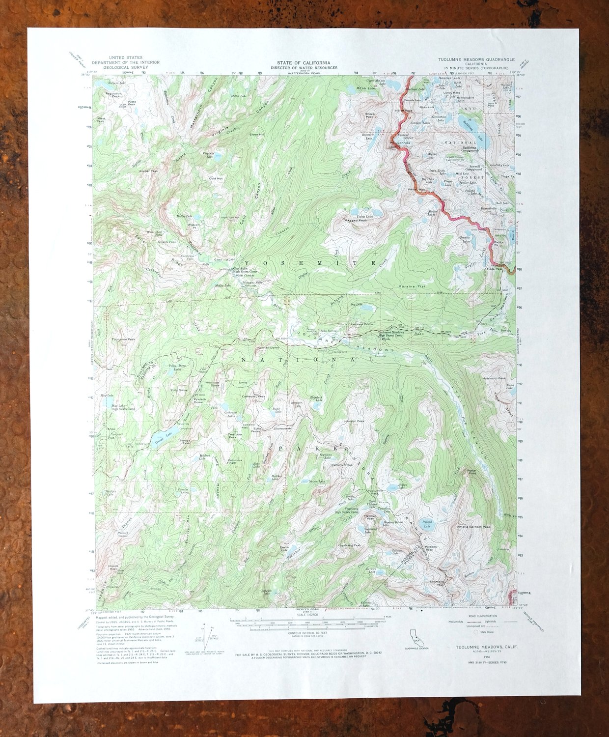
This is a 1956 edition of the Tuolumne Meadows quadrangle, printed in 1973 at 1:62,500 scale with the green woodland tint marking vegetated terrain. The sheet sits in the high country of Yosemite National Park, covering the Cathedral Range and Cold Mountain where Madera, Mariposa, Mono, and Tuolumne counties meet, and reaching into portions of the Inyo National Forest and the Yosemite, Hoover, and Ansel Adams wilderness areas. Mapped from aerial and field survey in 1955 and 1956, it traces the granite peaks and alpine meadows along the Tioga Road corridor. Never folded, it would frame well.
In stock
This vintage sheet is a 1956 edition of the Tuolumne Meadows California USGS topographic map. It is an original 53-year-old 1973 United States Geological Survey print in excellent condition.
HOW THIS MAP CAN BE USED
In addition to making a fascinating conversation piece, this sheet would look great in a frame or on display, make a unique and prized gift for anyone interested in this area, be perfect as a reference for genealogy studies or general historical research, or fill that missing piece in your collection. Maps of this vintage are printed on durable stock and are well-suited for outdoor activities and recreation of all kinds, including hiking, backpacking, hunting, rafting and kayaking, backcountry skiing, geocaching, general exploration, treasure hunting, etc.
FEATURES SHOWN ON THE MAP
The Tuolumne Meadows 15-minute map shows cities and towns, roads, railroads, utilities and energy infrastructure, rivers, creeks, elevation contour lines, public land survey lines, county, state, and other administrative boundaries as they existed at the time of the survey in 1955 and 1956. All known structures (houses, businesses, churches, schools, barns, cabins, etc) are also shown.
A VALUABLE HISTORICAL RECORD
Maps from the 15-minute series for the continental United States are no longer produced or printed by the USGS and original prints are becoming increasingly difficult to find. They are a valuable historical record for an area, as they contain many placenames and features that have been dropped from more recent maps.
Nearby maps
-
Hetch Hetchy Reservoir California USGS Topo Map 1973 Vintage
$39 Add to cart -
Tower Peak California USGS 15-Min Topo Map 1972 Vintage
$40 Add to cart -
Mount Morrison California Mammoth Lakes USGS Topo Map 1974
$52 Add to cart -
Fales Hot Springs California USGS Topo Map 1971 Vintage
$20 Add to cart -
1973 USGS Topo Map: Mount Abbot, Sierra Nevada, California
$48 Add to cart -
Huntington Lake California Shaver Lake USGS Topo Map 1968
$43 Add to cart -
Blackcap Mountain California USGS Topo Map 1972 Vintage
$40 Add to cart -

Merced California Planada USGS 15-Min Topo Map 1963 Vintage
$18 Add to cart -
Bishop California West Bishop Laws USGS Topographic Map 1969
$40 Add to cart -

Le Grand California Madera Chowchilla USGS Topo Map 1963
$14 Add to cart -

Kinsley California USGS 7.5-Min Topographic Map 1949 Vintage
$32 Add to cart -

Jawbone Ridge California Buck Meadows USGS Topo Map 1949
$27 Add to cart -

Raynor Creek California Chowchilla River USGS Topo Map 1947
$30 Add to cart -
Kismet California Madera USGS 7.5-Min Topo Map 1948 Vintage
$32 Add to cart -

Chowchilla California Le Grand El Nido USGS Topo Map 1962
$20 Add to cart -

Cressey California Livingston Delhi USGS Topo Map 1948
$23 Add to cart -
Sanger Del Ray Clotho California USGS 7.5-Min Topo Map 1923
$30 Add to cart -
Kentucky Well California USGS 7.5-Min Topo Map 1948 Vintage
$32 Add to cart -
Selma California Fresno Sanger USGS Topo Map 1954 Vintage
$35 Add to cart -

Mount Pinchot California USGS 15-Min Topo Map 1969 Vintage
$26 Add to cart -
Kerman California Madera Avenue USGS Topographic Map 1947
$25 Add to cart -

Salida California Modesto Ripon USGS Topo Map 1915 Antique
$58 Add to cart -
1954 Salida California USGS Topo Map: Modesto
$48 Add to cart -
Jamesan California Tranquillity USGS Topo Map 1924 Antique
$16 Add to cart