MAP DETAILS | |
|---|---|
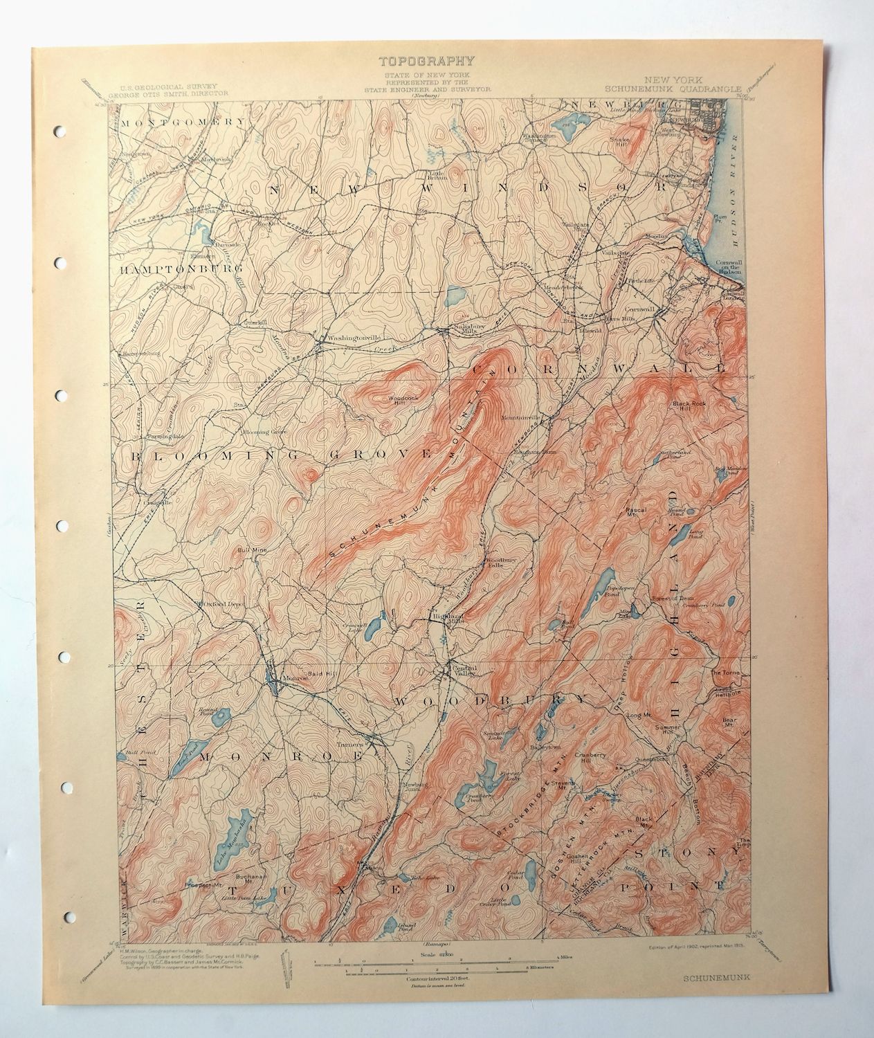
| TITLE | Schunemunk |
| STATE | New York |
| LOCATION | Vicinity of Newburgh, 45 miles north of New York |
| SERIES | 15-minute |
| SURVEYED | 1899 Field Survey |
| GEOGRAPHER | H.M. Wilson |
| ENGRAVED | 1902 |
| EDITION | 1902 |
| PRINTED | 1915 |
| PRINT NOTES | Thick paper stock |
| SCALE | 1:62500 |
| CONTOUR INTERVAL | 20 feet |
| SHEET DIMENSIONS | 16 1/2 x 20 inches |
| MAP DIMENSIONS | 13 1/8 x 17 1/2 inches |
| COVERAGE AREA | 13 x 17 miles |
| SOURCE | From an uncommonly well-preserved collection |
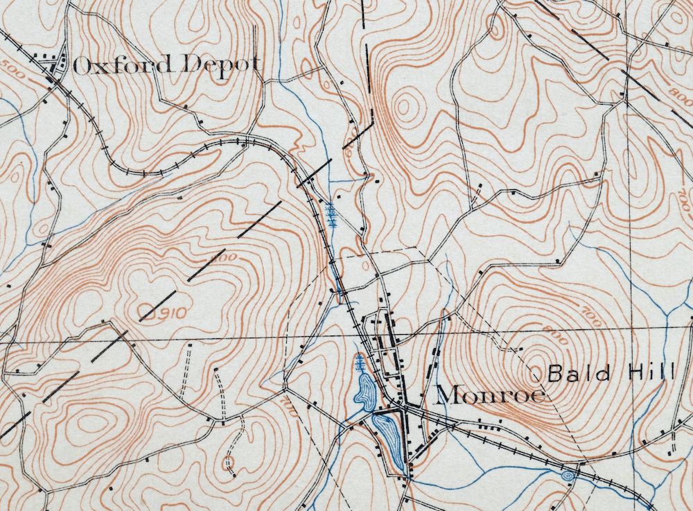
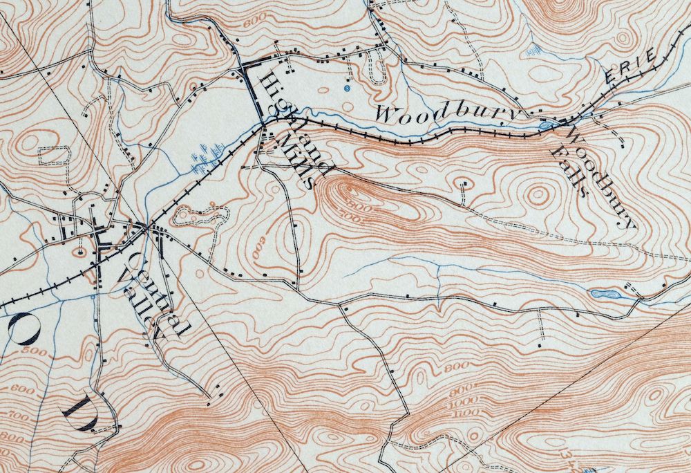
| MAP NOTES | A fascinating historical snapshot surveyed before the modern highway system, showing historic overland travel routes, rail lines, and early placenames. |
| SHEET CONDITION For maps of this vintage, effort is made to note all visible flaws, no matter how minor. | |
| OVERALL CONDITION | Excellent |
| SHEET NOTES | very lightly handled, never folded, smooth and flat |
| MAP AREA | flawless map area |
| COLLARS | no wear or tears, no markings, no blemishes, hole punches along left collar |
| MAP COVERAGE Quadrangle extent overlaid on current basemap. | |
| BACKSIDE LEGEND | |
 A map summary is printed on the back side of the Schunemunk sheet similar to the one shown in the picture. It outlines the history, purpose, and status of the USGS mapping program at the time of the printing in 1915. It also provides instructions on how to read contour lines and a description of how they are used to depict the terrain. At the bottom of the page is a legend showing all of the symbols used to represent the cultural, relief, and water features found on the map. | |
| PLACENAMES Depending on map series and survey date, all of the features listed below may not be shown on this map. This list contains features that currently exist or historically existed within the area covered by the map. The list can be used as a reference to determine if this map covers your area of interest. Placenames are listed alphabetically next to each feature type. | |
| CITIES AND TOWNS (CURRENT) | Arden, Beaverdam Lake-Salisbury Mills, Central Valley, Chester, Cornwall on Hudson, Cornwall-on-Hudson, Firthcliffe, Fort Montgomery, Harriman, Highland Mills, Kiryas Joel, Maybrook, Monroe, New Windsor, Newburgh, Salisbury Mills, Vails Gate, Walton Park, Washingtonville, and West Point |
| COUNTIES COVERED | Dutchess, Orange, and Rockland |
| FEDERAL LAND UNITS | West Point U.S. Military Academy |
| RIVERS AND STREAMS | Arden Brook, Baby Brook, Beaverdam Brook, Beechy Bottom Brook, Bockey Swamp Brook, Cromline Creek, Doodletown Brook, Highland Brook, Hudson River, Lake Tiorati Brook, Lewis Brook, Long Pond Brook, Mineral Spring Brook, Perry Creek, Quassaic Creek, Queensboro Brook, Ramapo River, Satterly Creek, Silver Stream, Stahahe Brook, Stillwater Brook, and Trout Brook |
| WATER BODIES | Aleck Meadow Reservoir, Ambreys Pond, Amdur Park Lake, Arthurs Pond, Barnes Lake, Beaverdam Lake, Blendale Lake, Blythea Lake, Bog Meadow Pond, Browns Pond, Bull Pond, Coronet Lake, Cranberry Lake, Cranberry Pond, Cromwell Lake, Crystal Lake, Earl Reservoir, Echo Lake, Forest Lake, Forest Road Lake, Lake Frederick, Lake Georgina, Great Swamp, Hillside Lake, Island Pond, Jims Pond, Kloibers Pond, Korby Lake, Lake Cohasset, Lake Nawahunta, Lake Tiorati, Lake Washington, Little Dam Lake, Long Pond, Lower Twin Lake, Lake Massawippa, Merriewold Lake, Mine Lake, Mombasha Lake, Mountain Lakes, Muchattoes Lake, Peckermans Pond, Popolopen Lake, Queensboro Lake, Round Lake, Round Pond, Saltzmans Lake, Lake Sapphire, Shadowmere Lake, Silver Mine Lake, Sphagnum Pond, Stilwell Lake, Summit Lake, Sutherland Pond, Tamarack Pond, Lake Te-Ata, Tomahawk Lake, Turkey Hill Pond, Upper Lake Cohasset, Upper Reservoir, Upper Twin Lake, Walton Lake, Weyants Pond, and Lake Winape |
| Locations: Camp Addisone Boyce, Camp Buckner, Camp La Guardia, Camp Lenni-Len-A-Pe, Camp Natural Bridge, Camp Wildwood, Central Valley Golf Course, Otter Kill Golf and Country Club, Perkins Memorial Observatory, Quaker Meetinghouse, Storm King Golf Club, Thevenet Hall, West Point Girls Camp, and Woodbury Country Club. Administrative Boundaries: Town of Blooming Grove, Town of Cornwall, Town of Highlands, Town of Monroe, Town of New Windsor, Town of Stony Point, and Town of Woodbury. Mountains, Peaks, and Summits: Adria Hill, Bald Hill, Bear Mountain, Bull Hill, Bull Mine Mountain, Bradley Mountain, Bellvale Mountain, Big Bog Mountain, Black Mountain, Black Rock, Blackcap Mountain, Brooks Mountain, Buchanan Hill, Buchanan Mountain, Buckberg Mountain, Cranberry Hill, Cranberry Mountain, Durland Hill, Eagles Cliff, Echo Mountain, Fingerboard Mountain, Flaggy Meadow Mountain, Goshen Mountain, Hasenclever Mountain, Hill of Pines, Island Pond Mountain, Lazy Hill, Letterrock Mountain, Lindley Mountain, Listening Hill, Long Mountain, Long Pond Mountain, Mount Misery, Pingyp Mountain, Prospect Mountain, Mount Rascal, Rattlesnake Hill, Round Hill, Schunnemunk Mountain, Sloon Hill, Snake Hill, Spy Rock, Stockbridge Mountain, Summer Hill, Surebridge Mountain, The Torne, Turkey Mountain, West Mountain, Whitehorse Mountain, and Woodcock Hill. Valleys and Canyons: Black Rock Hollow, Brooks Hollow, Cat Hollow, and Deep Hollow. Woods: The Pines. Parks: Anthony Wayne Recreation Area, Bear Mountain State Park, Delano-Hitch Park, Palisades Interstate Park, Sand Ring Park, Storm King State Park, Temple Hill Monument, and Washington Headquarters Monument. Trails: Stillwell Lake Trail. Drainages: Arden Brook, Baby Brook, Beaverdam Brook, Beechy Bottom Brook, Bockey Swamp Brook, Cranberry Brook, Cromline Creek, Hemlock Brook, Lewis Brook, Long Pond Brook, Mineral Spring Brook, Moodna Creek, Otter Kill, Perry Creek, Quassaic Creek, Queensboro Brook, Satterly Creek, Seely Brook, Silver Stream, Stahahe Brook, Stillwater Brook, Surebridge Brook, Woodbury Creek, and Youngs Brook. Capes: High Point and Plum Point. Churches: Bethlehem Church, Convent of Saint Helena, Hope Chapel, Mount Saint Francis Chapel, and Saint Thomas Church. Lakes and Ponds: Amdur Park Lake, Barnes Lake, Blythea Lake, Blendale Lake, Cranberry Pond, Crest View Lake, Cromwell Lake, Crystal Lake, Filers Lake, Forest Road Lake, Lake Frederick, Lake Georgina, Harrison Pond, Hillside Lake, Island Pond, Jims Pond, Kloibers Pond, Korby Lake, Little Dam Lake, Long Pond, Lower Twin Lake, Lake Massawippa, Merriewold Lake, Mine Lake, Monroe Ponds, Mountain Lakes, Muchattoes Lake, Orange-Rockland Lake, Owl Lake, Peckermans Pond, Placid Pond, Popolopen Lake, Rings Pond, Round Lake, Saltzmans Lake, Lake Sapphire, Shadow Lake, Shadowmere Lake, Spring Lake, Sutherland Pond, Lake Te-Ata, Turkey Hill Pond, Upper Twin Lake, Weyants Pond, and Lake Winape. Buildings: Columbia University Arden House and Knox Headquarters. Crossings: Interchange 16. Bays: Hell Hole. Basins: Blaggs Clove. Airports: Doms Heliport. Swamps: Great Swamp, Owl Swamp, and Surebridge Swamp. Schools: Central High School, Epiphany Apostolic College, Liberty Street School, Little Britain School, Monroe-Woodbury Central High School, New Windsor School, New York Mill Academy, Saint Francis School, Saint Patricks School, Walton Lake School, and Washington Street School. Reservoirs and Tanks: Aleck Meadow Reservoir, Arthurs Pond, Beaverdam Lake, Bull Pond, Bog Meadow Pond, Breeds Pond, Browns Pond, Coronet Lake, Cranberry Lake, Earl Reservoir, Echo Lake, Forest Lake, Lake Cohasset, Lake Nawahunta, Lake Tiorati, Lake Washington, Mombasha Lake, Queensboro Lake, Round Pond, Silver Mine Lake, Sphagnum Pond, Stilwell Lake, Summit Lake, Tamarack Pond, Tomahawk Lake, Upper Lake Cohasset, Upper Reservoir, and Walton Lake. Towers: WARW-AM (Cornwall), WGNY-AM (Newburgh), and WGNY-FM (Newburgh). | |
| SHIPPING AND RETURNS | |
 This map sheet will be carefully rolled in a sturdy tube and shipped via the US Postal Service. If you find that the sheet you receive is not as described in the listing, you may ship it back to us for a refund of the purchase price. | |
Schunemunk New York Newburgh Kiryas Joel USGS Topo Map 1915
$65
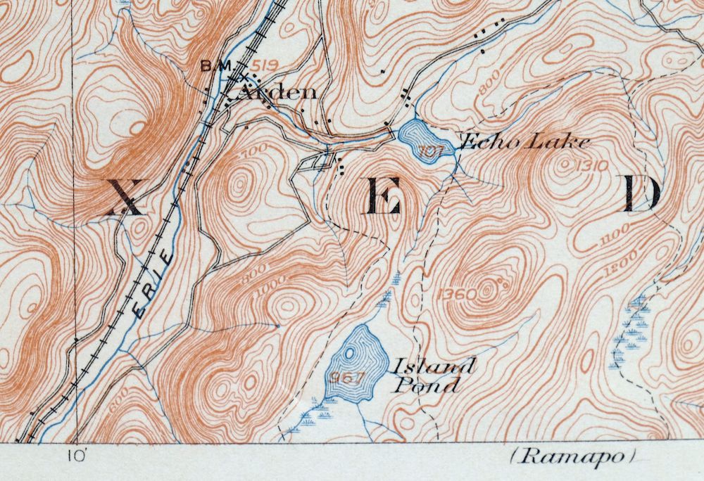
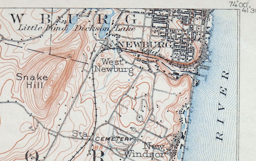
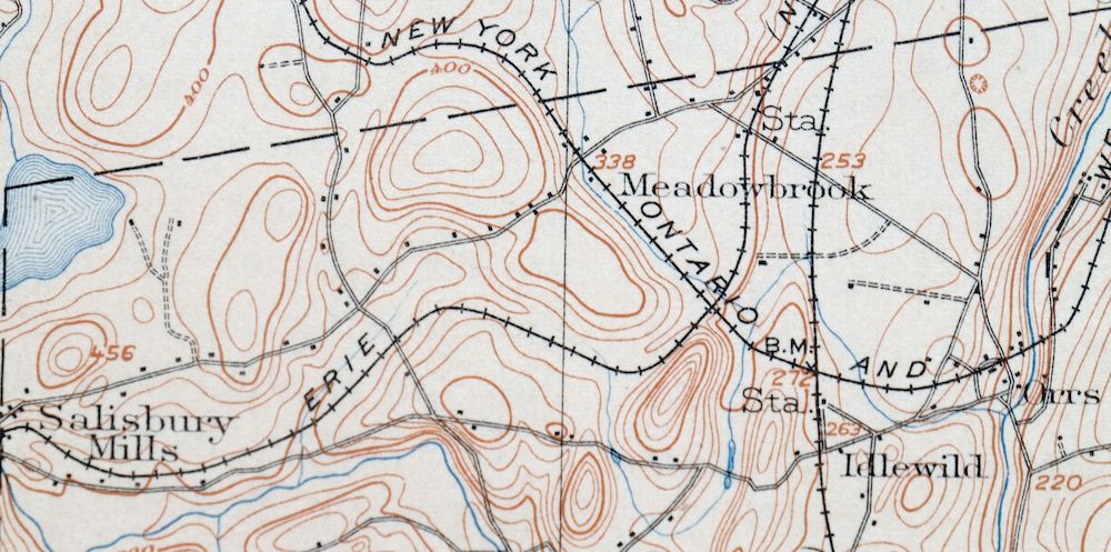
This USGS 15-minute topographic sheet is a 1902 edition, printed in 1915, and survives in excellent condition on thick stock — very lightly handled, never folded, smooth and flat, with a flawless map area and hole punches along the left collar. Drawn from an 1899 field survey and engraved in 1902 under geographer H.M. Wilson, it takes in the country near Newburgh about 45 miles north of New York City, with the quad area reaching across parts of Orange, Dutchess, and Rockland counties to include New Windsor, Monroe, West Point, Washingtonville, Salisbury Mills, and Arden. Surveyed before the modern highway system, it captures the overland travel routes, rail lines, and early placenames of the lower Hudson Valley as they stood at the turn of the century, and comes from an uncommonly well-preserved collection. The reverse carries printed reference material on reading the map’s contours and symbols.
In stock
This antique sheet is a 1902 edition of the Schunemunk New York USGS topographic map. It is an authentic 111-year-old 1915 United States Geological Survey print in excellent condition.
HOW THIS MAP CAN BE USED
In addition to making a fascinating conversation piece, this sheet would look great in a frame or on display, make a unique and prized gift for anyone interested in this area, be perfect as a reference for genealogy studies or general historical research, or fill that missing piece in your collection.
FEATURES SHOWN ON THE MAP
The Schunemunk 15-minute map shows cities and towns, roads, railroads, rivers, creeks, elevation contour lines, public land survey lines, county, state, and other administrative boundaries as they existed at the time of the survey in 1899. All known structures (houses, businesses, churches, schools, barns, cabins, etc) are also shown, with exceptions in some urban areas, where only landmark buildings may be shown.
A VALUABLE HISTORICAL RECORD
Maps from the 15-minute series for the continental United States are no longer produced or printed by the USGS and original prints are becoming increasingly difficult to find. They are a valuable historical record for an area, as they contain many placenames and features that have been dropped from more recent maps.
Nearby maps
-

Goshen New York Middletown Warwick USGS Topographic Map 1913
$55 Add to cart -

West Point New York Newburgh Peekskill USGS Topo Map 1912
$75 Add to cart -

Harlem New York New York Yonkers USGS Topo Map 1913 Antique
$250 Add to cart -

Milford Pennsylvania Lackawaxen Pond Eddy USGS Topo Map 1915
$58 Add to cart -

Danbury Connecticut Trumbull Bethel USGS Topo Map 1899
$70 Add to cart -
Wallpack New Jersey Newton Crandon Lakes USGS Topo Map 1916
$95 Add to cart -
Hawley Pennsylvania Tafton USGS 15-Min Topo Map 1964 Vintage
$44 Add to cart -

Damascus Pennsylvania Honesdale USGS Topo Map 1964 Vintage
$35 Add to cart -
Honesdale Pennsylvania Carbondale Waymart USGS Topo Map 1945
$49 Add to cart -

Park Ridge New Jersey New City Ridgewood USGS Topo Map 1963
$45 Add to cart -
Norwalk South Connecticut Stamford Darien USGS Topo Map 1963
$40 Add to cart -
Westport Connecticut Fairfield USGS Topographic Map 1973
$42 Add to cart -
Litchfield Connecticut Waterbury Oakville USGS Topo Map 1910
$100 Add to cart -

Plainfield New Jersey Edison Somerset USGS Topo Map 1965
$42 Add to cart -

New Brunswick New Jersey Spotswood Edison USGS Topo Map 1965
$32 Add to cart -
Starrucca Pennsylvania Hancock Lakewood USGS Topo Map 1964
$40 Add to cart -
Olyphant Pennsylvania Scranton Dunmore USGS Topo Map 1960
$37 Add to cart -
Delhi New York Davenport USGS 15-Min Topo Map 1911 Antique
$52 Add to cart -

Trenton New Jersey Philadelphia Levittown USGS Topo Map 1907
$150 Add to cart -
Susquehanna Pennsylvania Hallstead USGS 15-Min Topo Map 1959
$46 Add to cart -

Riverhead New York Manorville Calverton USGS Topo Map 1915
$175 Add to cart -

Wilkes-barre East Pennsylvania Laurel Run USGS Topo Map 1959
$36 Add to cart -

Moodus Connecticut Lake Pocotopaug USGS Topographic Map 1946
$32 Add to cart -

Troy New York Albany Watervliet USGS Topo Map 1907 Antique
$95 Add to cart
