MAP DETAILS | |
|---|---|
| TITLE | Navajo Mountain |
| STATE | Utah, Arizona |
| LOCATION | 35 miles northeast of Page, AZ |
| SERIES | 15-minute |
| SURVEYED | 1951 and 1953 Aerial and Field Survey |
| EDITION | 1953 |
| REVISIONS | Aerial revision in 1972. |
| PRINTED | 1973 |
| PRINT NOTES | Thick paper stock, includes woodland tint (green to indicate vegetated areas) |
| SCALE | 1:62500 |
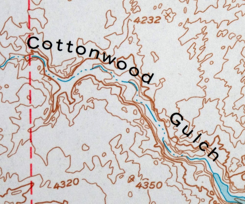
| CONTOUR INTERVAL | 80 feet |
| SHEET DIMENSIONS | 18 x 22 inches |
| MAP DIMENSIONS | 14 x 17 1/2 inches |
| COVERAGE AREA | 14 x 17 miles |
| SHEET CONDITION For maps of this vintage, effort is made to note all visible flaws, no matter how minor. | |
| OVERALL CONDITION | Very Good |
| SHEET NOTES | lightly handled, never folded |
| MAP AREA | flawless map area |
| COLLARS | no wear or tears, no markings |
 | |
| MAP COVERAGE Quadrangle extent overlaid on current basemap. | |
| PLACENAMES Depending on map series and survey date, all of the features listed below may not be shown on this map. This list contains features that currently exist or historically existed within the area covered by the map. The list can be used as a reference to determine if this map covers your area of interest. Placenames are listed alphabetically next to each feature type. | |
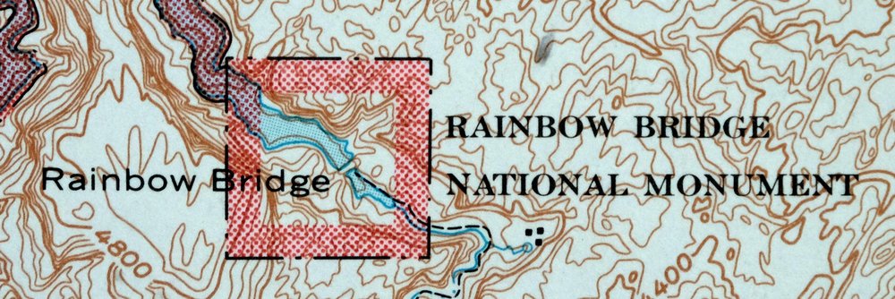
| NOTABLE PLACES | Rainbow Bridge, Lake Powell, Navajo, and Glen Canyon NRA |
| CITIES AND TOWNS (CURRENT) | Navajo Mountain |
| COUNTIES COVERED | Coconino, Kane, and San Juan |
| FEDERAL LAND UNITS | Glen Canyon National Recreation Area, Navajo Indian Reservation, and Rainbow Bridge National Monument |
| RIVERS AND STREAMS | Aztec Creek, Colorado River, Desha Creek, Nasja Creek, San Juan River, and Wilson Creek |
| Utah Populated Place: Navajo Mountain and Rainbow City. Locations: Echo Camp, Navajo Mountain Trailhead, Navajo Mountain Trailhead to Rainbow Bridge, Painted Rocks, Rainbow Bridge Floating Marina, and Rainbow Lodge Site Trailhead to Rainbow Bridge. Areas: Oak Glens. Administrative Boundaries: Navajo Mountain Chapter and San Juan Southern Paiute Northern Area. Mountains, Peaks, and Summits: Navajo Mountain, Cha Butte, Dougi Butte, Fiftymile Point, Grey Mesa, Nasja Mesa, Navajo Begay, and No Name Mesa. Valleys and Canyons: Tsagieto Canyon, Anasazi Canyon, Bald Rock Canyon, Cascade Canyon, Cha Canyon, Cliff Canyon, Cottonwood Canyon, Cottonwood Gulch, Desha Canyon, Dome Canyon, Forbidding Canyon, Hidden Passage Canyon, Johnsons Hole, Lehi Canyon, Llewellyn Gulch, Moepitz Canyon, Navajo Valley, Oak Canyon, Rainbow Bridge Canyon, Reflection Canyon, San Juan Valley, Shoot the Chute Canyon, Trail Canyon, and Twilight Canyon. Parks: Rainbow Bridge National Monument. Trails: Hoskaninni Company Road. Drainages: Aztec Creek, Bridge Creek, Cha Creek, Cottonwood Creek, Desha Creek, Junction Creek, Nasja Creek, Redbud Creek, San Juan River, and Wilson Creek. Islands: Register Rock. Gaps: Aladdins Lamp Pass, Redbud Pass, and Yabut Pass. Bays: Cha Bay. Basins: Surprise Valley. Bars: Music Temple Bar. Natural Arches: Old Settler Natural Bridge, White Crag Natural Bridge, Twilight Arch, Owl Bridge, and Rainbow Bridge. Airports: Navajo Mountain Airport. Census: Navajo Mountain Census Designated Place. Schools: Navajo Mountain School. Ridges: Lookout Ridge. Reservoirs and Tanks: Lake Powell. Springs: War God Spring. | |
| Arizona Springs: Rainbow Lodge Spring. | |
| SHIPPING AND RETURNS | |
 This map sheet will be carefully rolled in a sturdy tube and shipped via the US Postal Service. If you find that the sheet you receive is not as described in the listing, you may ship it back to us for a refund of the purchase price. | |

1973 Navajo Mountain Utah/Arizona USGS Topo Map
$38
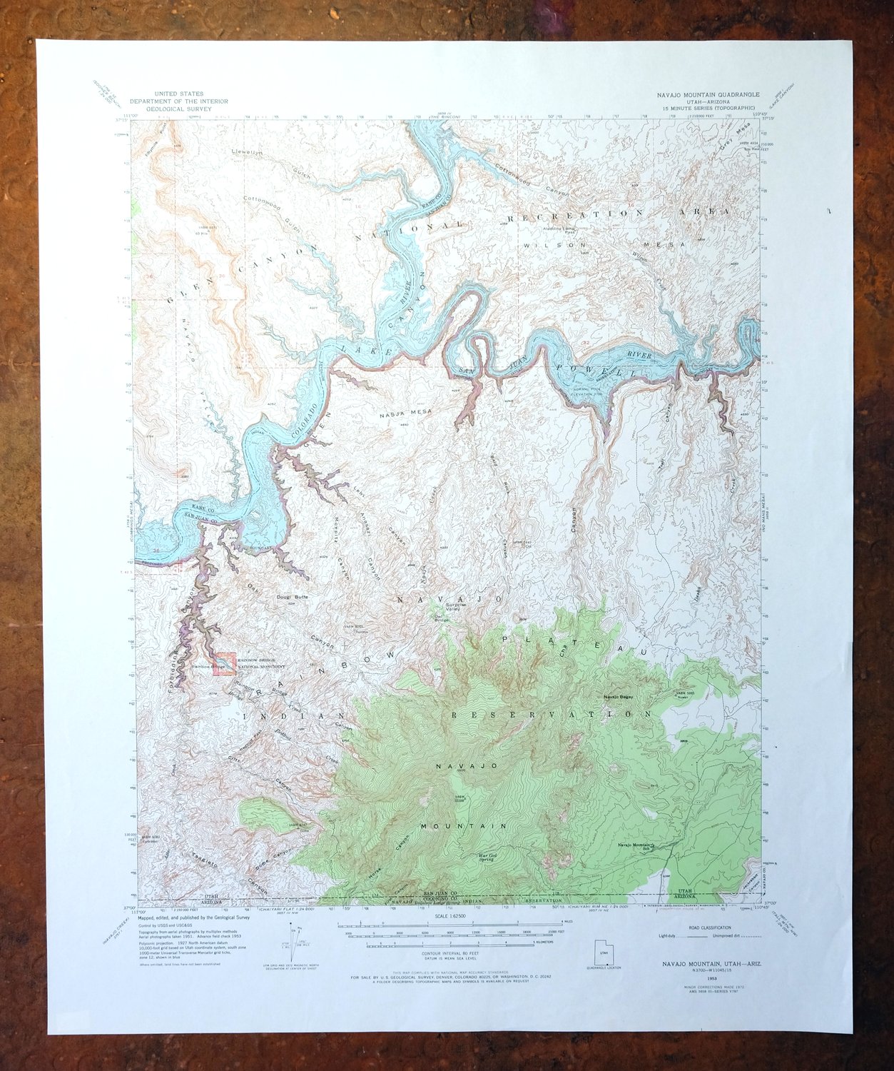
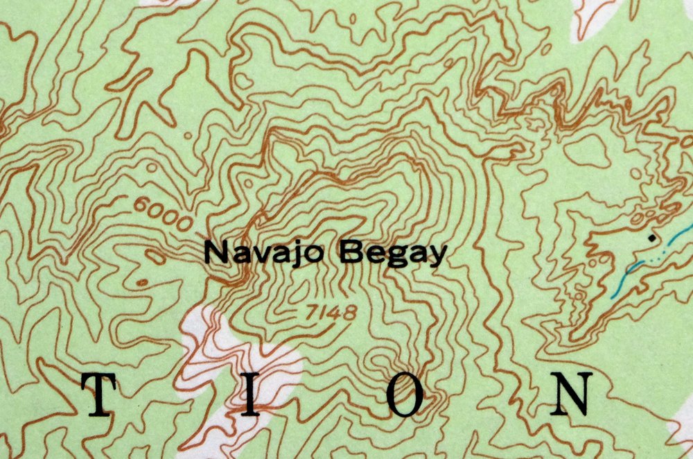
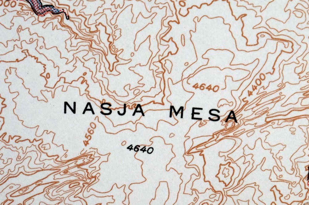
Named for the broad dome that rises above the surrounding canyon country, this 15-minute topographic quad was first published in a 1953 edition and printed in 1973, with a green woodland tint marking the vegetated areas. It covers ground where Utah meets Arizona about 35 miles northeast of Page, taking in the community of Navajo Mountain, part of the Navajo Indian Reservation, and the area around Rainbow Bridge National Monument. The 80-foot contour interval traces the deep slickrock drainages running toward Lake Powell, whose waters had only recently begun filling behind Glen Canyon Dam. Printed on thick stock and never folded, the sheet has a flawless map area.
In stock
This vintage sheet is a 1953 edition of the Navajo Mountain Utah USGS topographic map revised in 1972 using aerial photography. It is an original 53-year-old 1973 United States Geological Survey print in very good condition.
HOW THIS MAP CAN BE USED
In addition to making a fascinating conversation piece, this sheet would look great in a frame or on display, make a unique and prized gift for anyone interested in this area, be perfect as a reference for genealogy studies or general historical research, or fill that missing piece in your collection. Maps of this vintage are printed on durable stock and are well-suited for outdoor activities and recreation of all kinds, including hiking, backpacking, hunting, rafting and kayaking, backcountry skiing, geocaching, general exploration, treasure hunting, etc.
FEATURES SHOWN ON THE MAP
The Navajo Mountain 15-minute map shows cities and towns, roads, railroads, utilities and energy infrastructure, rivers, creeks, elevation contour lines, public land survey lines, county, state, and other administrative boundaries as they existed at the time of the survey in 1951 and 1953. All known structures (houses, businesses, churches, schools, barns, cabins, etc) are also shown.
A VALUABLE HISTORICAL RECORD
Maps from the 15-minute series for the continental United States are no longer produced or printed by the USGS and original prints are becoming increasingly difficult to find. They are a valuable historical record for an area, as they contain many placenames and features that have been dropped from more recent maps.
Nearby maps
-
Cummings Mesa Utah USGS 15-Min Topographic Map 1978 Vintage
$40 Add to cart -

Cummings Mesa Glen Canyon Utah Vintage USGS Topo Map 1964
$55 Add to cart -
Nipple Butte Utah Wahweap WSA Big Water USGS Topo Map 1962
$36 Add to cart -

Lees Ferry Arizona Page Marble Canyon USGS Topo Map 1971
$53 Add to cart -
Agathla Peak Arizona USGS 15-Min Topo Map 1959 Vintage
$40 Add to cart -

Paria Plateau Arizona Vermillion Cliffs USGS Topo Map 1978
$40 Add to cart -
Bears Ears Utah USGS 15 Minute Topographic Map 1974 Vintage
$45 Add to cart -
Marsh Pass Arizona Kayenta Pinon USGS Topo Map 1922 Antique
$74 Add to cart -
Echo Cliffs Arizona Tuba City Page USGS 60-Min Topo Map 1913
$34 Add to cart -
Notom Capitol Reef NP Utah USGS 15-Min Topo Map 1958 Vintage
$45 Add to cart -
House Rock Spring Arizona USGS 15-Min Topo Map 1972 Vintage
$40 Add to cart -
Fiddler Butte Utah USGS 15-Min Topographic Map 1958 Vintage
$38 Add to cart -
Nankoweap Arizona Grand Canyon USGS Topo Map 1970 Vintage
$32 Add to cart -

Jacob Lake Arizona Kaibab Plateau USGS Topo Map 1965 Vintage
$38 Add to cart -
Blue Spring Arizona USGS 15-Min Topographic Map 1978 Vintage
$40 Add to cart -
Toh Atin Mesa Arizona Red Mesa USGS Topo Map 1967 Vintage
$40 Add to cart -
Shinarump Arizona Kaibab USGS 15-Min Topo Map 1964 Vintage
$35 Add to cart -
De Motte Park Arizona USGS 15-Min Topo Map 1964 Vintage
$37 Add to cart -
Oraibi Arizona Second Mesa Shongopovi USGS Topo Map 1968
$34 Add to cart -
1965 USGS Topo Map: Hanksville, Dirty Devil River, Utah
$38 Add to cart -
Blanding Utah Montezuma Canyon White Mesa USGS Topo Map 1964
$33 Add to cart -
Big Springs Arizona Kaibab Nail Canyon USGS Topo Map 1984
$40 Add to cart -
Polacca Arizona First Mesa Second Mesa USGS Topo Map 1967
$39 Add to cart -
1958 USGS Topo Map: Torrey, Capitol Reef NP, Utah
$37 Add to cart