MAP DETAILS | |
|---|---|
| TITLE | Marsh Peak |
| STATE | Utah, Wyoming |
| LOCATION | 25 miles northwest of Vernal |
| SERIES | 30-minute |
| SURVEYED | 1905 and 1906 Field Survey |
| GEOGRAPHER | E.M. Douglas |
| EDITION | 1908 |
| PRINTED | 1908 |
| SCALE | 1:125000 |
| CONTOUR INTERVAL | 100 feet |
| SHEET DIMENSIONS | 16 1/2 x 20 inches |
| MAP DIMENSIONS | 13 1/4 x 17 1/2 inches |
| COVERAGE AREA | 26 x 35 miles |
| MAP NOTES | Surveyed before the existence of Flaming Gorge Reservoir on the Green River. |
| SHEET CONDITION For maps of this vintage, effort is made to note all visible flaws, no matter how minor. | |
| OVERALL CONDITION | Good |
| SHEET NOTES | lightly handled, never folded |
| MAP AREA | no markings, no blemishes |
| COLLARS | no markings, very minor blemishes, a few stabilized edge tears |
  | |
| MAP COVERAGE Quadrangle extent overlaid on current basemap. | |
| BACKSIDE LEGEND | |
 A map summary is printed on the back side of the Marsh Peak sheet similar to the one shown in the picture. It outlines the history, purpose, and status of the USGS mapping program at the time of the printing in 1908. It also provides instructions on how to read contour lines and a description of how they are used to depict the terrain. At the bottom of the page is a legend showing all of the symbols used to represent the cultural, relief, and water features found on the map. | |
| PLACENAMES Depending on map series and survey date, all of the features listed below may not be shown on this map. This list contains features that currently exist or historically existed within the area covered by the map. The list can be used as a reference to determine if this map covers your area of interest. Placenames are listed alphabetically next to each feature type. | |
| CITIES AND TOWNS (CURRENT) | Manila, McKinnon, and Washam |
| COUNTIES COVERED | Daggett, Duchesne, Sweetwater, and Uintah |
| FEDERAL LAND UNITS | Ashley National Forest, Flaming Gorge National Recreation Area, Flaming Gorge Reservoir, Steinaker Reservoir, and Uintah and Ouray Indian Reservation |
| RIVERS AND STREAMS | Anderson Creek, Ashley Creek, Big Brush Creek, Birch Creek, Black Canyon Creek, Burnt Creek, Cart Creek, Carter Creek, Center Creek, Center Fork Eagle Creek, Cliff Creek, Crow Creek, Cub Creek, Death Valley Creek, Deep Creek, Dowd Creek, Dry Fork, East Fork Carter Creek, East Fork Deep Creek, Elk Creek, Farm Creek, Francis Creek, Government Creek, Green River, Grouse Creek, Hominy Creek, Honslinger Creek, Johnson Creek, Leona Creek, Lily Lake Creek, Little Brush Creek, Little Elk Creek, Little Water, Loco Creek, Lodgepole Creek, Middle Fork Carter Creek, Middle Fork Sheep Creek, Mosby Creek, North Brownie Creek, North Fork Ashley Creek, North Fork Dry Fork, Paradise Creek, Red Pine Creek, Sheep Creek, Smelter Creek, South Fork Sheep Creek, Split Creek, Spring Creek, Trout Creek, West Fork Carter Creek, Weyman Creek, and Whiterocks River |
| WATER BODIES | Anson Lake, Big Lake, Blue Lake, Briggs Reservoir, Browne Lake, Chimney Rock Lake, Cliff Lake, Daggett Lake, Dead Lake, Deadman Lake, Dollar Lake, East Park Reservoir, Fish Lake, Flaming Gorge Reservoir, Goose Lakes, Gull Lake, Hacking Lake, Johnson Lake, Julius Park Reservoir, Kibah Lakes, Lamb Lakes, Lily Pad Lake, Little Elk Lake, Long Park Reservoir, Oaks Park Reservoir, Paradise Park Reservoir, Paul Lake, Pearl Lake, Pollen Lake, Potter Lake, Red Belly Lake, Red Lake, Sand Lake, Saucer Lake, Spirit Lake, Steinaker Reservoir, Stove Lake, Teds Lake, Tepee Lakes, Twin Lakes, Watkins Lake, Weyman Lakes, Whiterocks Lake, Lake Wilde, Wooley Lakes, and Workman Lake |
| Utah Populated Place: Bullionville, Dry Fork, and Manila. Locations: Anson Cabin, Antelope Flat Campground, Antelope Flat Development, Ashley Creek Recreation Site, Ashley Substation, Brown Lake Campground, Brush Creek Canyon Overlook, Brush Creek Corral, Canyon Rim Campground, Carmel Campground, Colton Ranger Station, Death Valley Enclosure, Deep Creek Campground, Dowd Mountain Enclosure, Dowd Mountain Overlook Picnic Area, Dowd Spring Recreation Area, Dowds Hole Enclosure, Dry Fork Overlook, Dry Fork Picnic Site, East Park Campground, Elkhorn Guard Station, Farm Creek Grazing Enclosure, Flamingo Gorge Overlook, Galloway Corral, Gooseneck Boat Camp, Greens Lakes Campground, Hicks Park Corral, Hideout Boat Camp, Hideout Canyon Campground, Hideout Eagle Basin Trail, Iron Spring Camp, Iron Springs Campground, Kaler Hollow Campground, Kingfisher Island Campground, Kingfisher Park, Little Mountain Overlook, Little Valley Corral, Lucerne Valley Campground, Lucerne Valley Development, Lucerne Valley Marina, Manila Ranger Station, Mann Camp, McConkie Ranch, Moenkopi Campground, Mosby Mountain Game Exclosure, Oaks Park Campground, Palisade Campground, Paradise Campground, Paradise Guard Station, Pine Ridge Picnic Site, Red Canyon Lodge, Red Canyon Overlook, Red Canyon Picnic Area, Red Canyon Visitor Center, Remember the Maine Picnic Site, Sheep Creek Bay Campground, Skull Creek Campground, Spring Creek Corral, Steinaker Campground, Summit Springs Guard Station, Trail Creek Ranch, Trout Creek Guard Station, Whiterocks Campground, and Willow Camp. Areas: Bull Pasture, Lightning Park, and Twin Parks. Administrative Boundaries: Town of Manila, West Daggett Division, and Daggett County. Mountains, Peaks, and Summits: Bare Top Mountain, Corson Peak, Dowd Mountain, Dyer Mountain, Ice Cave Peak, Jay Point, Jessen Butte, Lake Mountain, Leidy Peak, Little Mountain, Little Water Hills, Marsh Peak, Mesa, Middle Mountain, Mosby Mountain, Mount Untermann, Paradise Peak, Phil Pico Mountain, Red Knoll, Red Mountain, Sheep Creek Hill, Sims Peak, Taylor Mountain, Trout Creek Peak, Ute Mountain, Weasel Point, and Whiterocks. Valleys and Canyons: Alcorn Hollow, Alma Taylor Hollow, Ashley Gorge, Bathtub Trough, Big Tom Hollow, Birch Spring Draw, Black Canyon, Bridger Canyon, Brownie Canyon, Buck Draw, Campbell Draw, Carter Dugway, Chokecherry Draw, Coal Mine Draw, Colton Hollow, Cow Hollow, Davis Hollow, Dodds Hollow, Elkhorn Trough, Enchanted Canyon, Finch Draw, Flaming Gorge Valley, Gompers Canyon, Grizzly Hollow, Henry Olsen Draw, Hideout Canyon, Hideout Draw, Horseshoe Canyon, Kaler Hollow, Kingfisher Canyon, Lees Hollow, Lucerne Valley, Mahogany Draw, Mill Canyon, Pine Hollow, Ralphs Canyon, Red Pine Canyon, Rock Canyon, Scraper Spring Draw, Shindy Draw, Sols Canyon, South Valley, Trail Canyon, and Wild Horse Draw. Parks: Lucerne Point Group Site, Merkley Park, Navajo Cliffs Picnic Area, Old Carter Trail Historical marker, Palisades Memorial Park, Sheep Creek Canyon Geological Area, Shindy Hollow Picnic Site, and Steinaker State Park. Trails: Dry Fork Trail, Hideout Eagle Basin Trail, Icy Hill Dugway, and Uinta Highline Trail. Drainages: Anderson Creek, Beaver Creek, Black Canyon Creek, Burnt Creek, Carter Creek, Center Creek, Center Fork Eagle Creek, Crow Creek, Cub Creek, Death Valley Creek, Deep Creek, Dowd Creek, Dry Fork, Eagle Creek, East Fork Carter Creek, East Fork Deep Creek, East Fork Eagle Creek, Elk Creek, Government Creek, Grouse Creek, Henrys Fork, Hominy Creek, Honslinger Creek, Hope Creek, Kingfisher Creek, Lake Creek, Leona Creek, Lily Lake Creek, Little Elk Creek, Loco Creek, Lodgepole Creek, Middle Fork Carter Creek, Middle Fork Sheep Creek, Mosby Creek, North Brownie Creek, North Fork Ashley Creek, North Fork Crow Creek, North Fork Dry Fork, North Fork Sheep Creek, North Skull Creek, Paradise Creek, Red Pine Creek, Reynolds Creek, Roaring Fork, Sheep Creek, Skull Creek, Smelter Creek, South Brownie Creek, South Fork Ashley Creek, South Fork Dry Fork, South Fork Sheep Creek, Split Creek, Spring Creek, Trout Creek, West Fork Carter Creek, West Fork Eagle Creek, Weyman Creek, and Whiskey Creek. Islands: Kingfisher Island. Capes: Beehive Point. Mines: Dyer Mines and Little Water Mines. Churches: The Church of Jesus Christ of Latter Day Saints. Post Office: Manila Post Office. Lakes and Ponds: Lost Lake, Alma Taylor Lake, Anson Lake, Big Lake, Blue Lake, Chimney Rock Lake, Daggett Lake, Dead Horse Park, Dead Lake, Deadman Lake, Dollar Lake, Dowds Hole, Fish Lake, Goose Lakes, Greens Lakes, Gull Lake, Hacking Lake, Hopper Lakes, Johnson Lake, Kibah Lakes, Lake Wilde, Lamb Lakes, Lightning Park, Lily Lake, Lily Pad Lake, Little Elk Lake, Little Lake, Mill Pond, Moap Lake, Mytoge Lake, Paul Lake, Pearl Lake, Pollen Lake, Potter Lake, Red Belly Lake, Red Lake, Sand Lake, Saucer Lake, Spirit Lake, Stove Lake, Teds Lake, Tepee Lakes, Tool Box Park, Twin Lakes, Watkins Lake, Weyman Lakes, Wooley Lakes, and Workman Lake. Buildings: Daggett County Ambulance Service, Daggett County Jail, Daggett County Sheriff's Office, Manila Volunteer Fire Department, and United States Forest Service Fire Station - Manila Office. Waterfalls: Ashley Falls. Dams: Ashley Twin Lakes Dam, Browne Lake Dam, Cliff Lake Dam, Daggett Lake Dam, East Park Dam, Julius Park Dam, Long Park Dam, Lower Goose Lake Dam, Oaks Park Dam, Paradise Park Dam, Sheep Creek Dam, Spirit Lake Dam, Steinaker Dam, Upper Goose Lake Dam, and Whiterocks Lake Dam. Bluffs: Chalk Cliffs. Gaps: Gabbro Pass and Sheep Creek Gap. Canals: Farm Creek Canal, Lodgepole Canal, Mosby Canal, Peoples Canal, Pitt Ditch, Rock Point Canal, Sheep Creek Canal, South Valley Canal, Steinaker Ditch, and Whiterocks Canal. Bridges: Brush Creek Bridge, Carter Creek Bridge, Deep Creek Bridge, Deep Creek Campground Bridge, Dry Fork Bridge, Farm Creek Bridge, Hickerson Park Bridge, Lodgepole Canal Bridge, Sheep Creek Canal Bridge, and Upper Sheep Creek Bridge. Bays: Linwood Bay and Sheep Creek Bay. Basins: Castle Cove, Digger Basin, Eagle Basin, Lakeshore Basin, Mosby Sink, and The Hole. Airports: Manila Airport. Schools: Manila Elementary School and Manila High School. Ridges: Boars Tusk, Buck Ridge, Pine Ridge, Sawtooth Ridge, Sink Ridge, The Reaves, and Windy Ridge. Reservoirs and Tanks: Ashley Twin Lakes, Browne Lake, Burton Reservoir, Chokecherry Flat Reservoir, Cliff Lake, East Cart Hollow Reservoir, East Park Reservoir, Julius Park Reservoir, Long Park Reservoir, Lower Goose Lake, Lower Grouse Reservoir, Oaks Park Reservoir, Paradise Park Reservoir, Sheep Creek Lake, Steinaker Reservoir, Upper Goose Lake, and Whiterocks Lake. Flats: Bear Park, Big Park, Bills Park, Blanchett Park, Brush Park, Center Park, Charleys Park, Corral Park, Death of James Meadow, Deer Park, Dyer Park, Elk Park, Frenches Park, Government Park, Grasshopper Flat, Half Moon Park, Hells Kitchen Park, Hickerson Park, Hicks Park, Horseshoe Park, Johnson Park, Julius Park, Lake Park, Lightning Park, Loggers Cabin Park, Lonesome Park, Long Park, Lost Park, Macks Park, Manila Park, Meadow Park, Mill Park, Mosby Park, Murray Park, Oaks Park, Ox Park, Paradise Park, Pat Carroll Park, Round Park, Sheep Creek Park, Soldier Park, South Side Park, Summit Park, Trout Creek Park, Weyman Park, and Windy Park. Bench: Hen Lee Bench. Plains and Plateaus: Taylor Mountain Plateau. Springs: Ashley Spring, Aztec Spring, Bear Seep, Bear Spring, Bear Wallow Spring, Beck Spring, Beeler Spring, Bench Spring, Big Spring, Bills Spring, Birch Spring, Bodily Spring, Box Spring, Brush Creek Spring, Buckhorn Spring, Bullionville Spring, Bum Spring, Burch Spring, Burton Seep, Canyon Spring, Cart Hollow Spring, Cedar Point Spring, Charleys Park Spring, Chenab Spring, Chicken Spring, Chivers Spring, Chokecherry Spring, Colton Spring, Corral Spring, Cottonwood Spring, Cove Spring, Cow Spring, Cuch Spring, Davis Spring, Deep Creek Spring, Dodds Hollow Spring, Douglas Spring, Dowd Spring, Dryland Spring, East End Spring, Flat Spring, Galloway Spring, Gartell Spring, Gibson Spring, Green Spring, Grouse Flat Spring, Hawthorn Spring, Henline Spring, Horricks Spring, Ice Cave Spring, Indian Spring, Iron Spring, June Spring, Kabell Spring, Knoll Spring, Lake Canyon Spring, Leona Spring, Lightning Spring, Lind Spring, Lost Spring, Lower Big Tom Hollow Springs, Lower Bottom Spring, Lower Flat Seep, Lower Flat Spring, Lyles Hole Spring, Lyman Spring, Merkley Spring, Middle Mountain Seep, Middle Spring, Mill Canyon Spring, Mud Spring, Mule Hollow Spring, Murray Park Spring, Murray Spring, North Point Seep, Paradise Spring, Parson City Spring, Point Spring, Prospector Spring, Rat Spring, Red Pine Spring, Roaring Fork Spring, Ross Spring, Sage Hen Spring, Sand Point Spring, Scraper Spring, Shelmadine Spring, Shindy Spring, Single Trough Spring, Smelter Spring, Snake John Spring, Snider Spring, Sprouse Spring, Squaw Spring, Sulphur Spring, Summit Springs, Three Trough Spring, Trout Spring, Upper Big Tom Hollow Spring, Upper Cart Hollow Springs, Uranium Spring, Walkup Spring, Warden Spring, Willow Springs, Woodard Spring, and Youngs Spring. Cemetery: Dowds Grave, Dry Fork Cemetery, Manila Cemetery, and Reeds Cemetery. | |
| Wyoming Valleys and Canyons: Antelope Hollow. Drainages: Henrys Fork. Canals: Peoples Canal and Sheep Creek Canal. | |
| SHIPPING AND RETURNS | |
 This map sheet will be carefully rolled in a sturdy tube and shipped via the US Postal Service. If you find that the sheet you receive is not as described in the listing, you may ship it back to us for a refund of the purchase price. | |
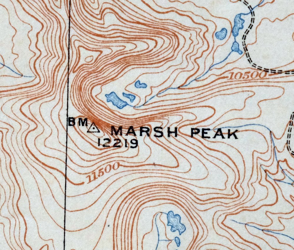
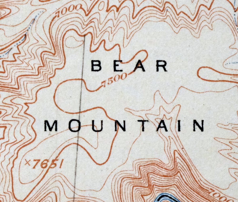

Marsh Peak Utah Manila McKinnon USGS Topo Map 1908 Antique
$55
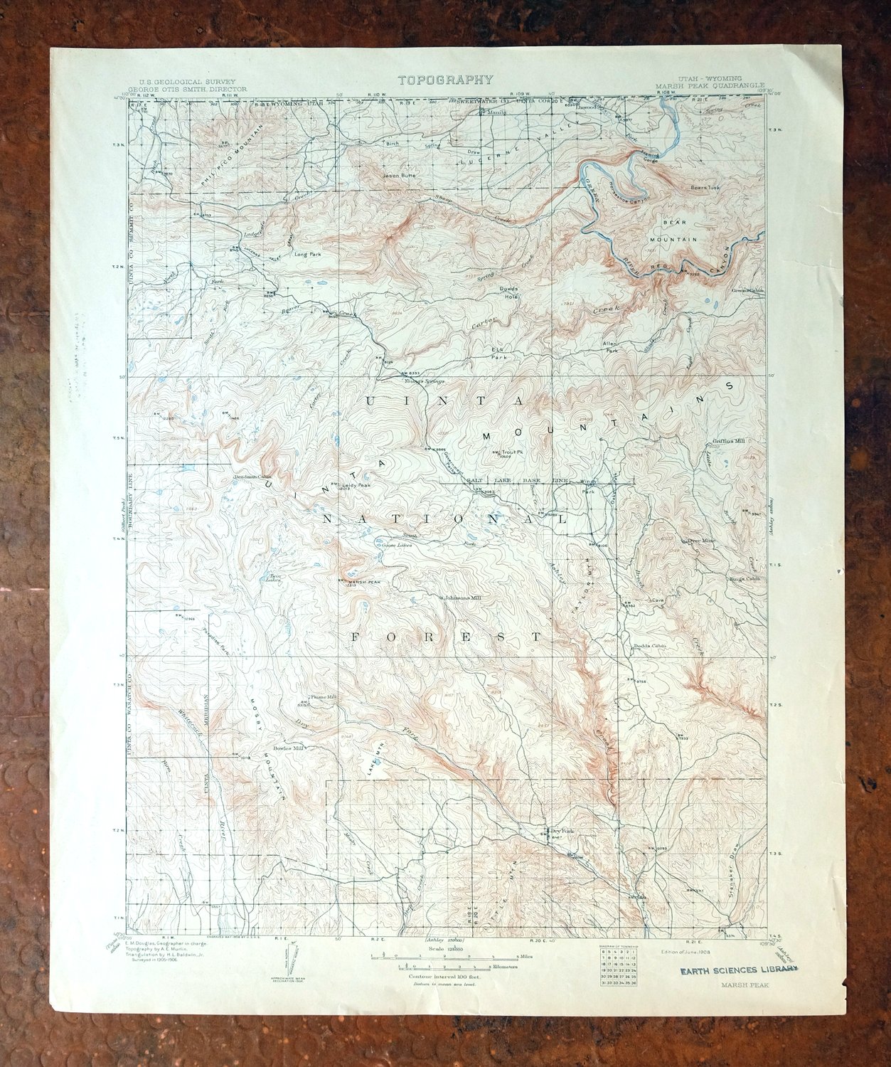
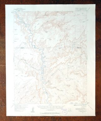
Printed in its year of first publication, 1908, this USGS 30-minute topographic sheet is in good condition, lightly handled and never folded. Its bounding box straddles the Utah-Wyoming line about 25 miles northwest of Vernal, taking in portions of the Ashley National Forest and the Uintah and Ouray Indian Reservation along with the community of Manila. Drawn from an 1905 and 1906 field survey by geographer E.M. Douglas, the map records the Green River country as it was before Flaming Gorge Reservoir filled the canyon. The reverse carries printed reference material about the mapping program of the era.
Out of stock
This antique sheet is a 1908 edition of the Marsh Peak Utah USGS topographic map. It is an authentic 118-year-old United States Geological Survey print in good condition.
HOW THIS MAP CAN BE USED
In addition to making a fascinating conversation piece, this sheet would look great in a frame or on display, make a unique and prized gift for anyone interested in this area, be perfect as a reference for genealogy studies or general historical research, or fill that missing piece in your collection.
FEATURES SHOWN ON THE MAP
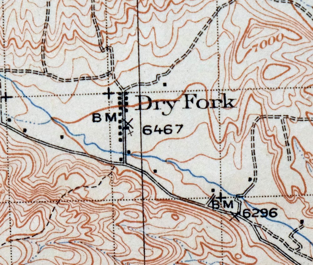
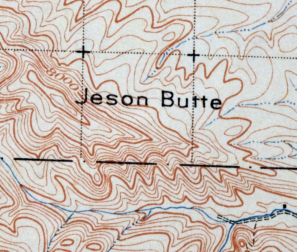
The Marsh Peak 30-minute map shows cities and towns, roads, railroads, rivers, creeks, elevation contour lines, public land survey lines, county, state, and other administrative boundaries as they existed at the time of the survey in 1905 and 1906.
A VALUABLE HISTORICAL RECORD
Maps from the USGS 30-minute series have been out of print for many years. They have never been common and original prints are increasingly difficult to find. For areas where the 30-minute map was produced, it is usually the first large-scale survey done by the USGS for that area. These are a valuable historical record, as they contain many placenames and features that have been dropped from more recent series’ and editions.
Nearby maps
-

Jensen Utah Vernal Dinosaur USGS 30-Min Topographic Map 1910
$50 Add to cart -

Duchesne Utah Roosevelt Neola USGS Topo Map 1939 Antique
$36 Add to cart -

Hayden Peak Utah Uinta Mountains USGS Topo Map 1946 Vintage
$45 Add to cart -
Grand Hogback Colorado Rifle Silt USGS Topographic Map 1959
$35 Add to cart -
Sunnyside Utah Book Cliffs East Carbon USGS Topo Map 1915
$54 Add to cart -

Castle Gate Utah Price Helper USGS Topo Map 1968 Vintage
$44 Add to cart -
Woodside Utah Book Cliffs Cedar USGS Topographic Map 1973
$26 Add to cart -
Provo Utah Uinta NF Spanish Fork USGS Topo Map 1959 Vintage
$36 Add to cart -
Monument Butte Colorado Moffat Hamilton USGS Topo Map 1915
$49 Add to cart -

Roan Creek Colorado USGS 15-Min Topographic Map 1950 Vintage
$39 Add to cart -

Moroni Utah Fountain Green USGS 15-Min Topo Map 1968 Vintage
$39 Add to cart -

Daton Peak Colorado Routt NF Hayden USGS Topo Map 1965
$28 Add to cart -
Grand Junction Colorado Redlands USGS Topo Map 1964 Vintage
$58 Add to cart -

Castle Dale Utah Ferron Clawson USGS Topographic Map 1925
$45 Add to cart -
The Wickiup Utah Mexican Mountain WSA USGS Topo Map 1967
$20 Add to cart -
Pilot Knob Colorado Routt NF USGS Topo Map 1963 Vintage
$37 Add to cart -
Stockton Utah Tooele Rush Valley USGS Topo Map 1941 Antique
$32 Add to cart -
Soda Springs Idaho Cache NF Grace USGS Topo Map 1951 Vintage
$32 Add to cart -

Pearl Colorado USGS 15-Min Topographic Map 1969 Vintage
$43 Add to cart -
The Spur Utah Canyonlands USGS 15-Min Topo Map 1971 Vintage
$38 Add to cart -
Leon White River NF Colorado USGS 7.5-Min Topo Map 1988
$36 Add to cart -

Hatch Rock Utah La Sal La Sal USGS Topo Map 1965 Vintage
$20 Add to cart -
Highland Peak Colorado Snowmass Village USGS Topo Map 1988
$43 Add to cart -
Fiddler Butte Utah USGS 15-Min Topographic Map 1958 Vintage
$38 Add to cart