MAP DETAILS | |
|---|---|
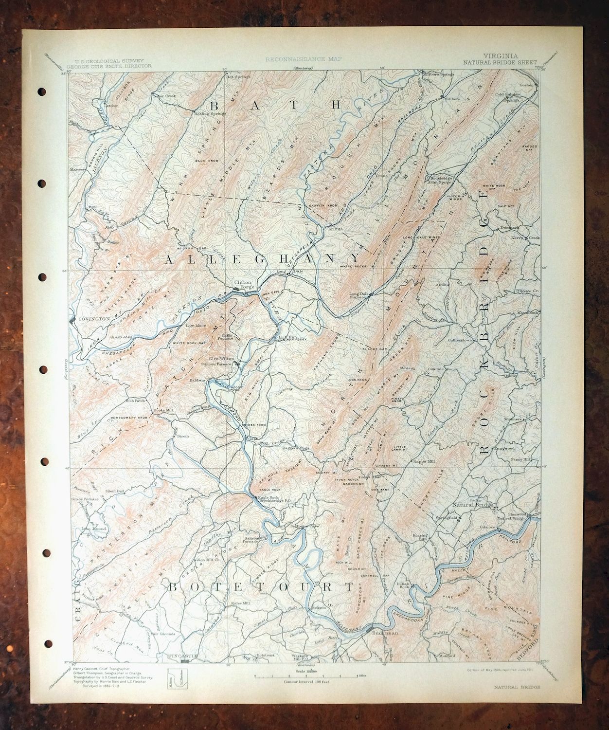
| TITLE | Natural Bridge |
| STATE | Virginia, West Virginia |
| LOCATION | Vicinity of Covington, 35 miles north of Roanoke |
| SERIES | 30-minute |
| SURVEYED | 1886 through 1888 Field Survey |
| GEOGRAPHER | Henry Gannett |
| EDITION | 1894 |
| PRINTED | 1911 |
| PRINT NOTES | Thick paper stock |
| SCALE | 1:125000 |
| CONTOUR INTERVAL | 100 feet |
| SHEET DIMENSIONS | 16 1/2 x 20 inches |
| MAP DIMENSIONS | 13 7/8 x 17 1/2 inches |
| COVERAGE AREA | 27 x 35 miles |
| SOURCE | From an uncommonly well-preserved collection |
| MAP NOTES | A fascinating historical snapshot surveyed before the modern highway system, showing historic travel routes, river crossings, rail lines, and placenames. |
| SHEET CONDITION For maps of this vintage, effort is made to note all visible flaws, no matter how minor. | |
| OVERALL CONDITION | Excellent |
| SHEET NOTES | very lightly handled, never folded, smooth and flat, lightly age-toned paper |
| MAP AREA | flawless map area |
| COLLARS | no wear or tears, no markings, no blemishes, hole punches along left collar |
| MAP COVERAGE Quadrangle extent overlaid on current basemap. | |
| BACKSIDE LEGEND | |
 A map summary is printed on the back side of the Natural Bridge sheet similar to the one shown in the picture. It outlines the history, purpose, and status of the USGS mapping program at the time of the printing in 1911. It also provides instructions on how to read contour lines and a description of how they are used to depict the terrain. At the bottom of the page is a legend showing all of the symbols used to represent the cultural, relief, and water features found on the map. | |
| PLACENAMES Depending on map series and survey date, all of the features listed below may not be shown on this map. This list contains features that currently exist or historically existed within the area covered by the map. The list can be used as a reference to determine if this map covers your area of interest. Placenames are listed alphabetically next to each feature type. | |
| CITIES AND TOWNS (CURRENT) | Buchanan, Clifton Forge, Covington, Eagle Rock, Falling Spring, Fincastle, Glen Wilton, Goshen, Healing Springs, Iron Gate, Low Moor, Millboro, Natural Bridge, Natural Bridge Station, Oriskany, and Selma |
| COUNTIES COVERED | Alleghany, Bath, Bedford, Botetourt, Clifton Forge, Covington, Craig, Greenbrier, and Rockbridge |
| FEDERAL LAND UNITS | Blue Ridge Parkway, George Washington National Forest, Jefferson National Forest, Lake Moomaw, Monongahela National Forest, Rich Hole Wilderness, Rough Mountain Wilderness, and Thunder Ridge Wilderness |
| RIVERS AND STREAMS | Allen Creek, Alum Creek, Back Creek, Back Run, Bearwallow Creek, Big Creek, Big Hollow Branch, Big Lick Creek, Biggs Run, Black Lick, Black Run, Blue Spring Run, Blue Suck Branch, Board Tree Run, Borden Creek, Broad Creek, Buffalo Creek, Bull Run, Cabin Creek, Calfpasture River, Catawba Creek, Cedar Creek, Chestnut Run, Claylick Run, Cold Sulphur Springs Branch, Colliers Creek, Cornelius Creek, Cove Creek, Cowpasture River, Craig Creek, Crawford Branch, Crawford Creek, Crooked Run, David Run, Deisher Branch, Downy Branch, Dry Branch, Dry Creek, Dry Run, Dunlap Creek, Dutchman Branch, East Branch Jackson River, East Fork Elk Creek, Elk Creek, Falling Spring Creek, Finley Branch, Furnace Branch, Gilmer Creek, Gochenour Branch, Guys Run, Hickory Hollow Branch, Hipes Branch, Hombarck Branch, Hook Branch, Hoover Creek, Hopper Creek, Jackson River, James River, Jennings Creek, Jerry Branch, Karnes Creek, Kerrs Creek, Lapsley Run, Lees Creek, Lemons Branch, Lick Block Run, Lick Run, Linkswiler Branch, Little Hellgate Creek, Little Patterson Creek, Little Wilson Creek, Maury River, McFalls Creek, Middle Creek, Mill Creek, Moore Creek, Mud Run, North Branch Simpson Creek, North Buffalo Creek, North Creek, North Fork Catawba Creek, Pads Creek, Patterson Creek, Penn Branch, Piney Branch, Ponding Mill Creek, Potts Creek, Purgatory Creek, Roaring Run, Rocky Creek, Roses Run, Saville Branch, Schoolhouse Branch, Sharvers Run, Shirkey Mill Branch, Sinking Creek, Slate Branch, Sloan Branch, Smith Creek, South Buffalo Creek, Spreading Spring Branch, Spring Branch, Spring Gap Creek, Sprouts Run, Stony Run, Stouts Creek, Stull Run, Sugar Creek, Sukey Johnson Branch, Toad Run, Town Branch, Union Creek, Walters Creek, Waterloo Creek, Whistle Creek, White Rock Creek, Wilson Branch, Wilson Creek, and Wolf Branch |
| WATER BODIES | Cave Mountain Lake, Clifton Forge Reservoir, Cold Sulpher Springs Lake, Douthat Lake, Lake Moomaw, Lexington Reservoir, Pike Pond, and Robertson Lake |
| Virginia Locations: Alleghany Country Club, Alleghany County Industrial Park, Bald Knob FS Repeater Site, Bald Knob Lookout, Bible Camp, Bolar Flat Picnic Area and Launch Ramp, Bolar Mountain Campground, Boys Camp, Callie Furnace, Camp Alkulana, Camp Appalachia, Camp Kannata, Camp Montgomery, Cascades Golf Club, Cave Mountain Recreation Area, Clifton Forge Industrial Park, Coles Mountain Picnic Area, Colon Hollow Shelter Campground, Cove Mountain Shelter, Covington Industrial Park, Craig Creek Campground, Fortney Boat Launch Ramp, Glenwood Furnace, Grace Furnace, Hobby Horse Farm, Hopper Creek Group Camp, Horton, Indian Rock, James River Work Center, Jane Furnace, Lake Robertson Recreational Area, Lick Run, Mallow Mall Shopping Center, Middle Creek Picnic Area, Morris Hill Campground, Morris Hill Picnic Area, Natural Bridge Camp for Boys, Natural Well, Nimrod Hall, North Creek Camping Area, Oak Hill Shopping Center, Rainbow Rocks, Rebecca Furnace, Roaring Run Furnace, Roaring Run Furnace Recreation Site, Rockbridge Alum Springs, Rocky Ford, Salisbury Furnace, Saltpetre Cave, Silent Dell, Smith Tract Campground, Thunder Hill Shelter, Top Dirve Overlook, Trappers Lodge, and Warm Springs Work Center. Areas: Sugarland and Sunset Field. Administrative Boundaries: Buchanan Magisterial District, Clifton Forge East Magisterial District, Clifton Forge West Magisterial District, Clifton Magisterial District, Covington, Fincastle Magisterial District, Jackson River Magisterial District, Kerrs Creek Magisterial District, Millboro Magisterial District, Natural Bridge Magisterial District, Sharon Magisterial District, and Valley Springs Magisterial District. Mountain Ranges: Little Mountain and Short Hills. Mountains, Peaks, and Summits: Ad Cox Knob, Anthony Knobs, Apple Orchard Mountain, Back Creek Mountain, Bald Knob, Beards Mountain, Bearwallow, Bearwallow Mountain, Big Hill, Big House Mountain, Big Knob, Biggs Mountain, Blue Spring Hill, Bratton Mountain, Brushy Knob, Brushy Mountain, Buck Hill, Buckhorn Knob, Caldwell Mountain, Camp Mountain, Carpenter Mountain, Cave Mountain, Chestnut Mountain, Crawford Mountain, Daisy Knob, Dale Mountain, Deisher Mountain, Fore Mountain, Furnace Mountain, Garden Mountain, Grassy Mountain, Green Hill, Green Spur, Griffith Knob, Gully Mountain, Horse Mountain, Howard Knob, Iron Ore Knob, Johnson Mountain, Kiger Hill, The Knob, Little Camp Mountain, Little House Mountain, Little Mare Mountain, Little Mountain, Little Piney Mountain, Lone Field Hill, Mays Mountain, Middle Mountain, Mill Hill, Mill Mountain, Montgomery Knob, Morris Hill, Mud Run Mountain, North Mountain, Orebank Mountain, Painter Mountain, Patterson Mountain, Pine Hills, Pine Mountain, Piny Knob, Mount Pisgah, Poplar Hill, Porter Mountain, Price Mountain, Prisehouse Mountain, Purgatory Mountain, Ragged Mountain, Rathole Mountain, Reidland, Rich Hill, Rich Patch Mountains, Rocky Hill, Rough Mountain, Round Mountain, Sandbank Mountain, Sanford Hill, Saville Hill, Scurff Mountain, Sheets Mountain, Shoemaker Knob, Short Mountain, Skillern Mountain, Stamping Ground Mountain, Sugarloaf Mountain, Switzer Mountain, Thomas Mountain, Thunder Hill, Waits Mountain, Warm Springs Mountain, White Rock Mountain, Wildcat Mountain, and Wilson Mountain. Valleys and Canyons: Backway Hollow, Beards Gap Hollow, Bay Lick Hollow, Bear Hollow, Big Hollow, Big Lick Draft, Big Lick Hollow, Blue Suck Hollow, Boggs Hollow, Bolar Draft, Brown Hollow, Brushy Hollow, Buck Hollow, Cabin Lick Hollow, Callaghan Hollow, Claylick Draft, Colon Hollow, Dolly Ann Hollow, Dry Hollow, Falling Spring Valley, Gilmore Hollow, The Gorge, Hickman Draft, Hickory Hollow, Hughes Draft, Indian Draft, Jarrett Hollow, Kelly Hollow, Lemon Hollow, Limestone Hollow, McGraw Hollow, Medden Hollow, Oppossum Hollow, Polecat Hollow, Poorhouse Hollow, Poplar Hollow, Rockbury Hollow, Ross Camp Hollow, Salt Hollow, Salt Stump Hollow, Second Hollow, Slim Ridge Hollow, Soldiers Retreat Valley, Spring Valley, Suck Lick Hollow, Sugar Hollow, Sugartree Hollow, Swamill Hollow, Tory Hollow, and Turkeypen Hollow. Parks: Booker T Washington Park, Bubbling Spring Recreation Area, Covington Historic District, Douthat State Park, Goshen Wildlife Management Area, Ingleside Park, Linden Park, Longdale Recreation Area, Memorial Park, and Rockbridge Alum Springs Historic District. Trails: Beards Gap Trail, Beards Mountain Trail, Blue Suck Trail, Bridle Trail, Brushy Hollow Trail, Brushy Ridge Trail, Buck Lick Trail, Coles Mountain Fire Trail, Cove Mountain Trail, Crane Trail, George Trail, Gillam Run Trail, Gilliam Run Trail, Gochenour Hunter Access Trail, Hemlock Trail, Huffs Trail, Little Mountain Trail, Lodge Trail, McFalls Ridge Trail, Middle Hollow Trail, Middle Mountain Trail, Mountain Side Trail, Mountain Top Trail, North Branch Trail, North Mountain Trail, Open Trail, Orebank Trail, Pine Tree Trail, Rich Hole Trail, Ross Camp Trail, Salt Pond Ridge Trail, Salt Stump Trail, Sandy Gap Trail, Stony Run Trail, Tobacco House Ridge Trail, White Rock Tower Trail, Wildcat Trail, and Wilson Creek Trail. Drainages: Allen Creek, Alum Creek, Back Creek, Back Run, Bear Loop Branch, Bearwallow Creek, Big Branch, Big Creek, Big Hollow Branch, Big Lick Creek, Biggs Run, Black Lick, Black Run, Blacks Creek, Blue Suck Branch, Board Tree Run, Borden Creek, Brattons Run, Dunlap Creek, Dutchman Branch, East Branch Jackson River, East Fork Elk Creek, Bull Run, Cabin Creek, Cascades Creek, Catawba Creek, Cedar Creek, Chestnut Run, Claylick Run, Cold Sulphur Springs Branch, Colliers Creek, Cornelius Creek, Cove Creek, Cowpasture River, Craig Creek, Crawford Branch, Crawford Creek, Crooked Run, Crush Run, David Run, Deisher Branch, Downy Branch, Dry Branch, Dry Creek, Dry Run, Falling Spring Creek, Finley Branch, Fortney Branch, Furnace Branch, Gillam Run, Gochenour Branch, Harmon Run, Hayslette Creek, Hickory Hollow Branch, Hipes Branch, Hombarck Branch, Hook Branch, Hoover Creek, Hopper Creek, Hot Springs Run, Hughes Creek, Indiandraft Creek, Jackson River, Jennings Creek, Jerry Branch, Karnes Creek, Lapsley Run, Laurel Branch, Laurel Run, Left Prong Wilson Creek, Lemons Branch, Lick Block Run, Lick Run, Linkswiler Branch, Little Cove Creek, Little Hellgate Creek, Little Patterson Creek, Little Wilson Creek, Long Run, Looney Creek, McFalls Creek, McGee Run, Middle Creek, Mill Branch, Mill Creek, Moore Creek, Mud Lick, Mud Run, North Branch Simpson Creek, North Buffalo Creek, North Creek, North Fork Catawba Creek, Pads Creek, Patterson Creek, Penn Branch, Piney Branch, Piney Mountain Branch, Ponding Mill Creek, Porters Mill Creek, Potts Creek, Purgatory Creek, Renick Run, Roaring Run, Rocky Creek, Roses Run, Sales Branch, Saville Branch, Schoolhouse Branch, Sharvers Run, Shirkey Mill Branch, Shop Run, Simpson Creek, Sinking Creek, Slate Branch, Slim Ridge Branch, Sloan Branch, Smith Branch, Smith Creek, South Buffalo Creek, South Fork Pads Creek, Spreading Spring Branch, Spring Branch, Spring Gap Creek, Sprouts Run, Stony Run, Stouts Creek, Stuart Run, Stull Run, Sugar Creek, Sukey Johnson Branch, Swanson Branch, Toad Run, Town Branch, Trout Run, Union Creek, Waterloo Creek, White Rock Creek, Wilson Branch, Wilson Creek, Wolf Branch, and Yellowstone Branch. Islands: Woods Island. Mines: Peanut Mine, Rich Patch Mines, and Ritchpatch Mine. Churches: Altamont Church, Andrew Chapel, Assembly of God Church, Bethel Church, Broad Creek Church, Emmanuel Church, Emmanuel Episcopal Church, Buchanan Presbyterian Church, Buffalo Church, Calvary Baptist Church, Calvary Church, Cave Mountain Church, Cedar Bluff Church, Cedar Grove Church, Central Church, Central United Methodist Church, Church of God, Church of the Brethren, Clifton Forge Baptist Church, Clifton Forge Presbyterian Church, Covington Baptist Church, Emory Church, Epworth Methodist Church, Epworth United Methodist Church, Faith Church, Falling Spring Presbyterian Church, First Baptist Church, First Christian Church, First Church of God, First Church of the Nazarene, First Methodist Church, First Presbyterian Church, Forest Grove Church, Galatia Church, Glenwood Church, Grace Church, Granbery Memorial United Methodist Church, High Bridge Church, Holy Cross Church, Horeb Church, Hot Springs Presbyterian Church, Indian Hill Church, Indian Rock Church, Jackson Church, Jennings Creek Church, Kerrs Creek Church, King Memorial Church, Lapsley Run Church, Lily of the Valley Church, Locust Bottom Church, Lone Star Church, Longdale Church, Low Moor Presbyterian Church, Main Street Baptist Church, Mallow Presbyterian Church, McAllister Memorial Presbyterian Church, Mount Bethel Church, Mount Beulah Church, Mount Carmel Church, Mount Horeb Church, Mount Joy Church, Mount Moreland Church, Mount Moriah Church, Mount Olive Church, Mount Olivet Church, Mount Pleasant Church, Mount Zion Church, Mountain Valley Church, Natural Bridge Church, New Hope Church, North Fork Church, Oak Grove Church, Oakland Church, Oxford Church, Parrish Court United Methodist Church, Pentecostal Holiness Church, Pierce Chapel, Pilgrim Holiness Church, Pine Street Baptist Church, Rapps Church, Sacred Heart Catholic Church, Sacred Heart Roman Catholic Church, Saint Andrews Episcopal Church, Saint Jacobs Church, Saint Josephs Roman Catholic Church, Saint Luke Episcopal Church, Saint Marks Church, Sharon Church, Shiloh Church, Sinking Spring Church, Spring Valley Church, Sycamore Valley Church, Triangle Hill Church, Trinity Baptist Church, Trinity Episcopal Church, Trinity Methodist Episcopal Church South, Union Chapel, Union View Church, Virginia Church, Walton Memorial Church, Wheatland Church, White Rock Church, and Zion Hill Church. Forests: James River Ranger District. Hospitals: Alleghany Memorial Hospital, Allegheny Regional Hospital, and C And O Hospital. Lakes and Ponds: Pike Pond. Buildings: Alleghany County Courthouse, Alleghany County Jail, Clifton Forge City Hall, Clifton Forge Public Library, Covington City Hall, Glenwood Ranger Station, Homested Hotel, Jones Memorial Branch Library, and The Pillars. Waterfalls: Apple Orchard Falls, Blue Suck Falls, and Falling Spring Falls. Dams: Ad Cox Knob Dam, Bear Loop Hunt Club Dam, Cave Mountain Dam, Clifton Forge Lower Dam, Cold Sulpher Springs Dam, Douthat Dam, Gathright Dam, Moores Creek Dam, Robertson Dam, and Turner Dam. Crossings: Hollow Ford, Interchange 14, Interchange 16, Interchange 167, Interchange 168, Interchange 175, Interchange 180, Interchange 21, Interchange 24, Interchange 27, Interchange 29, Interchange 35, Interchange 43, and Jenkins Ford. Gaps: Beards Gap, Blacks Gap, Cartmell Gap, Cherry Orchard Gap, The Gorge, Hays Gap, Heartsblood, Hoop Pole Gap, Lees Gap, Lower Brushy Gap, McGraw Gap, Parkers Gap, Rainbow Gap, Rich Hole, Sandy Gap, Spring Gap, Upper Brushy Gap, and White Rock Gap. Bridges: Herbert B Chittum Bridge, Kelly Bridge, McAllister Bridge, Phoenix Bridge, Robert F Craft Memorial Bridge, Smith Bridge, Springwood Truss Bridge, and Thomas S Dixon Bridge. Bends: Horseshoe Bend. Natural Arches: Natural Bridge. Airports: Alleghany Regional Hospital Heliport, Big Hill Airport, Ingalls Field, Riverwood Airport, and Springwood Airstrip Gliderport. Schools: Ashwood Elementary School, Breeckenridge School, Eagle Rock Elementary School, East Covington School, Edgemont Elementary School, Effinger Elementary School, Buchanan Elementary School, Buchanan High School, Central Academy, Central High School, Clifton Forge High School, Covington High School, Dabney S Lancaster Community College, Falling Spring Elementary School, James River High School, Jefferson Elementary School, Jefferson High School, Jeter School, Moody School, Selma Public School, Sharon School, and Watson High School. Ridges: Backbone Ridge, Big Ridge, Brushy Ridge, Bryant Ridge, Buzzard Ridge, Cedar Ridge, Chestnut Ridge, Drummond Hill, Dry Run Ridge, Greavers Ridge, Green Spur, Hoover Ridge, Hopper Ridge, Little Cove Mountain, Little Timber Ridge, The Loope, Mad Ann Ridge, Mill Mountain, Peters Ridge, Pine Ridge, Pine Spur Ridge, Piney Ridge, Salt Pond Ridge, Slim Ridge, Snakeden Ridge, Southside Ridge, Sulphur Ridge, Timber Ridge, and Winding Ridge. Reservoirs and Tanks: Cave Mountain Lake, Clifton Forge Reservoir, Cold Sulpher Springs Lake, Douthat Lake, Lake Moomaw, Lake Robertson, Lexington Reservoir, and Robertson Lake. Flats: Chestnut Flats and Smith Flats. Tunnels: Colemans Tunnel, Lick Run Tunnel, Mason Tunnel, and Millboro Tunnel. Towers: Eagle Mountain Lookout, Purgatory Mountain Lookout, WCFV Radio Tower, WIQO-FM (Covington), WKEY-AM (Covington), WWES-AM (Hot Springs), WXCF-AM (Clifton Forge), and WXCF-FM (Clifton Forge). Pillars: The Pinnacle. Springs: Big Spring, Bubbling Spring, Karnes Spring, Sand Springs, Sulphur Spring, and Woodville Spring. | |
| West Virginia Drainages: Potts Creek. | |
| SHIPPING AND RETURNS | |
 This map sheet will be carefully rolled in a sturdy tube and shipped via the US Postal Service. If you find that the sheet you receive is not as described in the listing, you may ship it back to us for a refund of the purchase price. | |
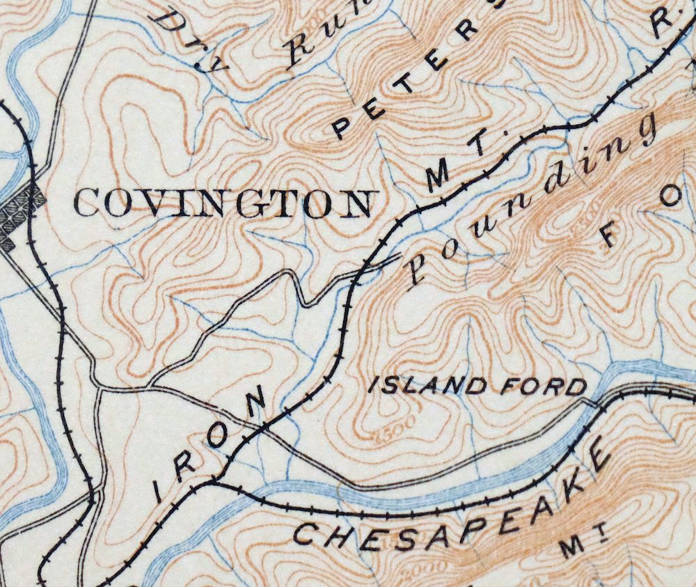
Natural Bridge Virginia Covington Selma USGS Topo Map 1911
$62
This USGS Reconnaissance Topo Map is an 1894 edition printed in 1911, a thick-stock antique sheet in excellent condition – never folded, smooth and flat, with lightly age-toned paper and hole punches along the left collar. On the 30-minute scale it takes in a stretch of western Virginia around Covington and Clifton Forge, with the quad area including Buchanan, Goshen, and the namesake community of Natural Bridge, plus portions of the George Washington and Jefferson National Forests as the boundary edges toward West Virginia. Surveyed between 1886 and 1888 under geographer Henry Gannett, the sheet predates the modern highway system and records the historic travel routes, river crossings, rail lines, and placenames of that era. It comes from an uncommonly well-preserved collection, and the reverse carries printed reference material about the mapping program of the day.
In stock
This antique sheet is an 1894 edition of the Natural Bridge Virginia USGS topographic map. It is an authentic 115-year-old 1911 United States Geological Survey print in excellent condition.
HOW THIS MAP CAN BE USED
In addition to making a fascinating conversation piece, this sheet would look great in a frame or on display, make a unique and prized gift for anyone interested in this area, be perfect as a reference for genealogy studies or general historical research, or fill that missing piece in your collection.
FEATURES SHOWN ON THE MAP
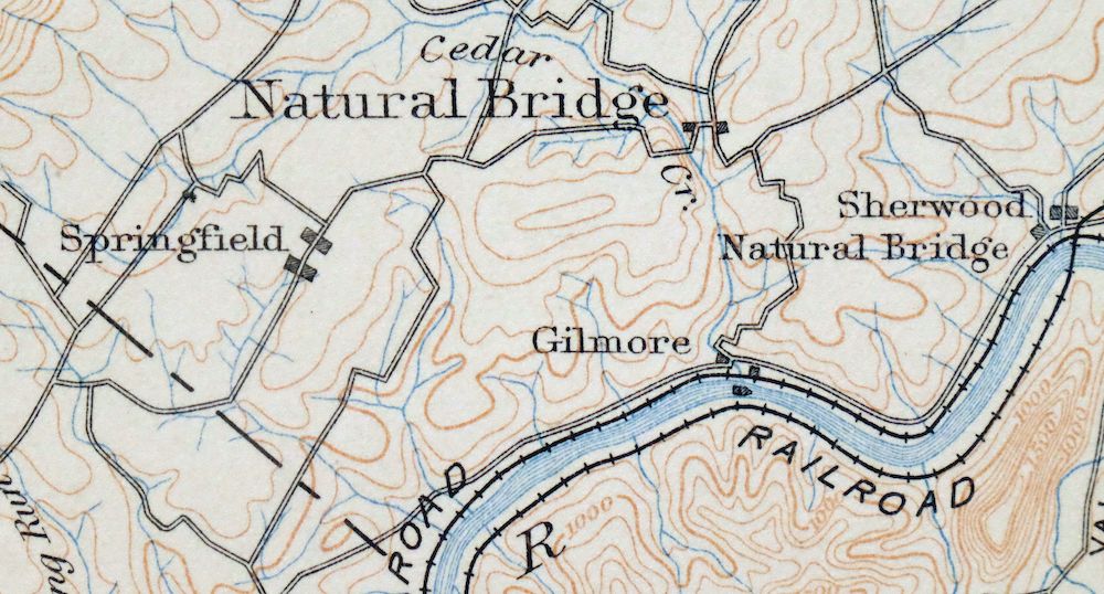
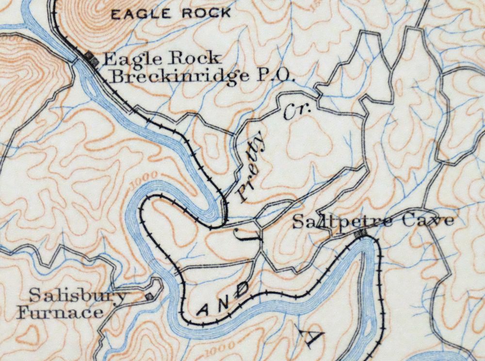
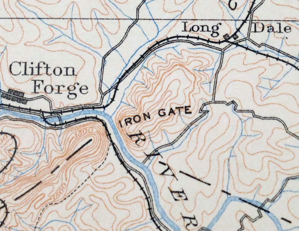
The Natural Bridge 30-minute map shows cities and towns, roads, railroads, rivers, creeks, elevation contour lines, public land survey lines, county, state, and other administrative boundaries as they existed at the time of the survey in 1886 through 1888.
A VALUABLE HISTORICAL RECORD
Maps from the USGS 30-minute series have been out of print for many years. They have never been common and original prints are increasingly difficult to find. For areas where the 30-minute map was produced, it is usually the first large-scale survey done by the USGS for that area. These are a valuable historical record, as they contain many placenames and features that have been dropped from more recent series’ and editions.
Nearby maps
-
Staunton Virginia Stuarts Draft USGS Topographic Map 1913
$120 Add to cart -

Nicholas West Virginia Summersville Cowen USGS Topo Map 1912
$54 Add to cart -
Appomattox Virginia Brookneal Toga USGS Topographic Map 1912
$55 Add to cart -

Franklin West Virginia Petersburg Onego USGS Topo Map 1914
$49 Add to cart -

Palmyra Virginia Lake Monticello Dillwyn USGS Topo Map 1907
$75 Add to cart -

Raleigh West Virginia Beckley Oak Hill USGS Topo Map 1901
$95 Add to cart -

Sutton West Virginia Glenville Elk River USGS Topo Map 1907
$110 Add to cart -
Farmville Virginia Blackstone Rice USGS Topographic Map 1914
$55 Add to cart -

Luray Virginia Front Royal Stanley USGS Topographic Map 1910
$115 Add to cart -

Wytheville Virginia Marion Sparta USGS Topo Map 1907 Antique
$105 Add to cart -

Oceana West Virginia Logan Gilbert USGS Topographic Map 1912
$58 Add to cart -
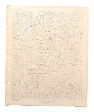
Amelia Virginia Richmond Bon Air USGS Topo Map 1904 Antique
$120 Add to cart -

Romney West Virginia Keyser Delray USGS Topographic Map 1909
$115 Add to cart -

Winchester Virginia Middletown Inwood USGS Topo Map 1916
$100 Add to cart -

Warfield West Virginia Pikeville Harts USGS Topo Map 1911
$105 Add to cart -

Bald Knob West Virginia Mallory USGS Topo Map 1923 Antique
$50 Add to cart -

Peytona West Virginia Marmet Belle USGS Topographic Map 1911
$42 Add to cart -

Charleston West Virginia Cross Lanes Rand USGS Topo Map 1914
$75 Add to cart -

Charleston West West Virginia Dunbar USGS Topo Map 1978
$22 Add to cart -

Pocatalico West Virginia Dunbar USGS Topographic Map 1977
$30 Add to cart -

Saint Albans West Virginia Dunbar USGS Topographic Map 1909
$37 Add to cart -
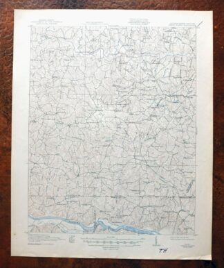
White Plains Virginia Triplet Ebony USGS Topo Map 1944
$39 Add to cart -

Winfield West Virginia Bancroft Southside USGS Topo Map 1908
$37 Add to cart -

Saint Marys West Virginia Ellenboro Pike USGS Topo Map 1916
$47 Add to cart
