MAP DETAILS | |
|---|---|
| TITLE | Glenblair |
| STATE | California |
| LOCATION | 80 miles northwest of Santa Rosa, CA |
| SERIES | 15-minute |
| SURVEYED | 1942 and 1943 Aerial and Field Survey |
| EDITION | 1943 |
| PRINTED | 1943 |
| PRINT NOTES | Thick paper stock, includes woodland tint (green to indicate vegetated areas) |
| SCALE | 1:62500 |
| CONTOUR INTERVAL | 100 feet |
| SHEET DIMENSIONS | 17 x 22 inches |
| MAP DIMENSIONS | 13 1/2 x 17 1/2 inches |
| COVERAGE AREA | 13 x 17 miles |
| SHEET CONDITION For maps of this vintage, effort is made to note all visible flaws, no matter how minor. | |
| OVERALL CONDITION | Good |
| SHEET NOTES | never folded |
| MAP AREA | no markings, no blemishes |
| COLLARS | no markings, no blemishes, handling wear in bottom collar |
 | |
| MAP COVERAGE Quadrangle extent overlaid on current basemap. | |
| PLACENAMES Depending on map series and survey date, all of the features listed below may not be shown on this map. This list contains features that currently exist or historically existed within the area covered by the map. The list can be used as a reference to determine if this map covers your area of interest. Placenames are listed alphabetically next to each feature type. | |
| NOTABLE PLACES | Glen Blair, Noyo River, and Big River |
| CITIES AND TOWNS (CURRENT) | Comptche |
| COUNTIES COVERED | Mendocino |
| RIVERS AND STREAMS | Albion River, Caspar Creek, Chamberlain Creek, Churchman Creek, East Branch North Fork Big River, Hare Creek, Hayworth Creek, James Creek, Jug Handle Creek, Kass Creek, Laguna Creek, Little North Fork Noyo River, Little River, Little Valley Creek, Marsh Creek, Mettick Creek, Middle Fork of North Fork Noyo River, North Fork Albion River, North Fork Big River, North Fork Hayworth Creek, North Fork James Creek, North Fork Noyo River, North Fork South Fork Noyo River, Olds Creek, Parlin Creek, Pudding Creek, Ramon Creek, Redwood Creek, Russell Brook, Soda Spring Creek, South Fork Albion River, South Fork Big River, South Fork Hare Creek, South Fork Noyo River, South Fork Ten Mile River, Tom Bell Creek, and Two Log Creek |
| Locations: Banfill Turn, Big Stump Ranch, Burns Camp, Camp Four, Camp Mendocino, Camp Noyo, Camp Saint Albert, Camp Three Spur, Caspar Orchard, Chamberlain Creek Conservation Camp, Grimes Ranch, Hansens Curve, Hayshed Siding, Layton Sky Ranch, MacDonalds Ranch, Marble Creek Ranch, Mathison Peak Lookout, McDonald Ranch, McGuire Mill, Mendocino Woodlands, North Fork Camp, Old Camp Seven, Parlin Fork Conservation Camp, Reep Ranch, Russel Ranch, South Fork Camp, and Woodlands Station. Mountains, Peaks, and Summits: Docker Hill, Mathison Peak, McGuire Hill, Noyo Hill, and Observatory Hill. Valleys and Canyons: Alpine Gulch, Anderson Gulch, Arvola Gulch, Bear Gulch, Berry Gulch, Biggs Gulch, Bowman Gulch, Brandon Gulch, Bunker Gulch, Camp Eight Gulch, Camp Four Gulch, Camp Ten Gulch, Camp Three Gulch, Dietz Gulch, Dry Dock Gulch, Duffy Gulch, Gulch Eleven, Gulch Five, Gulch One, Gulch Seven, Gulch Sixteen, Gulch Thirtyone, Hayshed Gulch, Kaisen Gulch, Kelly Gulch, Kidwell Gulch, Lake Gulch, Little McDonald Gulch, Manly Gulch, Marble Gulch, McDonald Gulch, McKay Gulch, Morrison Gulch, Park Gulch, Peterson Gulch, Portuguese Gulch, Poverty Gulch, Railroad Gulch, Rocky Gulch, Sindel Gulch, Thompson Gulch, Tramway Gulch, Water Gulch, and Wheel Gulch. Parks: Jackson State Forest and Mendocino Woodlands Outdoor Center. Drainages: Chamberlain Creek, Churchman Creek, Dewarren Creek, East Branch Little North Fork, East Branch North Fork Big River, Freathy Creek, Hayworth Creek, James Creek, Kass Creek, Laguna Creek, Little North Fork Big River, Little North Fork Noyo River, Little Valley Creek, Marsh Creek, Mettick Creek, Middle Fork of North Fork Noyo River, North Fork Albion River, North Fork Big River, North Fork Hayworth Creek, North Fork Noyo River, North Fork South Fork Noyo River, Olds Creek, Parlin Creek, Ramon Creek, Redwood Creek, Soda Spring Creek, South Fork Albion River, South Fork Big River, South Fork Hare Creek, South Fork Noyo River, Tom Bell Creek, and Two Log Creek. Dams: McGuire 1386 Dam. Gaps: Dunlap Pass and Low Gap. Basins: Little Valley. Swamps: Big River Laguna. Schools: Comptche Elementary School. Ridges: Center Ridge, Chamberlain Ridge, Hi Chute Ridge, Ramsey Ridge, Riley Ridge, and Three Chop Ridge. Flats: Clark Opening, McDuffy Opening, Negro Nat Opening, Tom Bell Flat, and Wild Horse Opening. Towers: KOZT-FM (Fort Bragg). Springs: Mallory Spring and Soda Spring. | |
| SHIPPING AND RETURNS | |
 This map sheet will be carefully rolled in a sturdy tube and shipped via the US Postal Service. If you find that the sheet you receive is not as described in the listing, you may ship it back to us for a refund of the purchase price. | |

Glenblair California Comptche USGS Topo Map 1943 Vintage
$38
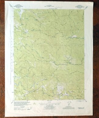
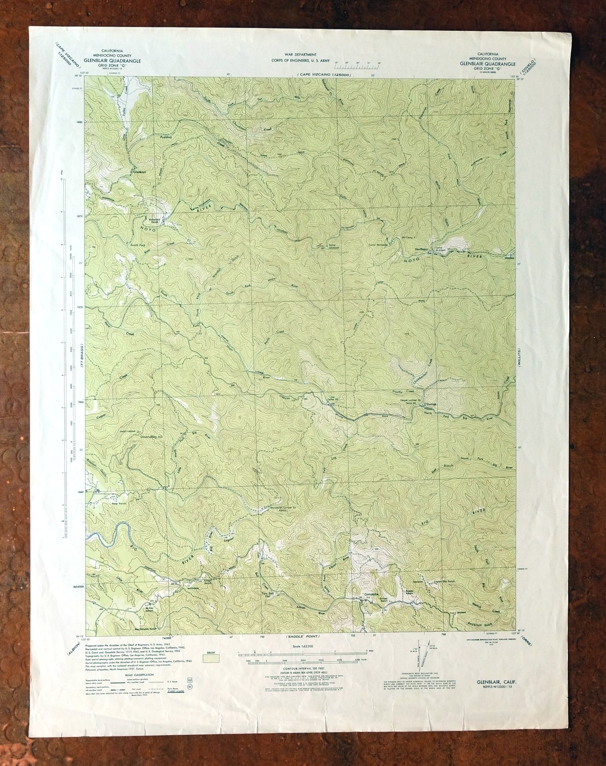
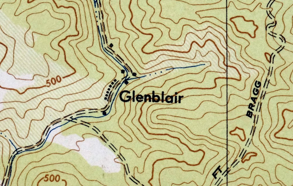
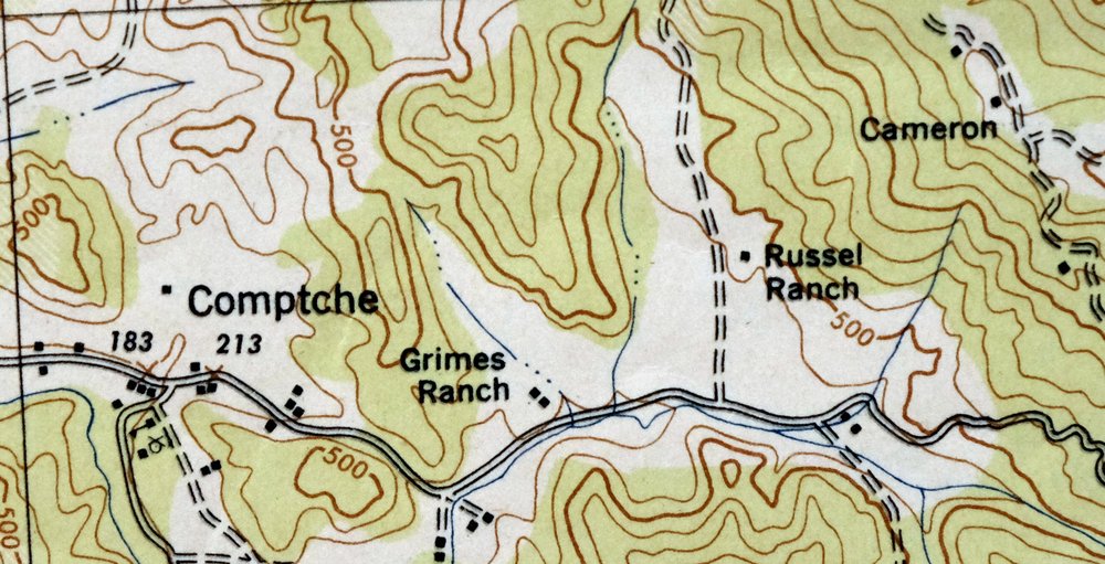
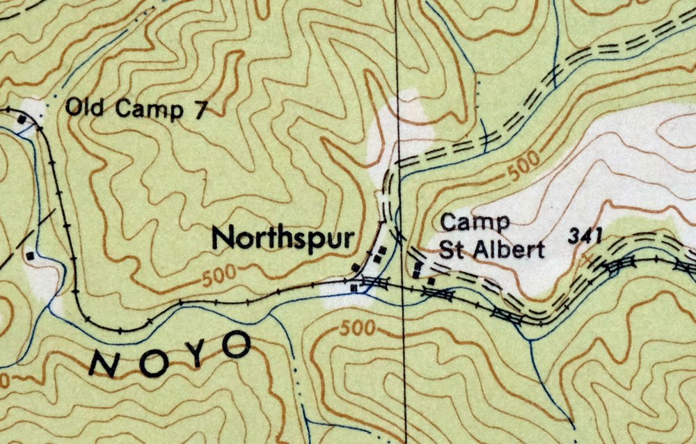
This 15-minute topographic sheet of Glenblair was made by the Army Corps of Engineers from 1942 and 1943 aerial and field survey work, first published and printed in 1943. It covers a stretch of the Mendocino coast country in Mendocino County, with the community of Comptche within the quad area and a woodland tint marking the forested ground. Printed during the war years, the sheet carries the green vegetation shading that distinguished Corps topographic work from the standard USGS style, on thick stock that has never been folded.
In stock
This vintage sheet is a 1943 edition of the Glenblair California USACE topographic map. It is an original 83-year-old US Army Corp of Engineers print in good condition.
HOW THIS MAP CAN BE USED
In addition to making a fascinating conversation piece, this sheet would look great in a frame or on display, make a unique and prized gift for anyone interested in this area, be perfect as a reference for genealogy studies or general historical research, or fill that missing piece in your collection.
FEATURES SHOWN ON THE MAP
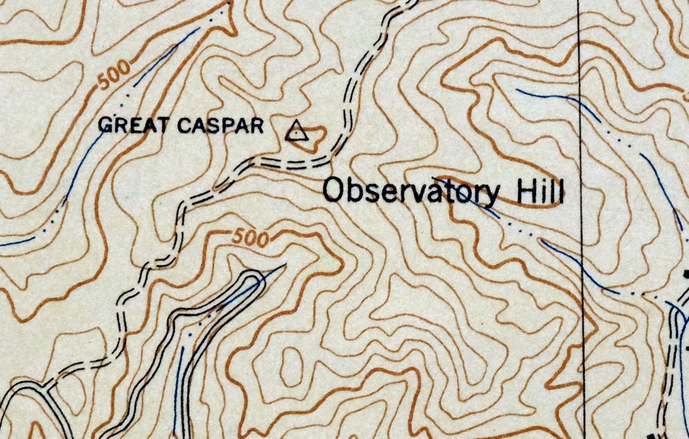
The Glenblair 15-minute map shows cities and towns, roads, railroads, rivers, creeks, elevation contour lines, public land survey lines, county, state, and other administrative boundaries as they existed at the time of the survey in 1942 and 1943. All known structures (houses, businesses, churches, schools, barns, cabins, etc) are also shown.
A VALUABLE HISTORICAL RECORD
Maps from the 15-minute series for the continental United States are no longer produced or printed by the USACE and original prints are becoming increasingly difficult to find. They are a valuable historical record for an area, as they contain many placenames and features that have been dropped from more recent maps.
Nearby maps
-
Piercy California USGS 15-Min Topographic Map 1971 Vintage
$33 Add to cart -
Lakeport California Lucerne Nice USGS Topo Map 1977 Vintage
$44 Add to cart -
Stonyford California USGS 15-Min Topo Map 1967 Vintage
$39 Add to cart -
Fruto California Stony Creek Nye Creek USGS Topo Map 1944
$30 Add to cart -

Richardson Springs California Chico Nord USGS Topo Map 1966
$35 Add to cart -
Mount Vaca California Fairfield Vacaville USGS Topo Map 1967
$40 Add to cart -
Panther Spring California USGS 15-Min Topo Map 1970 Vintage
$36 Add to cart -
Gridley California Oroville Live Oak USGS Topo Map 1959
$37 Add to cart -
Petaluma Point California Novato USGS Topographic Map 1951
$30 Add to cart -

San Rafael California Mill Valley Tiburon USGS Topo Map 1966
$60 Add to cart -
San Quentin California Richmond Tiburon USGS Topo Map 1980
$46 Add to cart -
Point Bonita California Sausalito USGS Topographic Map 1955
$44 Add to cart -
Lamoine California Shasta Lake USGS Topo Map 1974 Vintage
$40 Add to cart -
Port Chicago California Concord Martinez USGS Topo Map 1956
$38 Add to cart -
1960 Port Chicago California USGS Topo Map: Mountain View
$52 Add to cart -
Pittsburg California Concord Fairfield USGS Topo Map 1965
$38 Add to cart -
San Francisco South California USGS 7.5-Min Topo Map 1975
$47 Add to cart -
Hunters Point California Oakland USGS Topographic Map 1969
$38 Add to cart -
Manzanita Lake California Viola USGS Topo Map 1974 Vintage
$39 Add to cart -

Redwood Point California Fremont Hayward USGS Topo Map 1948
$24 Add to cart -

Newark California Fremont Hayward USGS Topo Map 1948 Vintage
$47 Add to cart -
Palo Alto California Redwood City Ladera USGS Topo Map 1969
$45 Add to cart -
Shasta California McCloud USGS 15-Min Topo Map 1968 Vintage
$40 Add to cart -
Westwood California USGS 15-Min Topographic Map 1961 Vintage
$38 Add to cart